Cima del Vallone via Sentiero del Centenario
Route scheme
Trip overview
Cima del Vallone is a prominent 2,368-meter peak in the Julian Alps of northeastern Italy, located in the Friuli-Venezia Giulia region and part of the Rio Bianco subgroup - being the highest. First ascended in 1890 by Julius Kugy and companions, it features a challenging normal route with numerous II-degree rock climbing passages, making it less frequented than nearby summits. The mountain offers stunning panoramic views eastward toward the Jof Fuart group, though its western aspect is partially obscured by the Cima di Riofreddo.
We will be climbing Cima del Vallone using the normal route, but to get to it's starting point we will also climb Sentiero del Centenario via-ferrata. It was opened in 1983 to commemorate the centennial of the Gorizia section of the Club Alpino Italiano. Starting at Forca del Vallone saddle (2180 m), this short but scenic route winds through World War I fortresses and galleries, offering close views of surrounding peaks like Cima Alta di Riobianco while demanding moderate climbing skills rated at difficulty B/C.
The return route takes us back to the Rio Bianco valley as far as Capanna Brunner lodge, however here we take the longer way down through Re di Sassonia via-ferrata named after the King of Saxony. It passes through a final stretch of woodland before skirting the walls of the Cime di Rio Bianco, along a scree ledge. From here, the equipment for the most exposed sections begins, especially the section affected by the landslide that abruptly interrupted the path in 2012, which was restored in 2016.
Route description
Access to Via-ferrata Sentiero del Centenario - Forcella alta di Riobianco:
Starting from Rio Bianco parking lot we take trail no. 625 and head for Capanna Brunner lodge, next we continue on that trail, finally more into western direction and land below Bivacco C.A.I. Gorizia bivouac. Here we leave the trail 625. and continue on marked trail to the south in direction of Forcella alta di Riobianco (2138 m) saddle. This part is a bit tedious due to unstable ground, luckily it is relatively short.
Via-ferrata Sentiero del Centenario (C) - description:
Via-ferrata begins/finishes on Forcella alta di Riobianco saddle (2.138 m). It's a really scenic route, protected in places with ladders and wires. It runs along couple of peaks, some of them we can visit. In this variant Sentiero del Centenario ends with passage via tunnel drilled in the rocks. Here a headlamp comes in handy - although might be also doable with led lamp from the phone. We descend maybe 20 meters and leave the tunnel to land on Forcella del Vallone saddle (2185 m).
Cima del Vallone normal route (II+ or III):
We start at Forcella del Vallone saddle (2185 m) and we have two options to enter the normal route. First is to set off directly from the saddle in the northern direction via system of ledges with one very exposed section (II+) secured with cord on the piton. Second is to descend 30 meters in direction of Corsi mountain hut and head north into the base of a gully with difficulties not reaching III grade. Both of these will get us to the same spot, where the gully widens and flattens a bit and from now on the difficulties don't exceed II grade. Continue up and at some point turn right into a broad ledge and left again into chimney, leave it after 10 meters and make the most approachable way with good holds and steps to the top. Descent way same as ascent - back to the saddle. From Forcella del Vallone saddle we head back in the direction of Capanna Brunner lodge using trail no. 625.
Using Sentiero del Centenario to get to Forcella del Vallone saddle is of course optional, we can go there directly from C.A.I. Gorizia bivouac skipping the ridge and decreasing the effort. Normal route can also be reached from the side of former Corsi mountain hut, effort is comparable.
Re di Sassonia via-ferrata (C) - info:
At Capanna Brunner lodge we can continue on trail no. 625 back to the parking lot or we can prolong the fun a bit and take the trail no. 629 leading us to Re di Sassonia via-ferrata. Its characteristics don't make it a worthwhile standalone mountain goal however it works well as an option to add spice to the lengthy descent. It is a series of traverses along southern walls of the Cime di Rio Bianco - so there will be going up and down included, some exposure (spots rated as C) and interesting views in the direction of Italian - Slovenian border. Protection seemed solid although the terrain is susceptible to landslides there and we cross at least two past landslides. We also cross some streambeds that open up options to refresh. Re di Sassonia path runs as far as former Guido Corsi mountain hut but it's more of a hike than actual via-ferrata in there. We leave it much earlier, on the junction with trail no. 650 that takes us back to the starting point.
Trip conditions
Weather:
Cool yet motionless air with sun blurred from high hanging clouds. Whole trip done in short sleeve, lack of wind.
Trail:
Most of the route is in good condition, markings are clear. Trails seemed to be quite popular, I met a lot of other people and because of that paths are well-trodden. Only going up to Forca del Vallone saddle (2180 m) is a bit tedious and also descending back in direction of Rio Bianco valley from Forcella del Vallone pass isn't very pleasant. Normal route to Cima del Vallone is unmarked, however there are many cairns that should suffice to help get to the top.
Current status of both via-ferratas can be checked on CAI Friuli Venezia Giulia mountain club website.
Additional information
Tips and author's comments:
If you want to check both options to start into normal route to Cima del Vallone I would suggest to use the variant from the saddle with cord support for the climb-up. I used it for downclimbing and it wasn't mentally pleasant (narrow, exposed).
Dangers:
Risk of slipping below Forca del Vallone and Forcella del Vallone saddle. Final parts of the normal route to Cima del Vallone are a bit crumbly as well. Watch out if there are people above.
Gear used:
20l rucksack, hiking poles, ascent shoes, headlamp, helmet
Transportation:
Starting point reached by car. There is a big parking available 100 meters from start of the trail, there's a fee, price is 8 EUR per day. However there are also numerous options on both sides of the road 76 if you arrive in the early morning.
Links:Parking location
Accommodation:
There is an option to stay in Capanna Brunner hunting lodge which is located quite close to the start of the trail. However for the stay we need to get the key from CAI Tarvisio alpine club.
Trip photos and videos
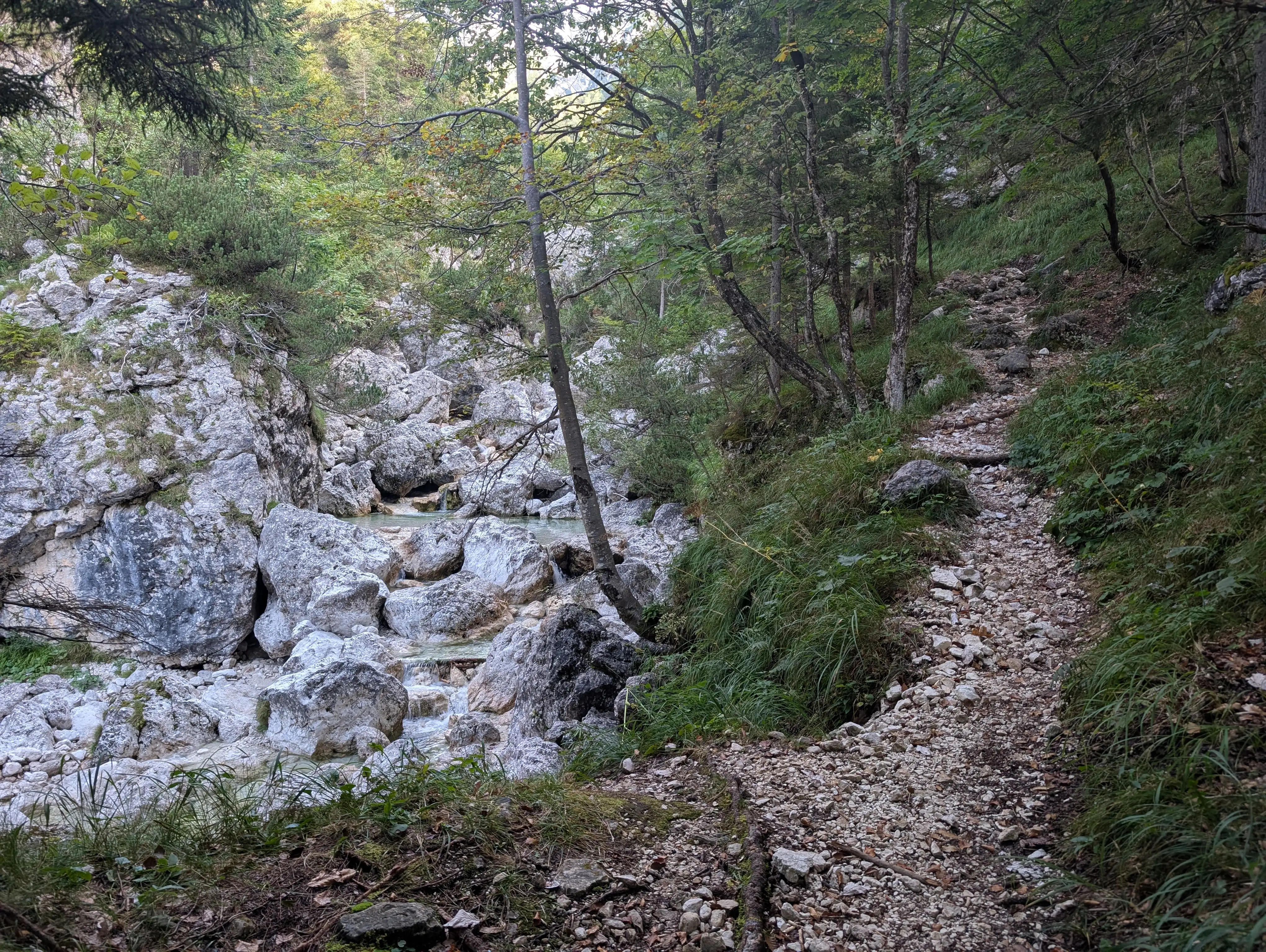 Warming up along Rio Bianco stream, very pleasant section.
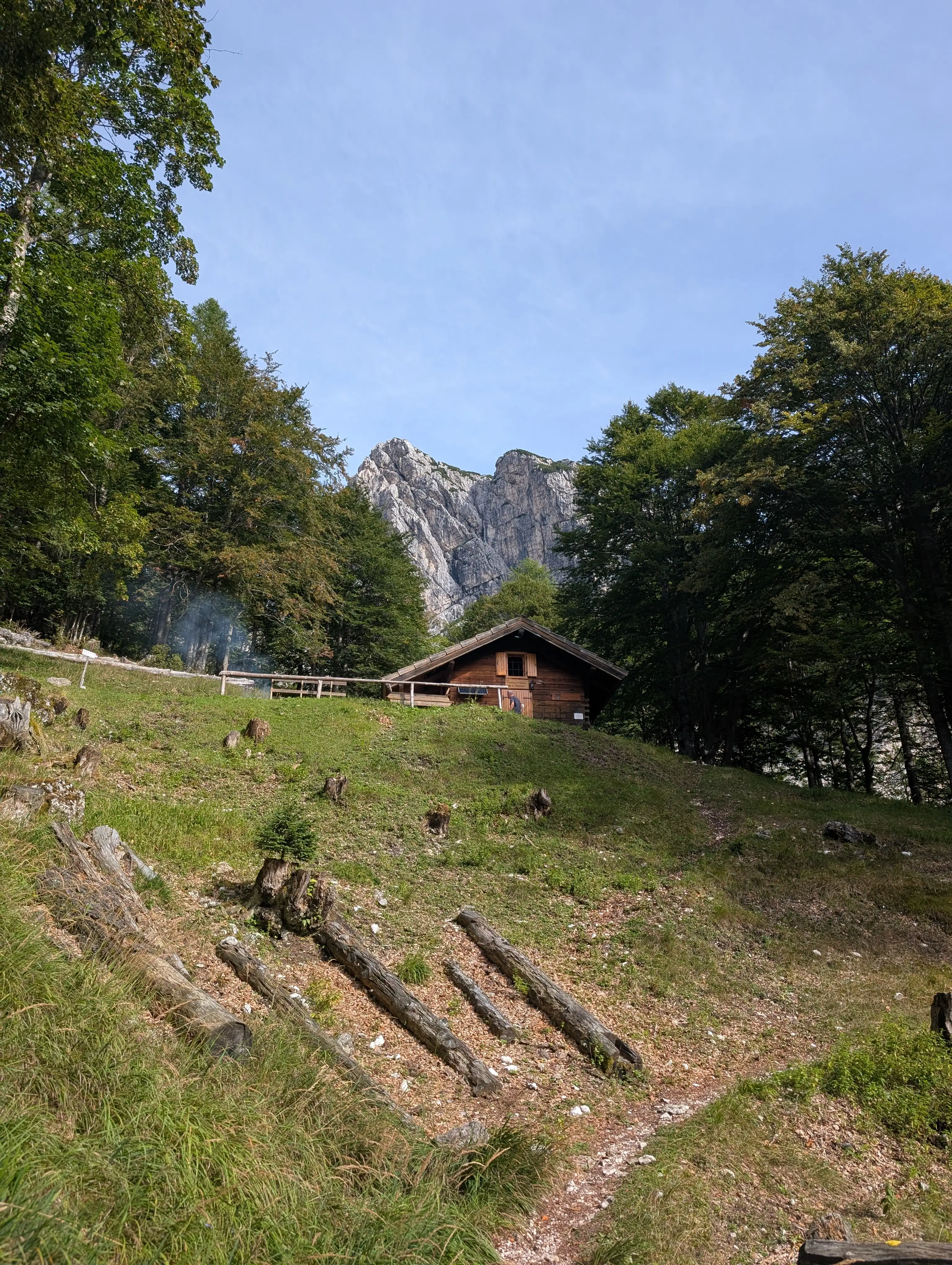 Approaching Capanna Brunner lodge, junction for many trails. On the way back we will be heading to the left, for now we will go behind the lodge.
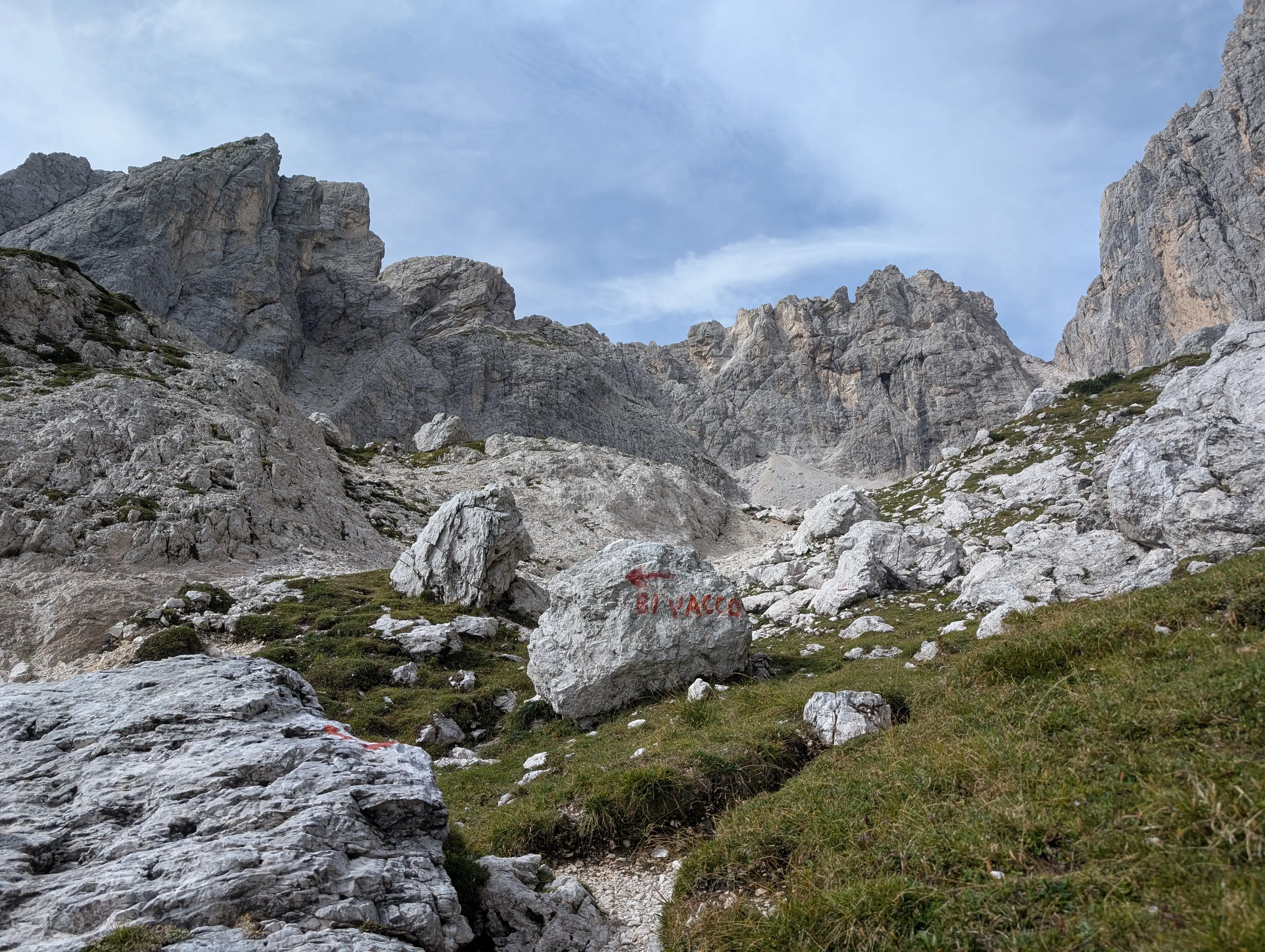 About to enter upper part of Rio Bianco valley. Sentiero del Centenario route runs along the ridge present in the central part of the image (Cime Piccole di Riobianco), on the right we can already see Forcella del Vallone saddle and high walls of Cima del Vallone.
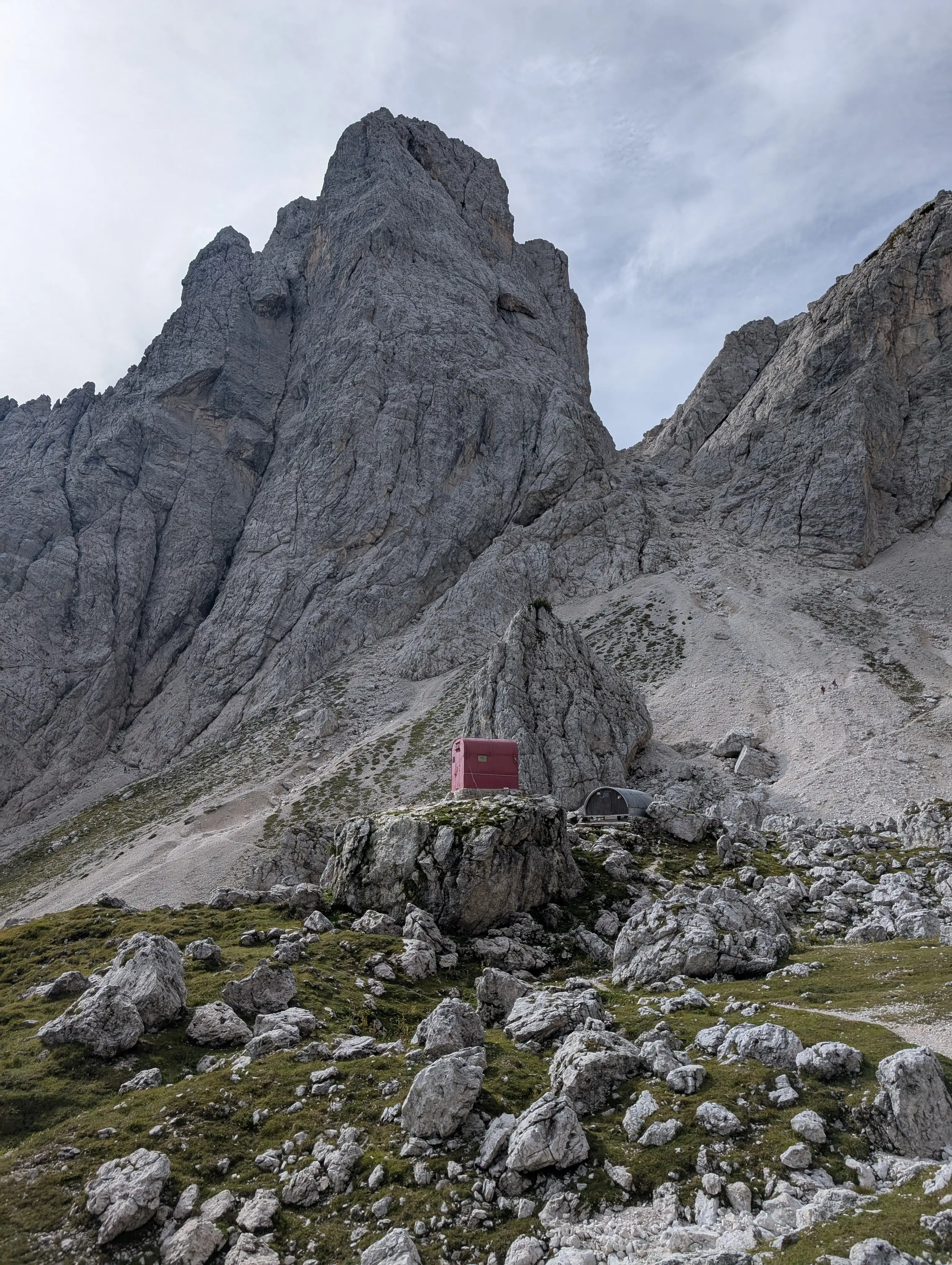 C.A.I. Gorizia bivouac and refuge in the shadows of Cima alta di Rio Bianco. We go past these huts and up to the visible saddle (Forcella alta di Riobianco) where Sentiero del Centenario route starts.
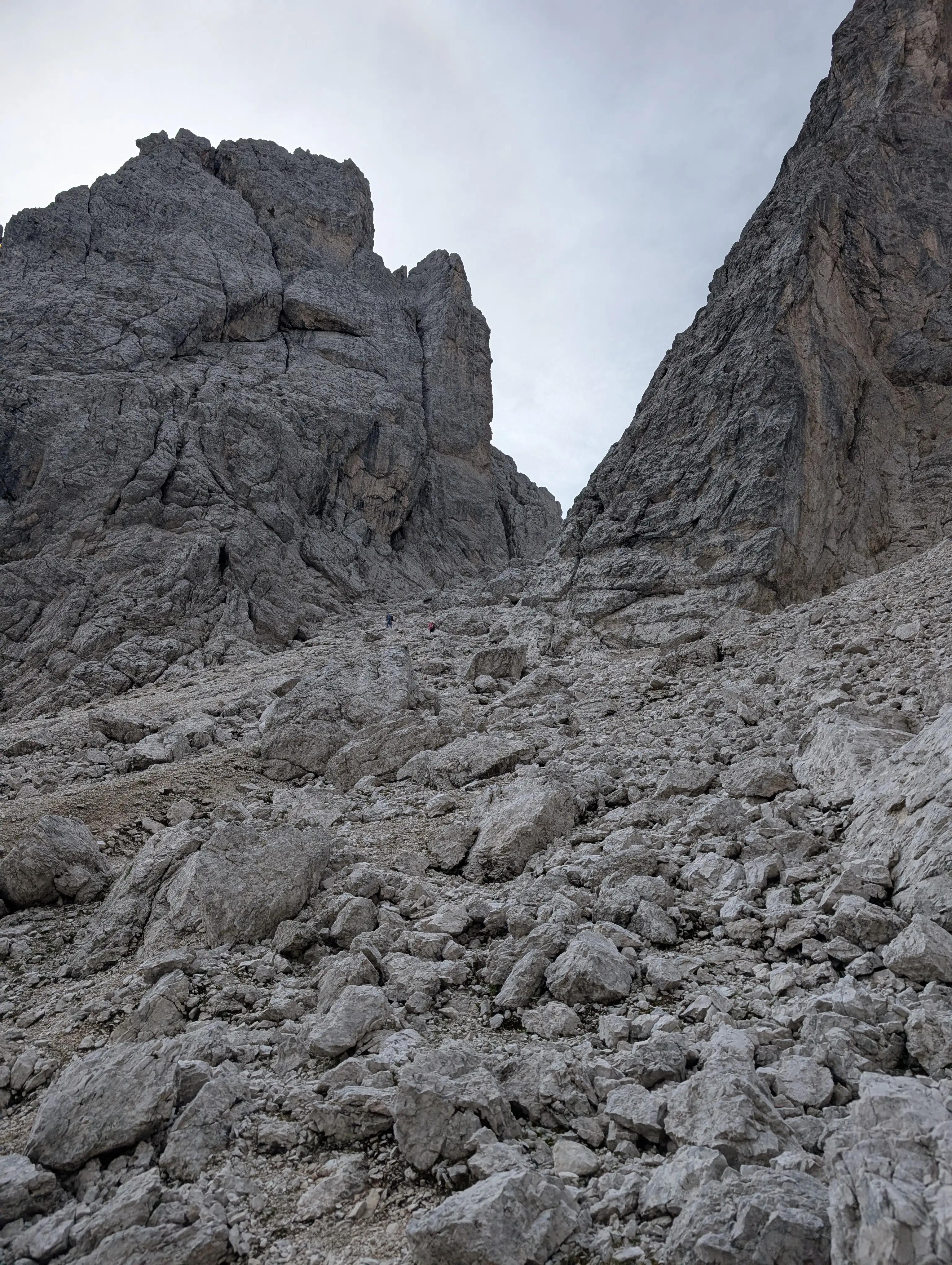 Nasty ascent under Forcella alta di Riobianco saddle.
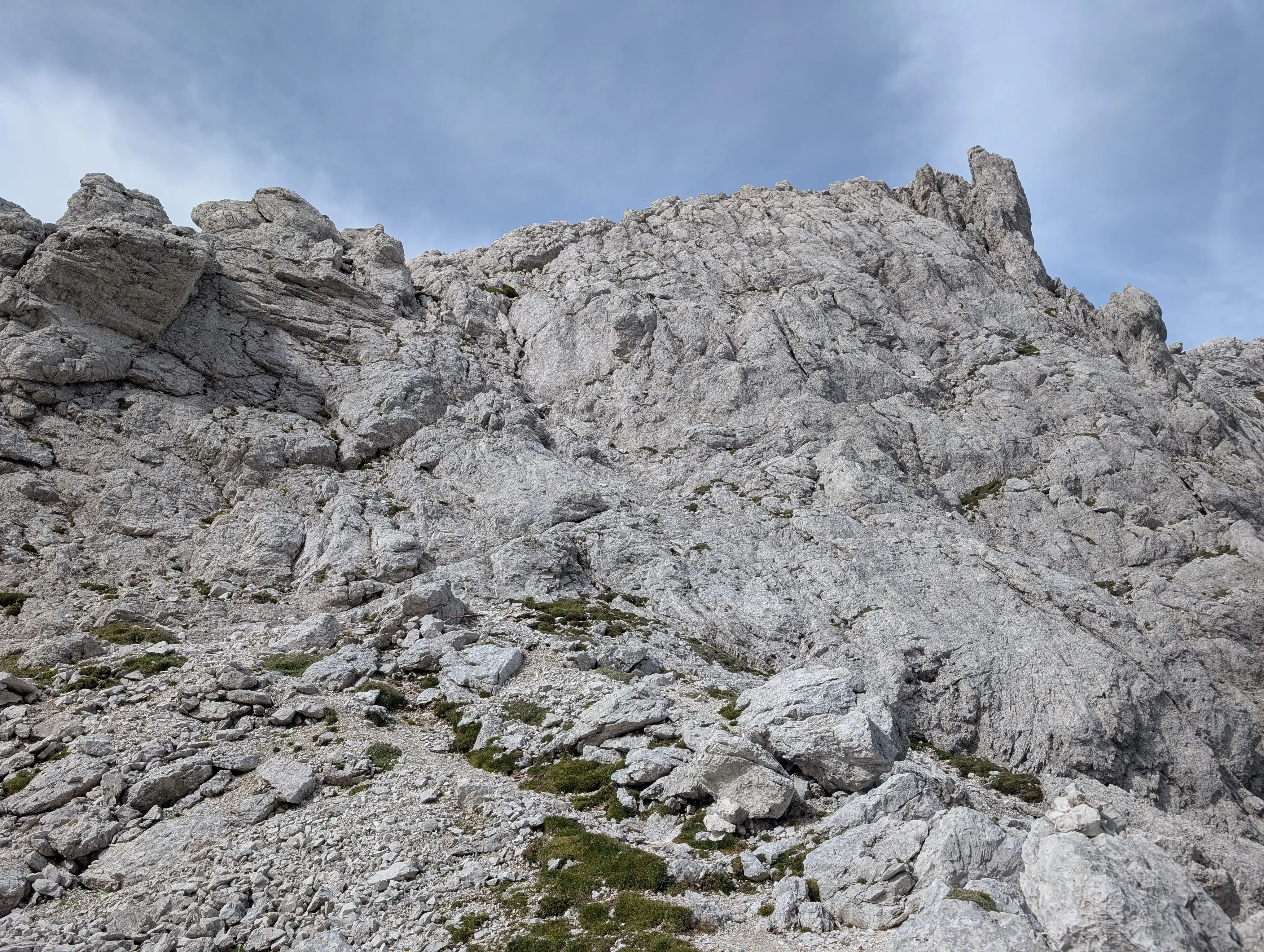 Start into Sentiero del Centenario, two variants possible (path was re-routed).
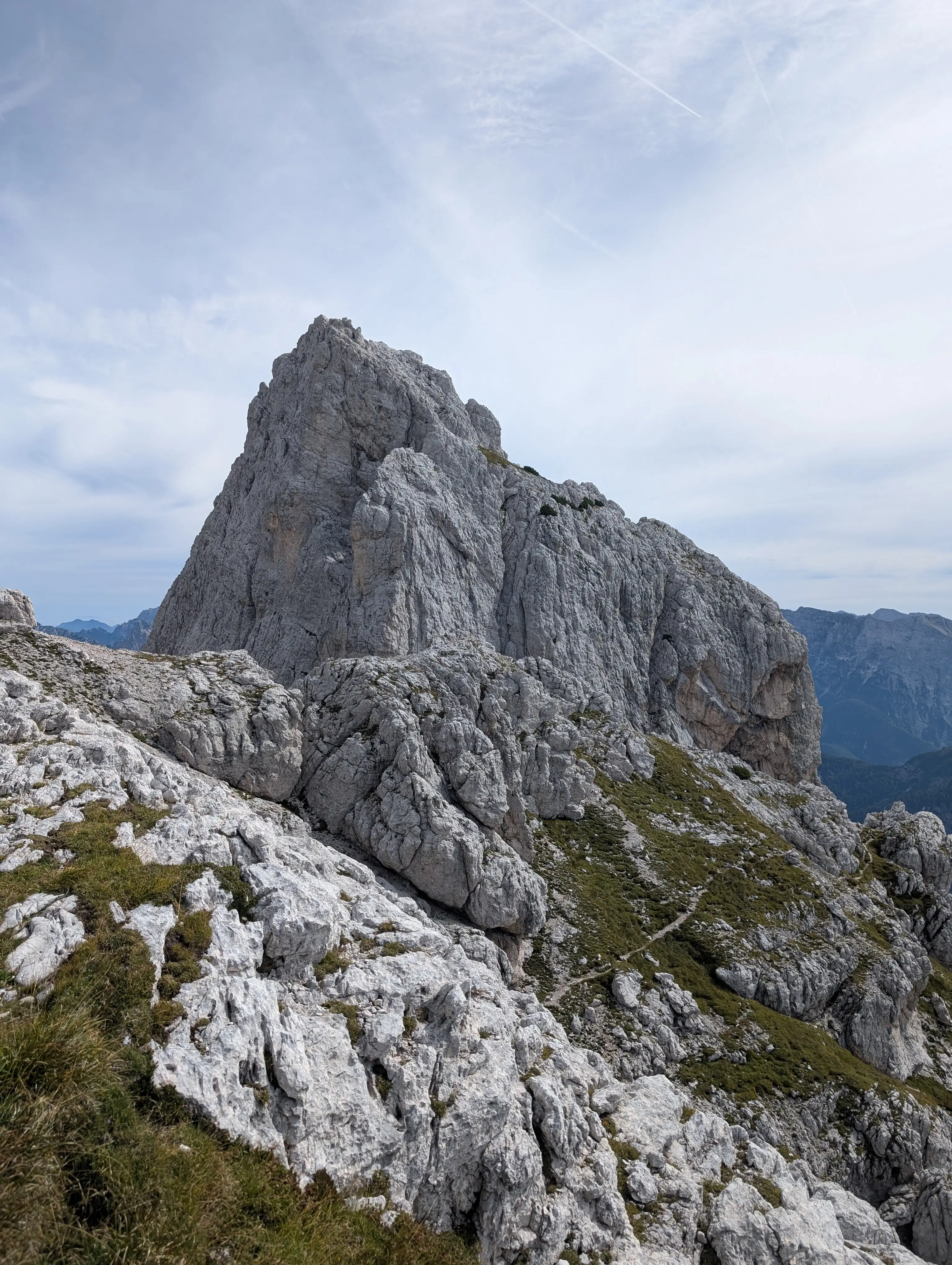 Terrain in Sentiero del Centenario.
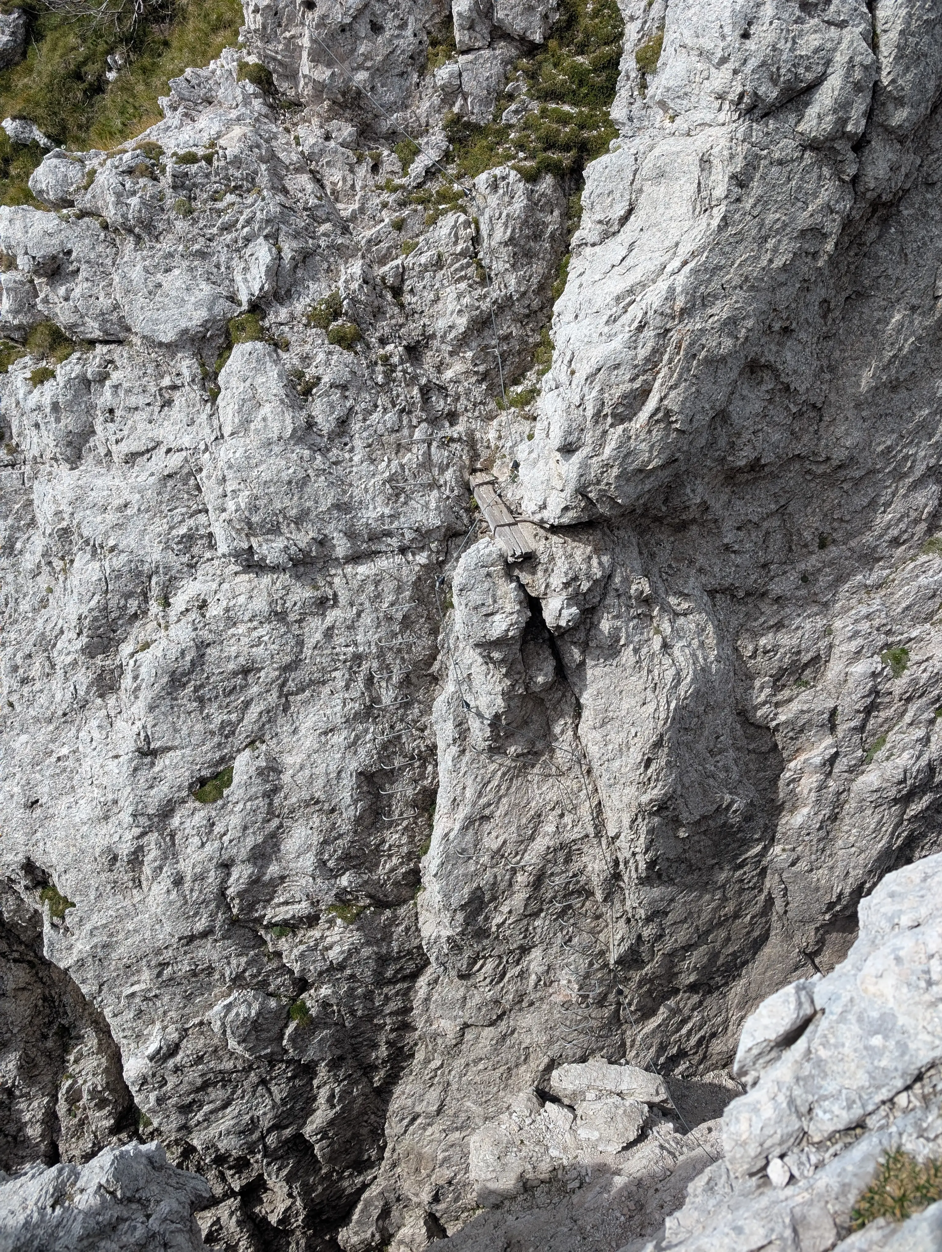 Crossing this chimney is the hardest spot of Sentiero del Centenario route. This section is really vertical and I felt a bit sorry missing my protection set.
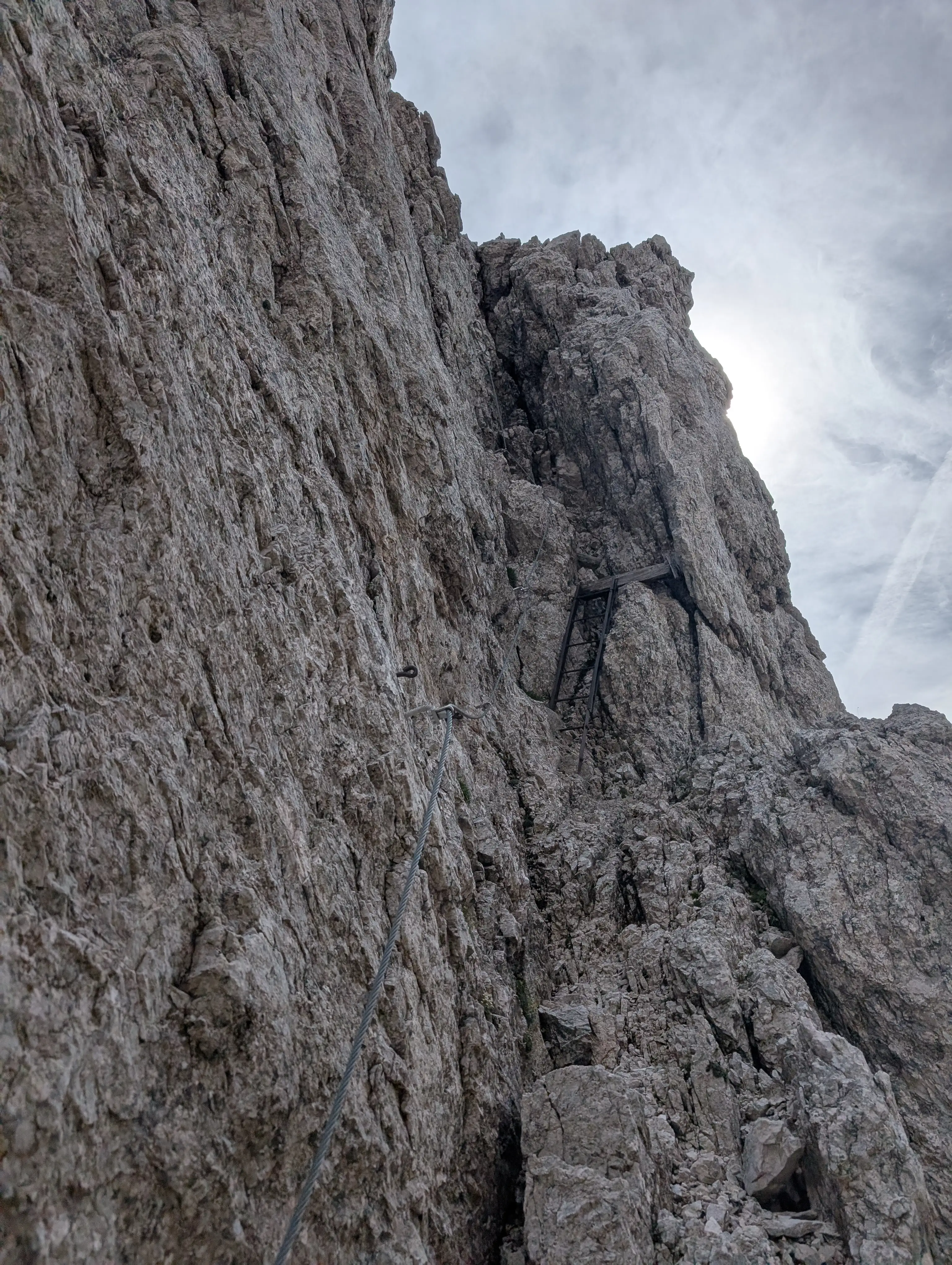 Descent to the base of the chimney. Quality of wires is superb, they have been renewed lately. Old protection which is still in good shape was left as it is, so there's still a historical WWI vibe to it.
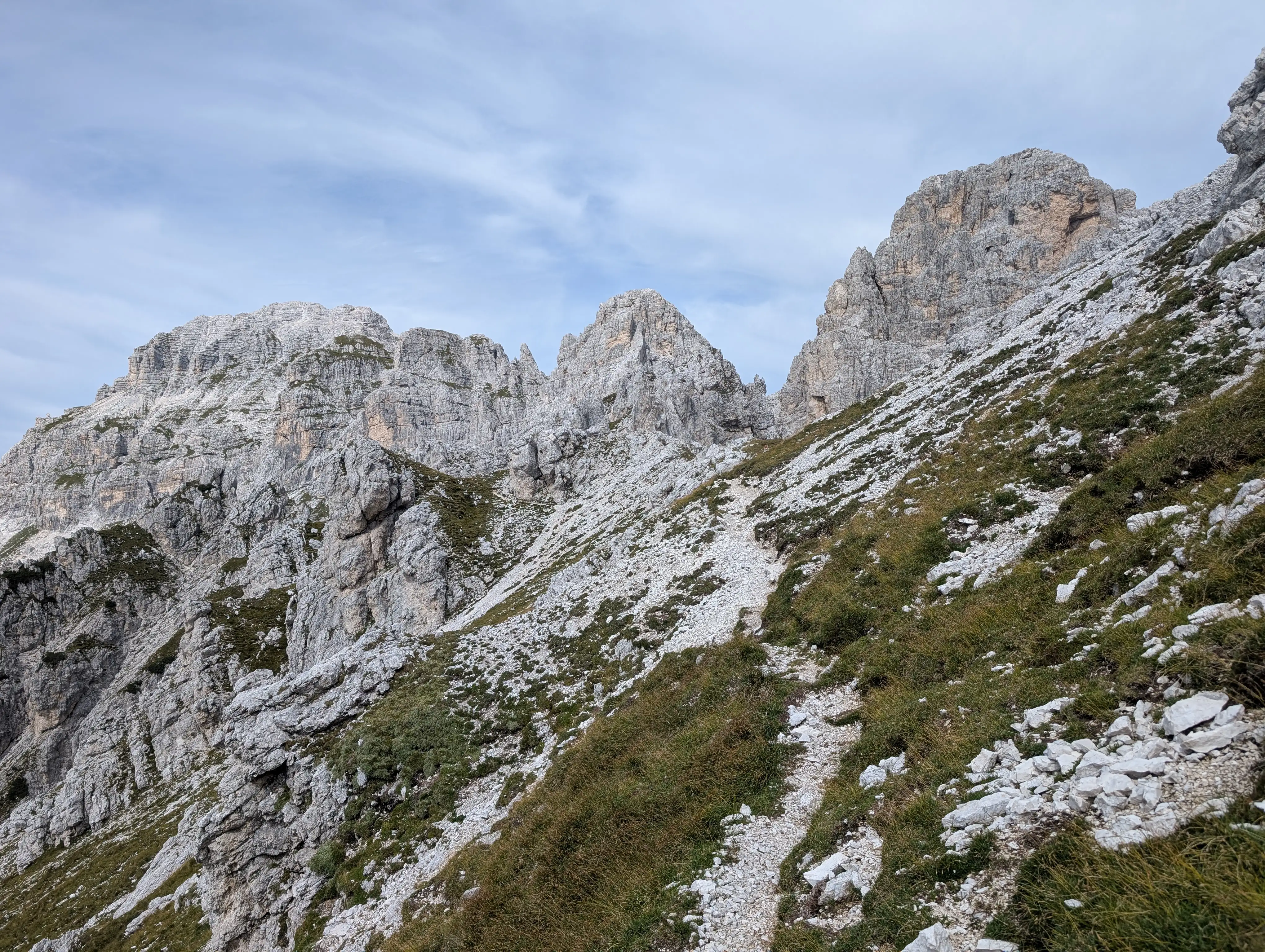 Terrain somewhere in the middle of Sentiero del Centenario, with Jof Fuart group already visible and Cima del Vallone on the right side.
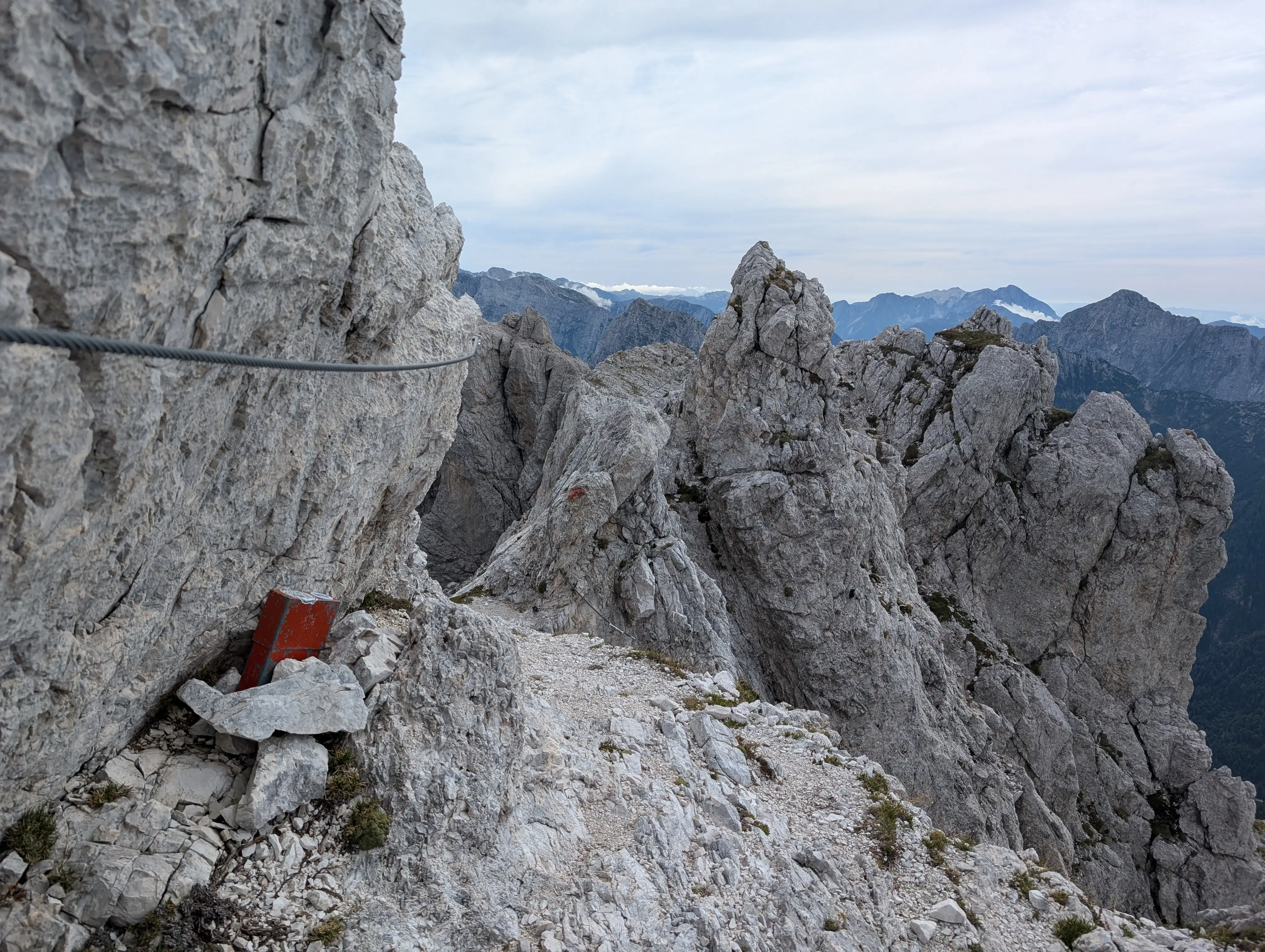 Memorial book and wire protection on crumbly traverse.
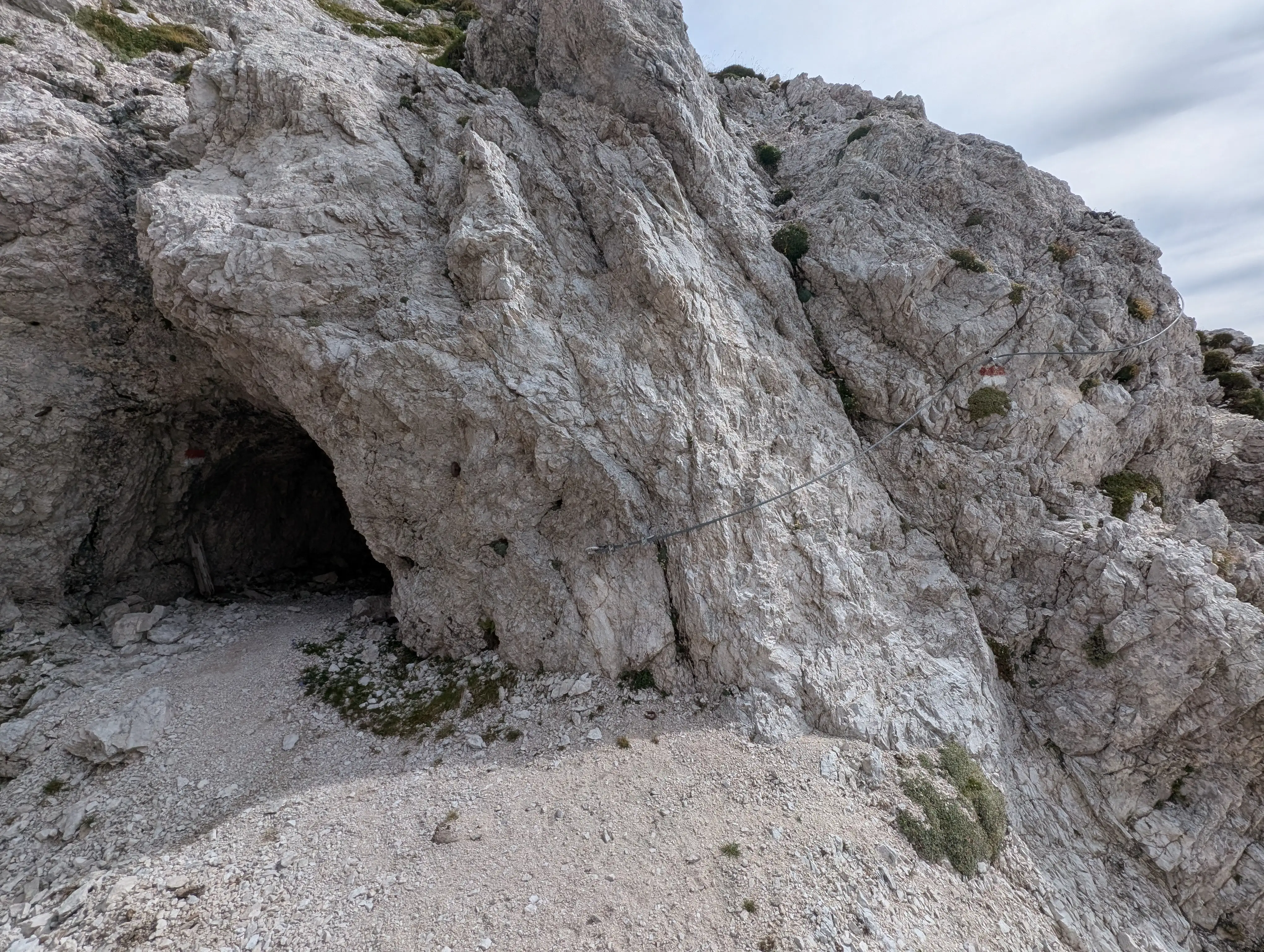 Wires lead us directly to tunnel entrance, here we leave the ridge and enter the underground bunker carved in the rock.
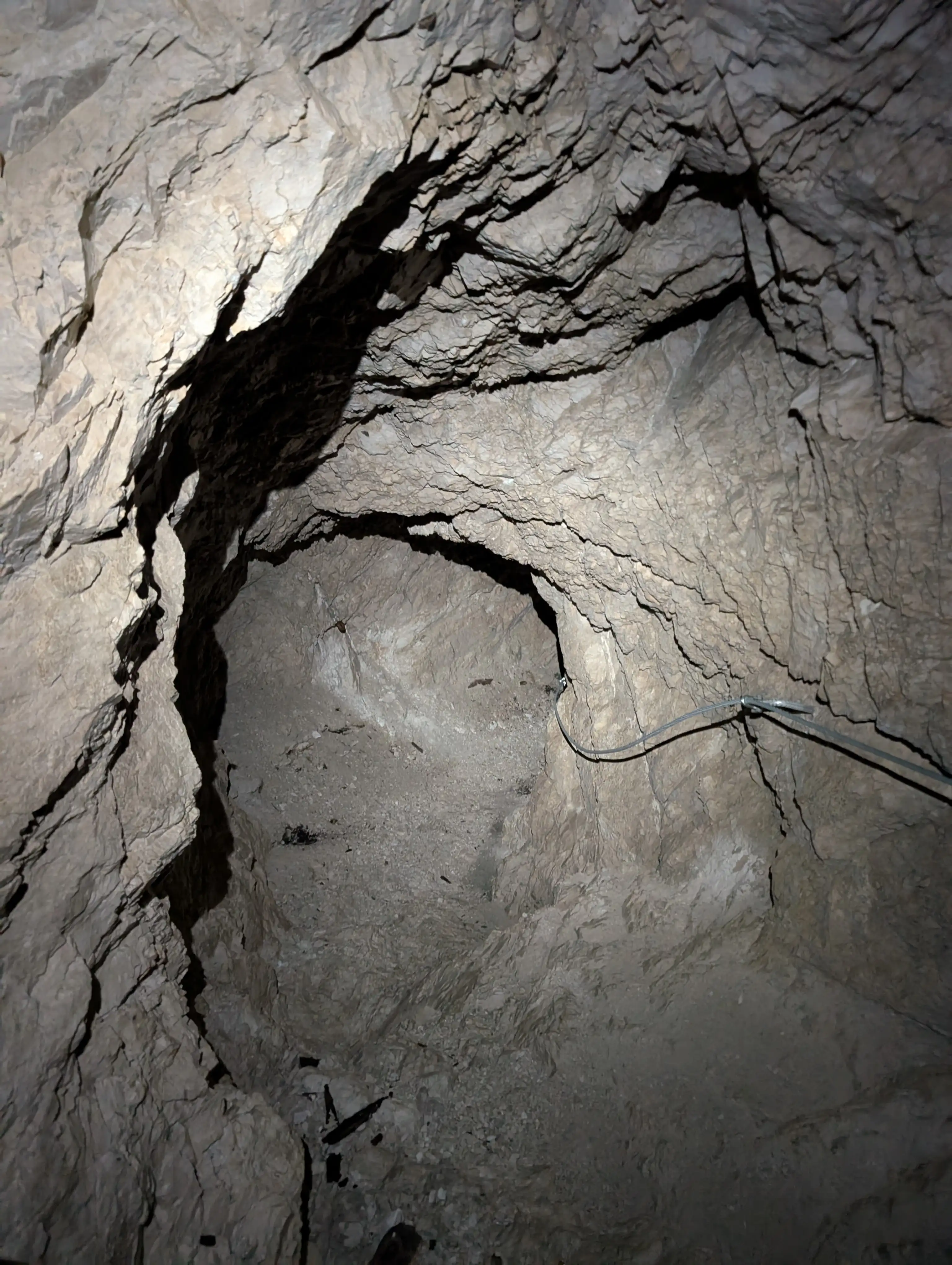 There's a flat part of the bunker with narrow window used to observe the immediate vicinity and a descending hallway protected with wire.
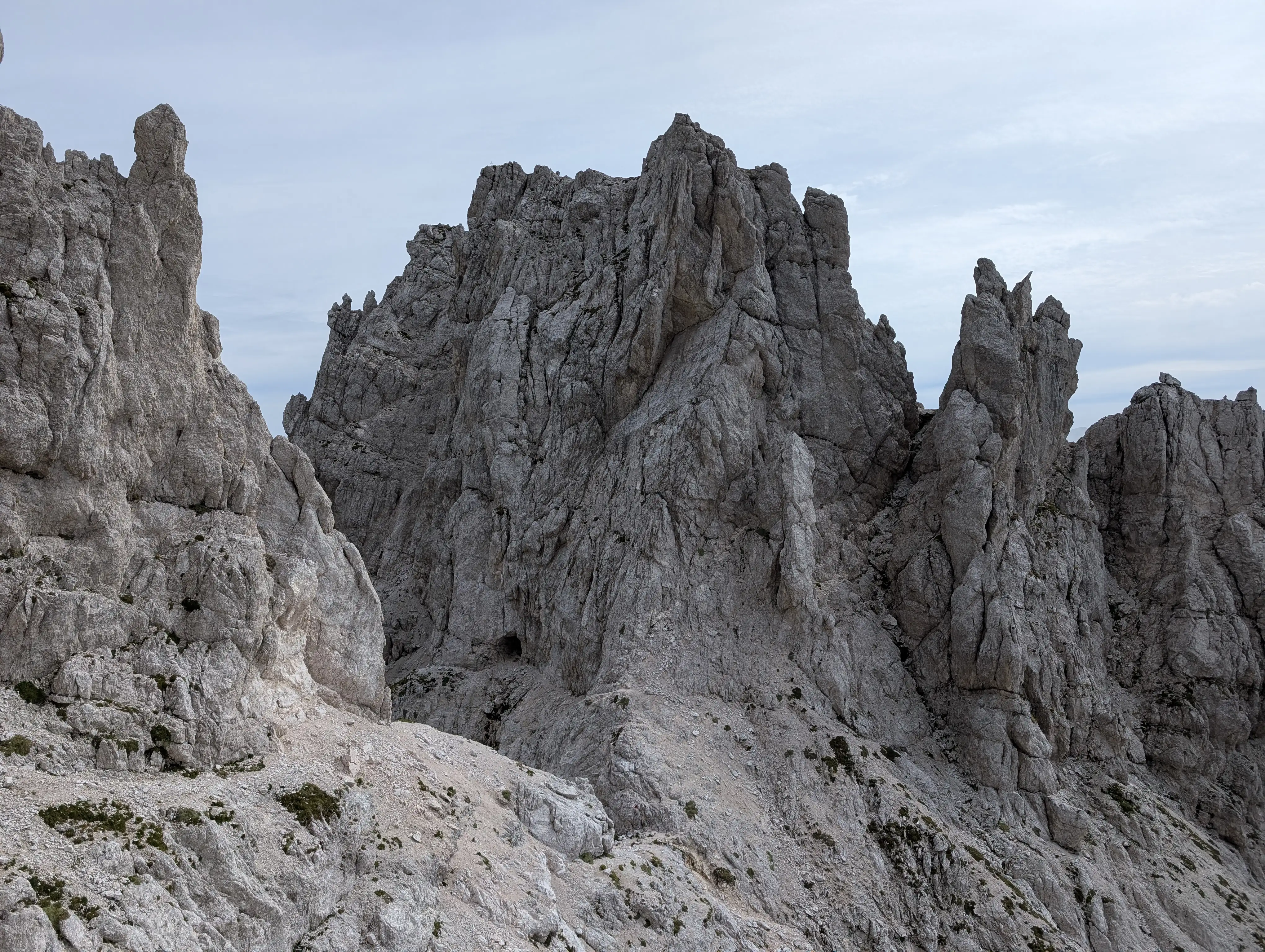 Tunnel takes us to the other side of the Cima delle Forcelle peak and almost directly on Forcella del Vallone saddle. This is the view from normal route to Cima del Vallone.
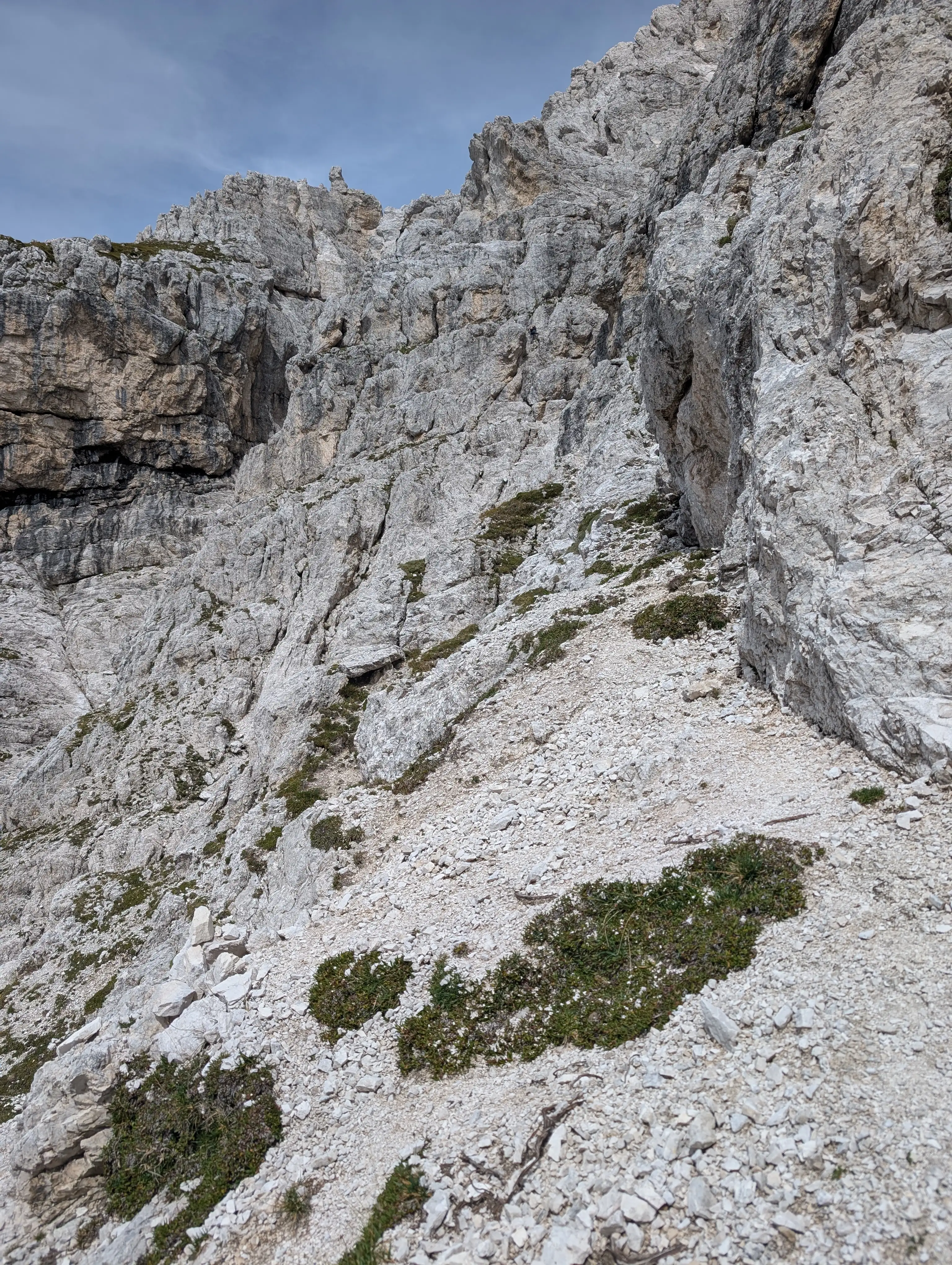 Start of the normal route to Cima del Vallone - ledge variant. View from Forcella del Vallone saddle.
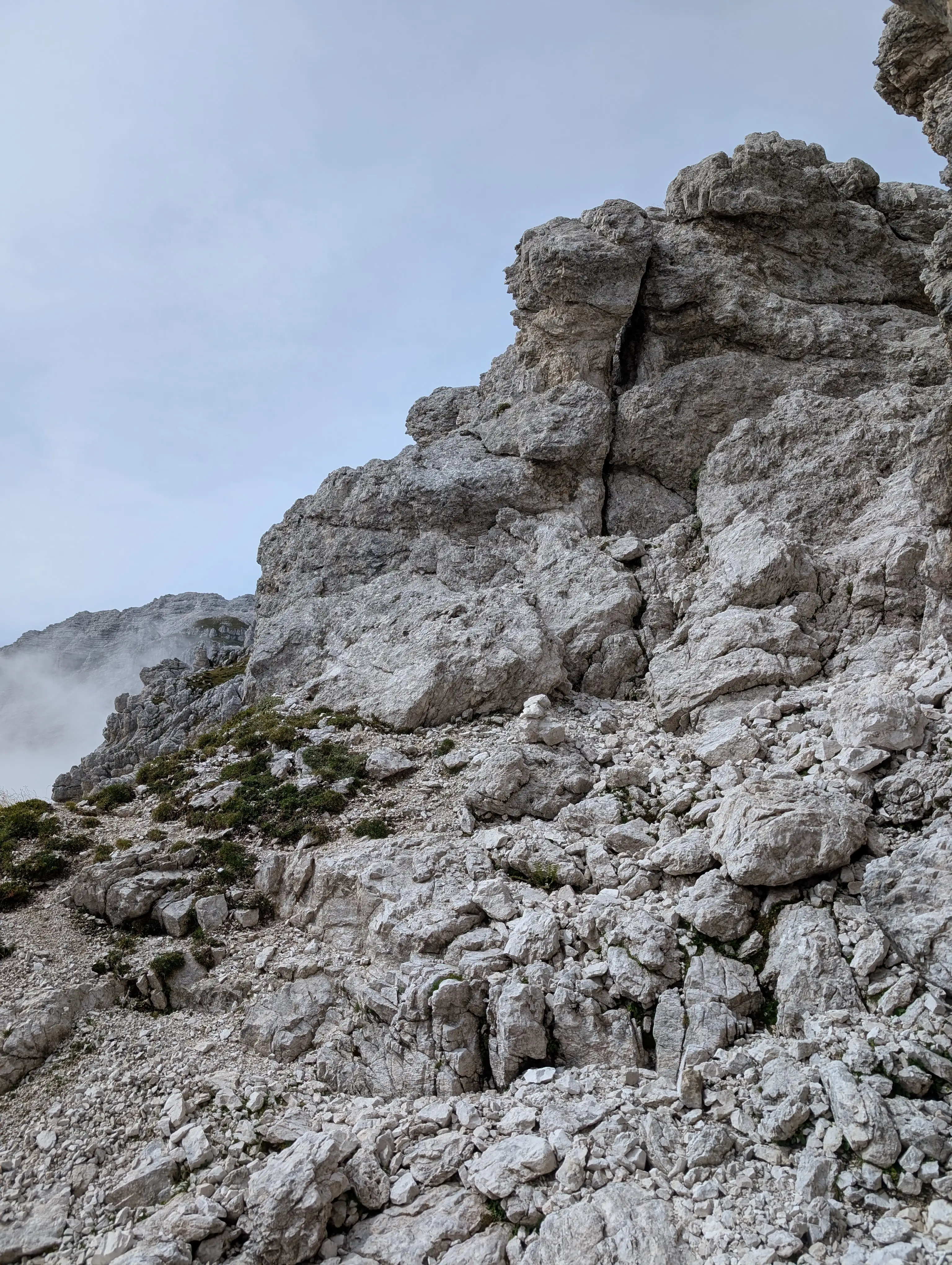 Follow the cairn, here go left, don't climb up to the right!
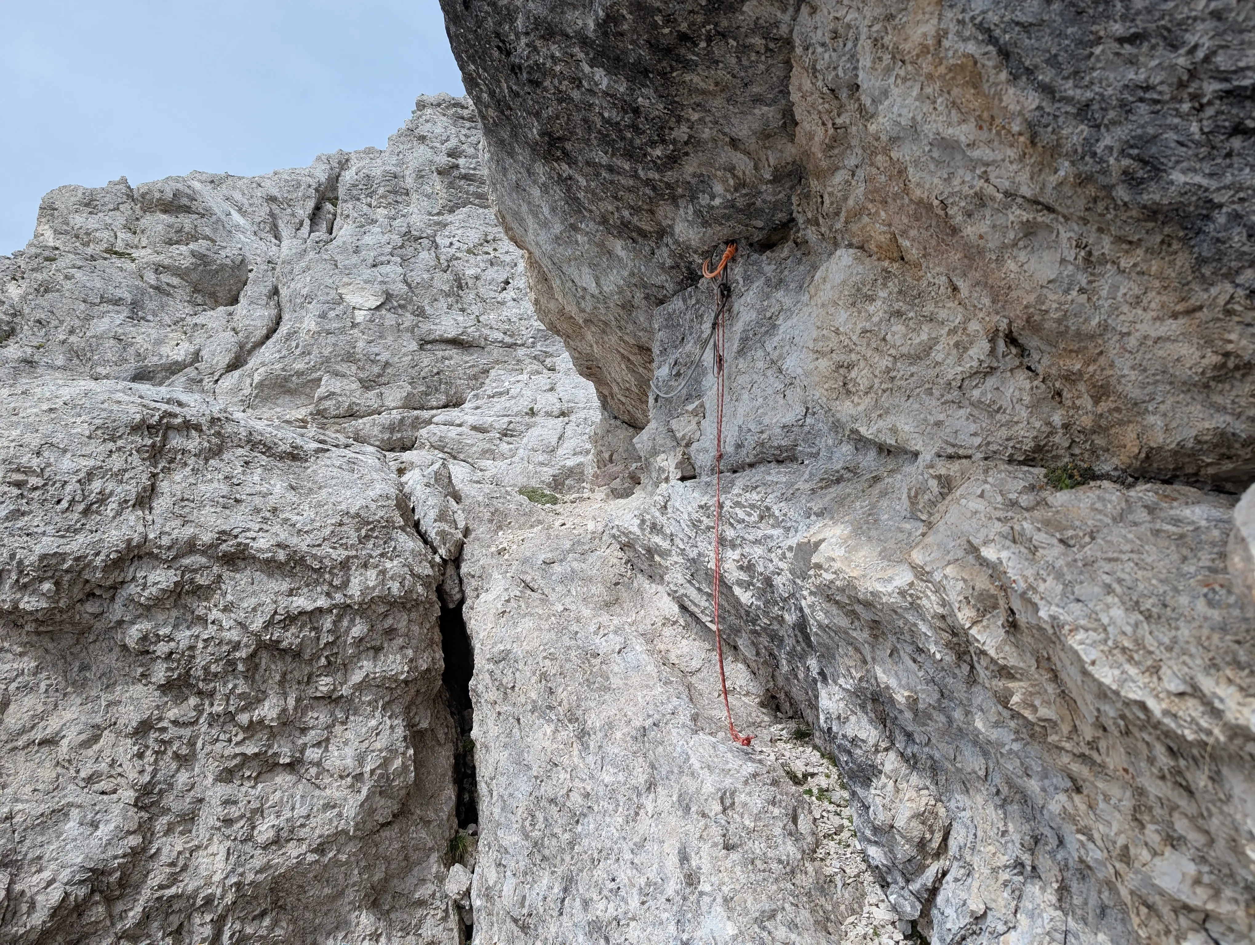 Ledge variant of normal route is pleasant until this point. The cord helps mentally but good balance is essential to make a safe passage. The spot is exposed, ledge gets narrower and slightly overhanging rocks don't help either. If taken, I recommend to use it while going up rather than descending.
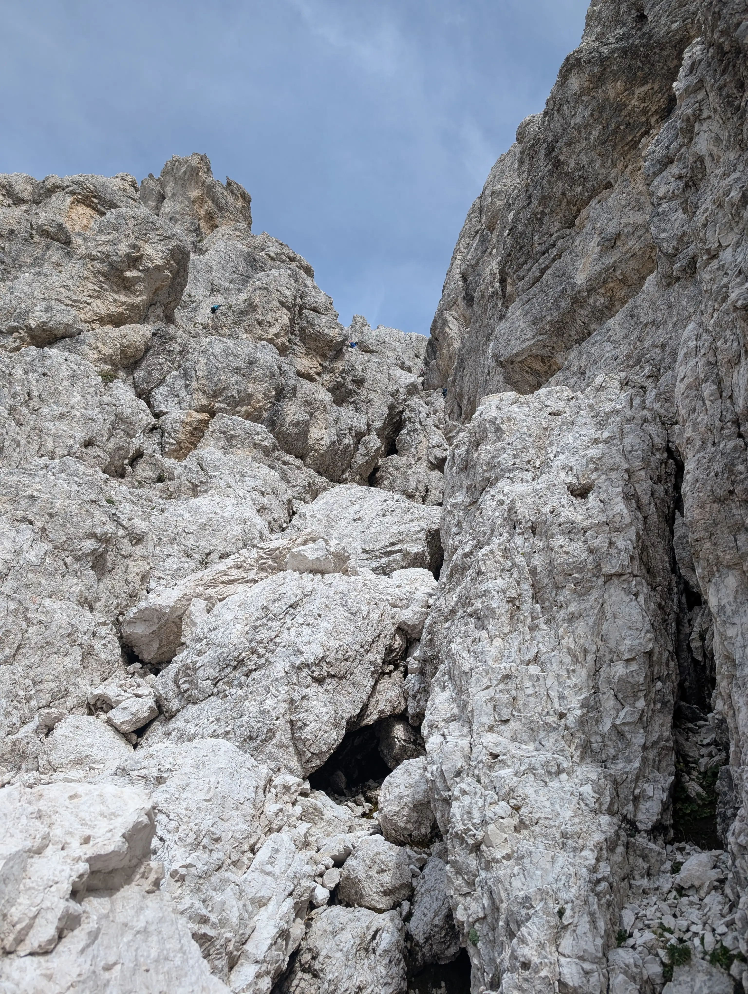 There is also gully variant of the normal route - for me it was easier to spot and more natural to follow. It's a bit more difficult technically but less exposed. To get to the start we need to descend couple of meters in direction of former Guido Corsi mountain hut.
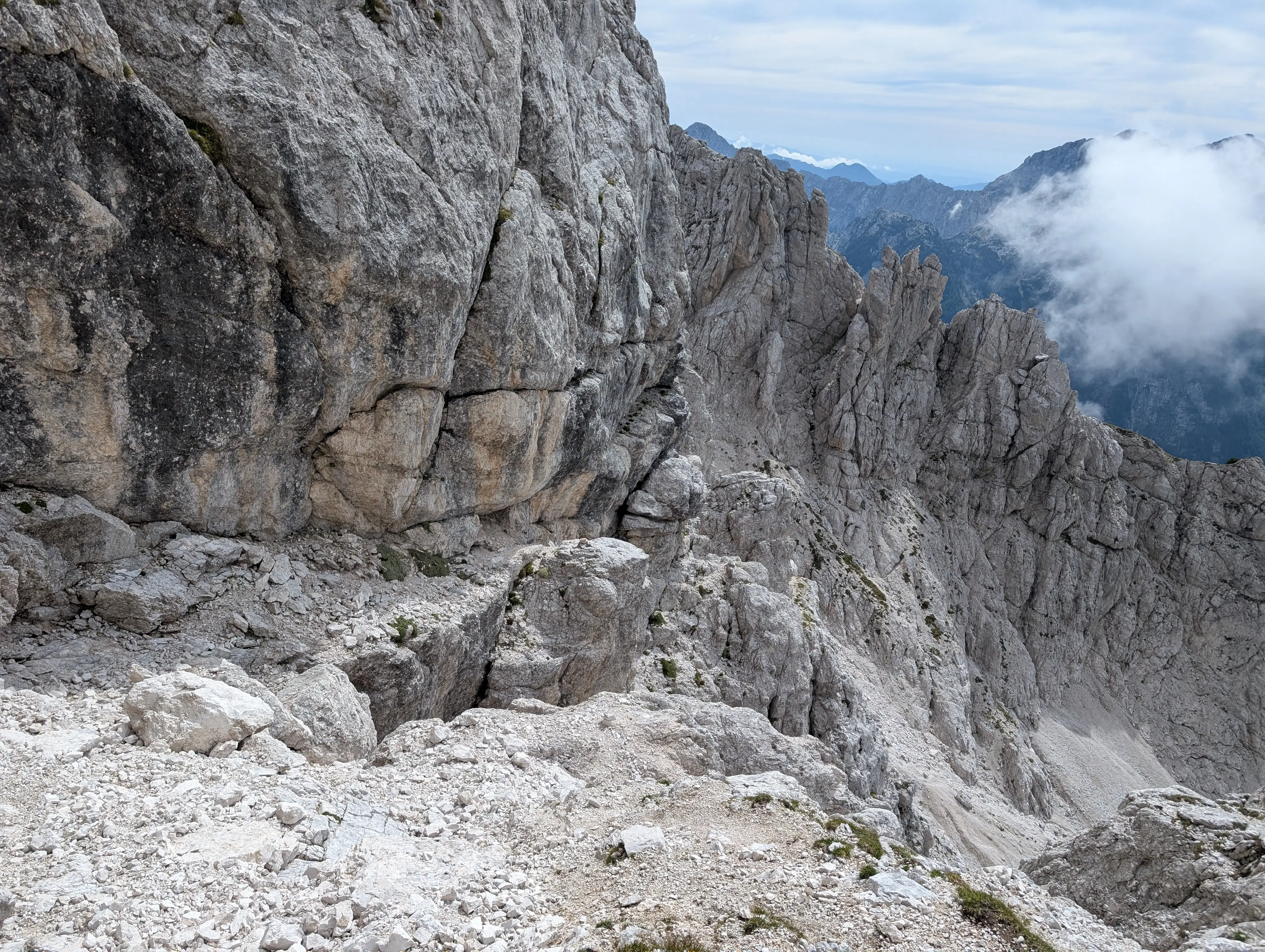 Here we can see how these variants combine - ledge one runs under the wall (yellow rocks, cord can be seen), gully brings us here from below where the grass is seen.
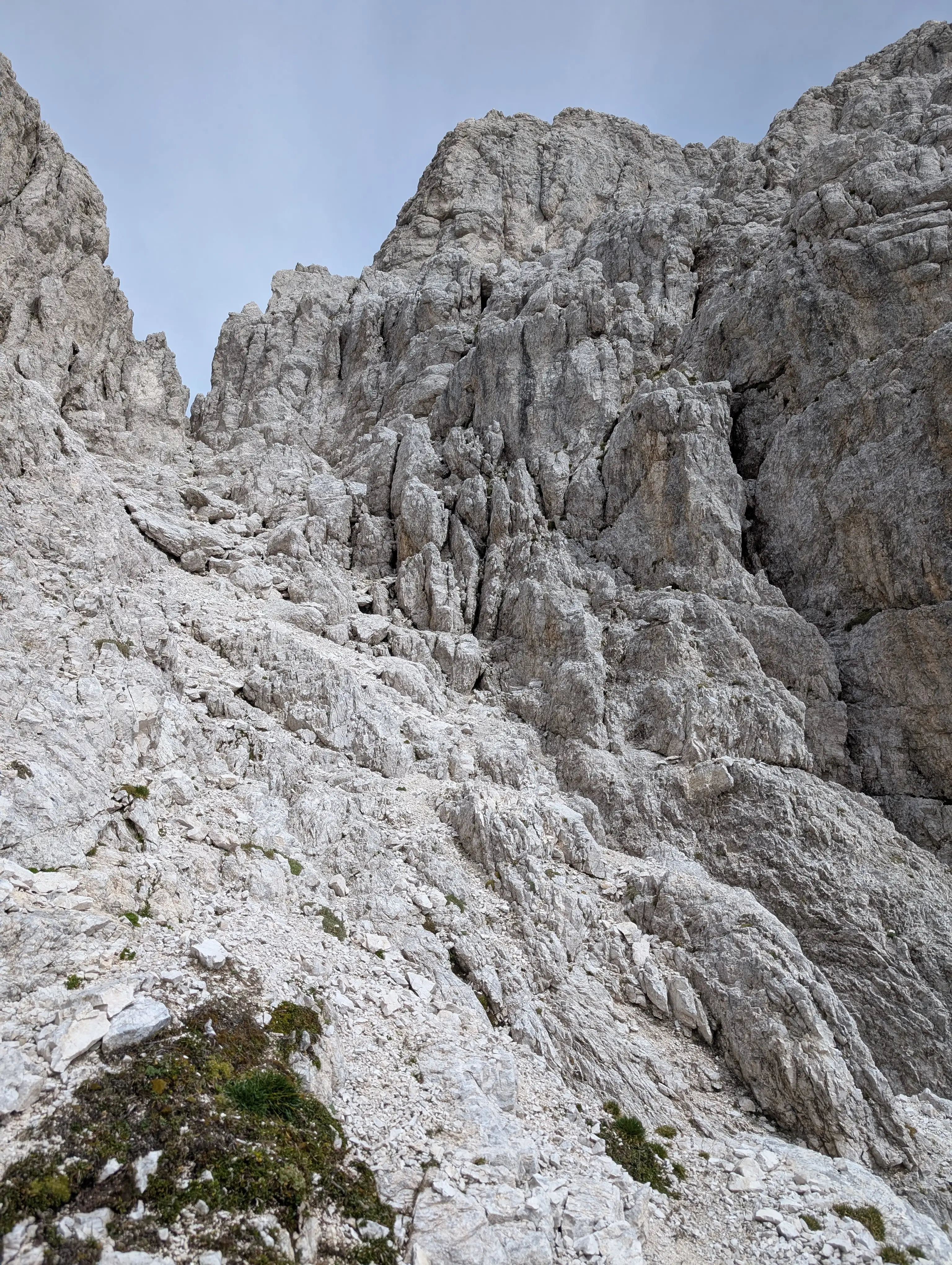 Cima del Vallone normal route overview - from here our general direction can be seen so first up via the bottom of the ravine, then to the rocks on the right, and with combination of ledges and chimneys - to the top.
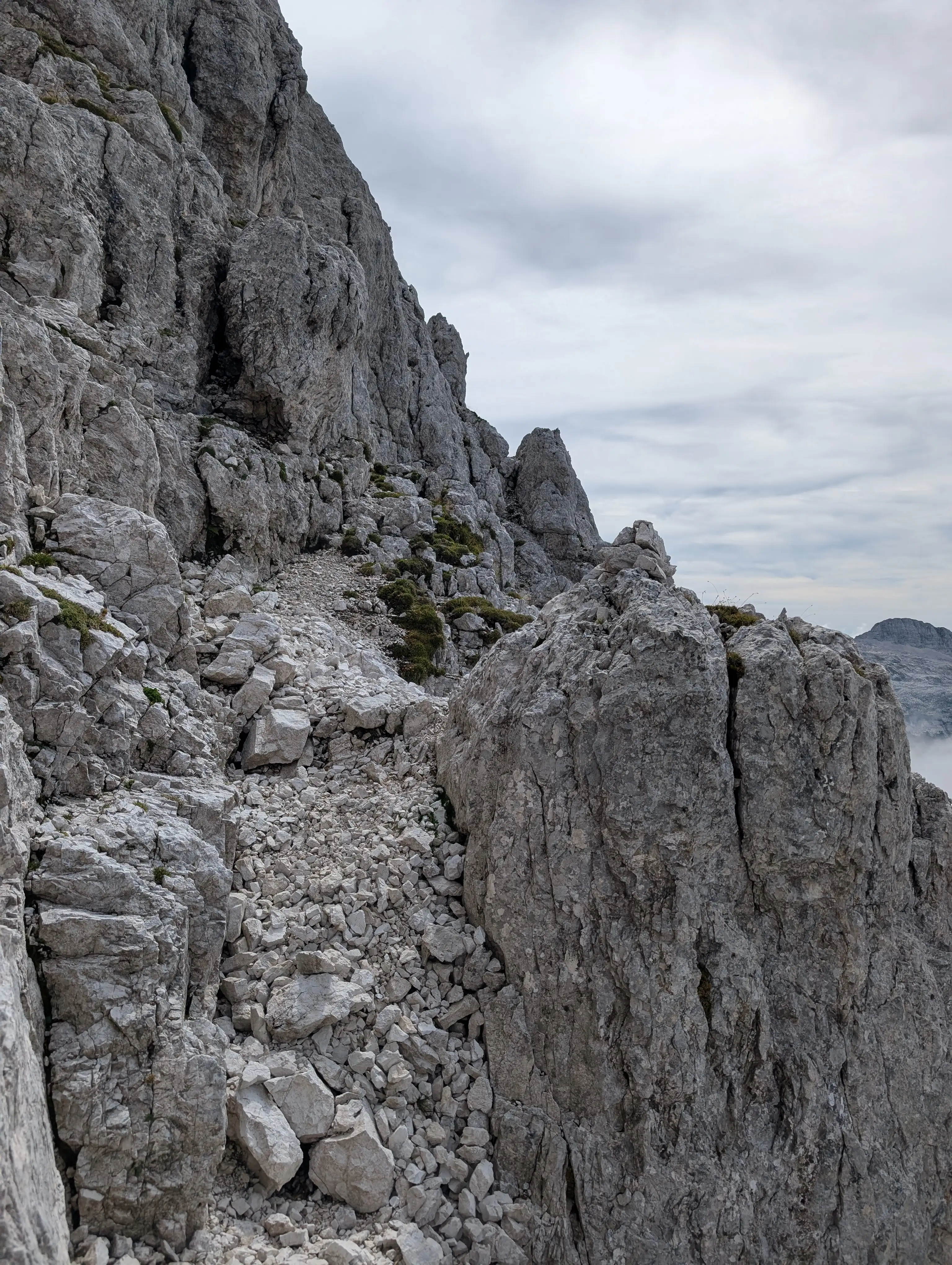 Ledge terrain above the ravine from previous image.
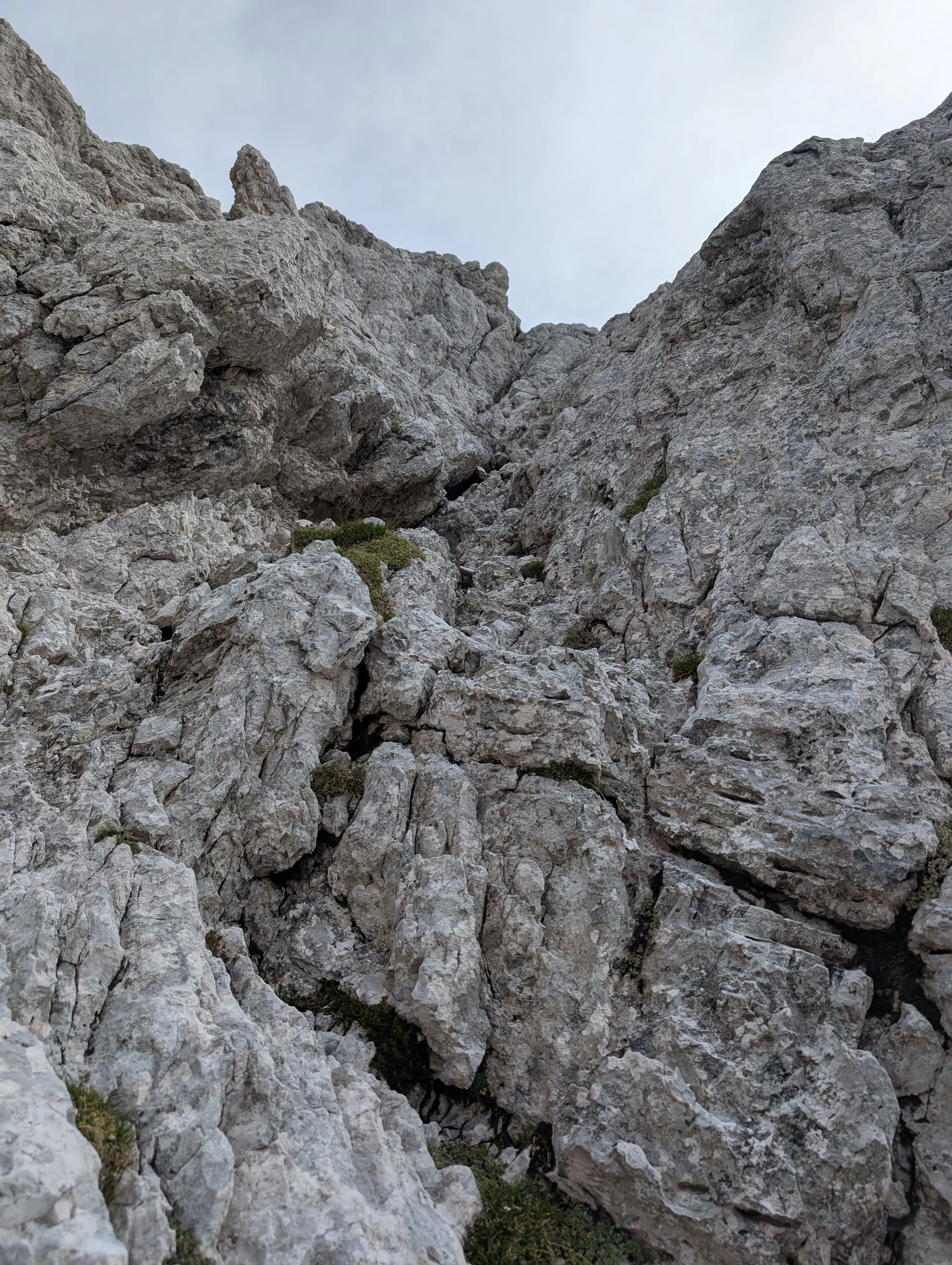 One of the ascent chimneys.
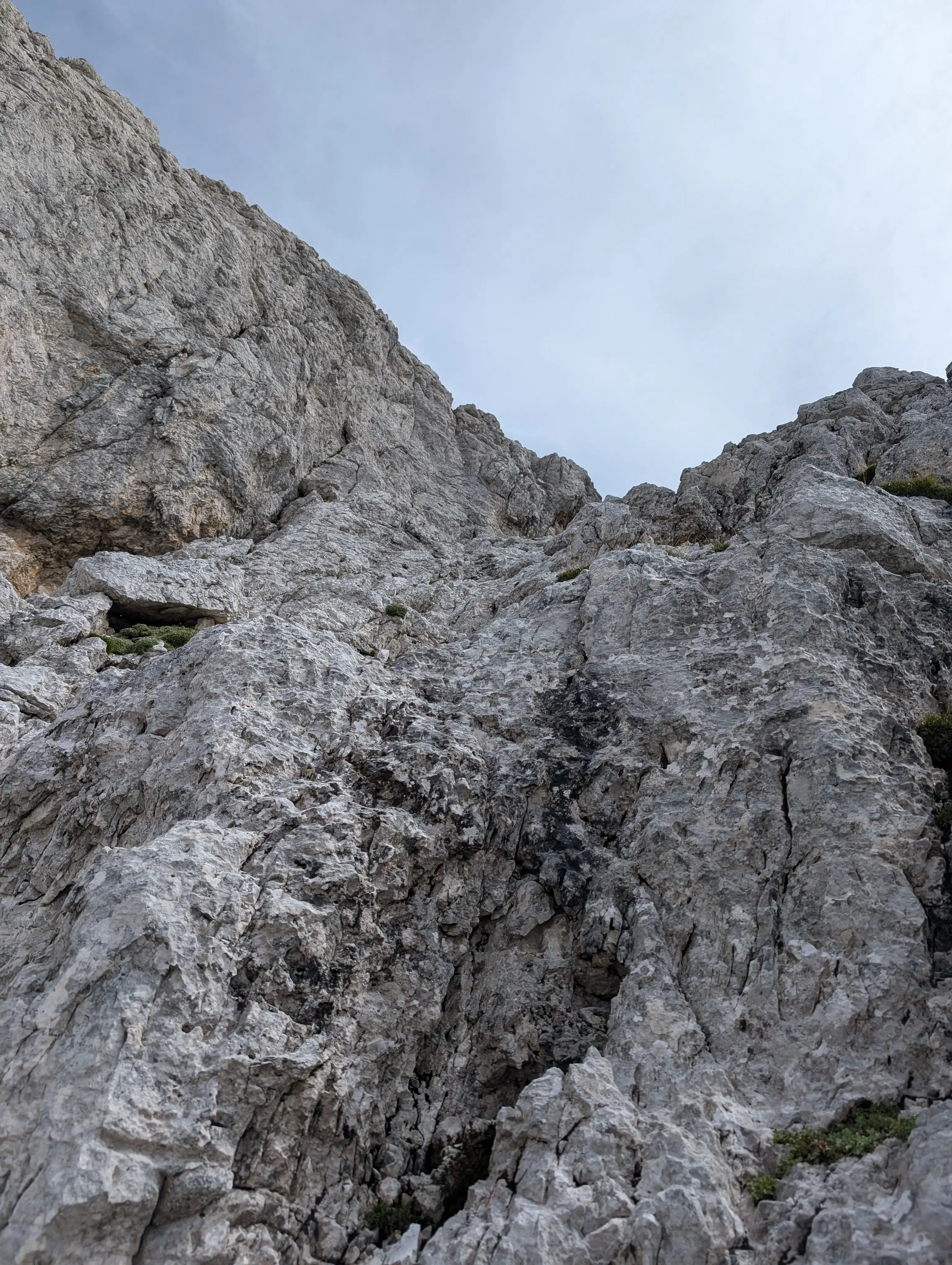 Final part of the climb.
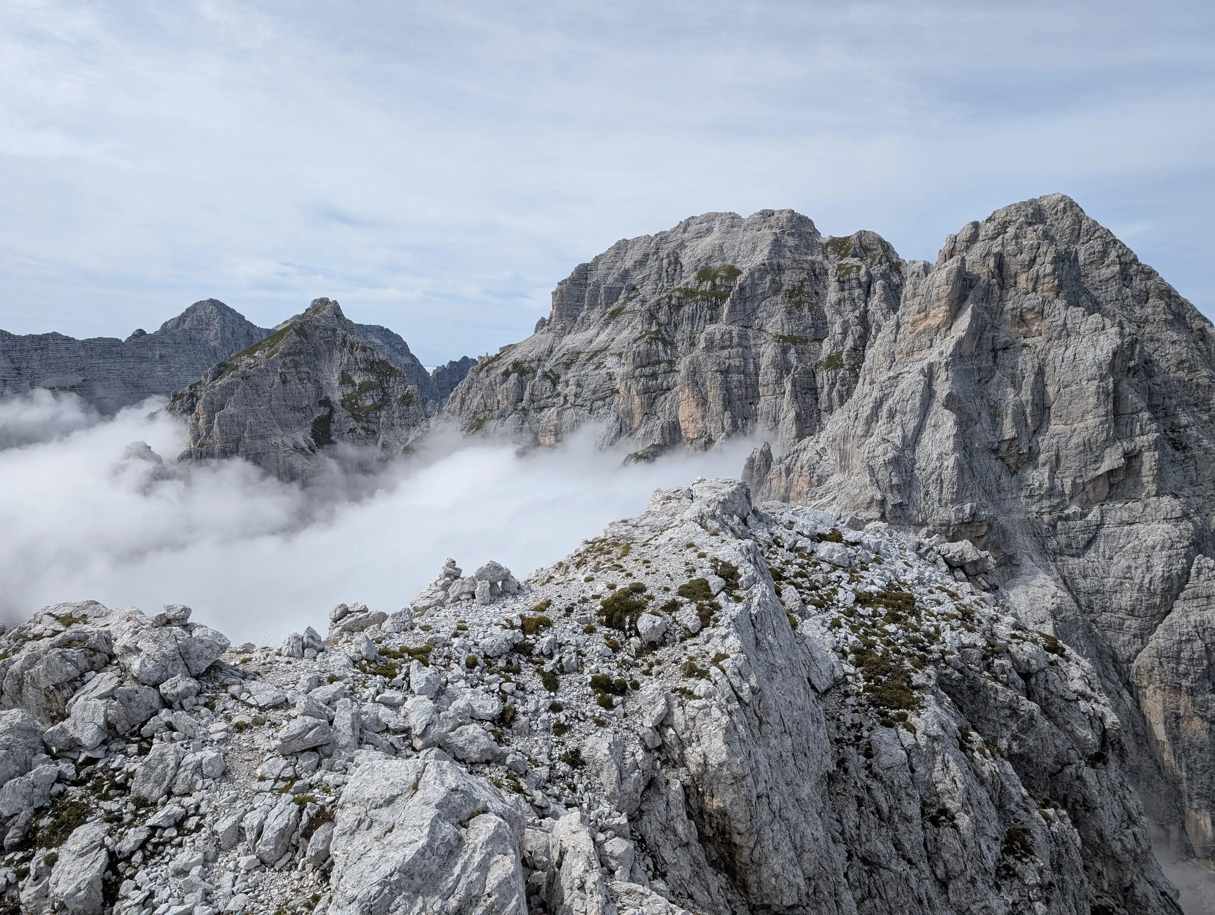 Top of Cima del Vallone is very broad and quite flat. Views are really spectacular.
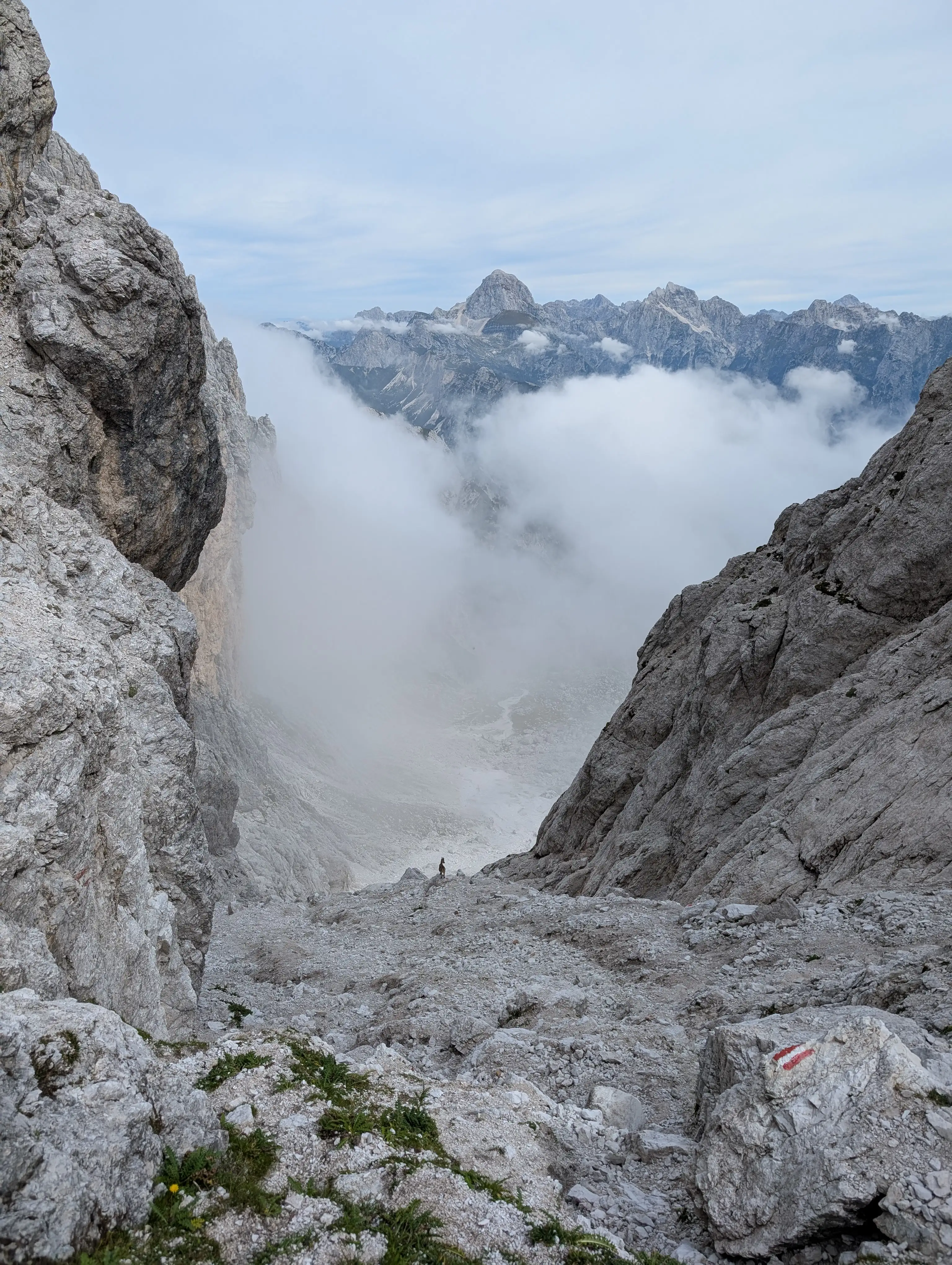 Going down, here starting nasty descent below Forcella del Vallone saddle. Here pay the most attention, lots of loose rock material.
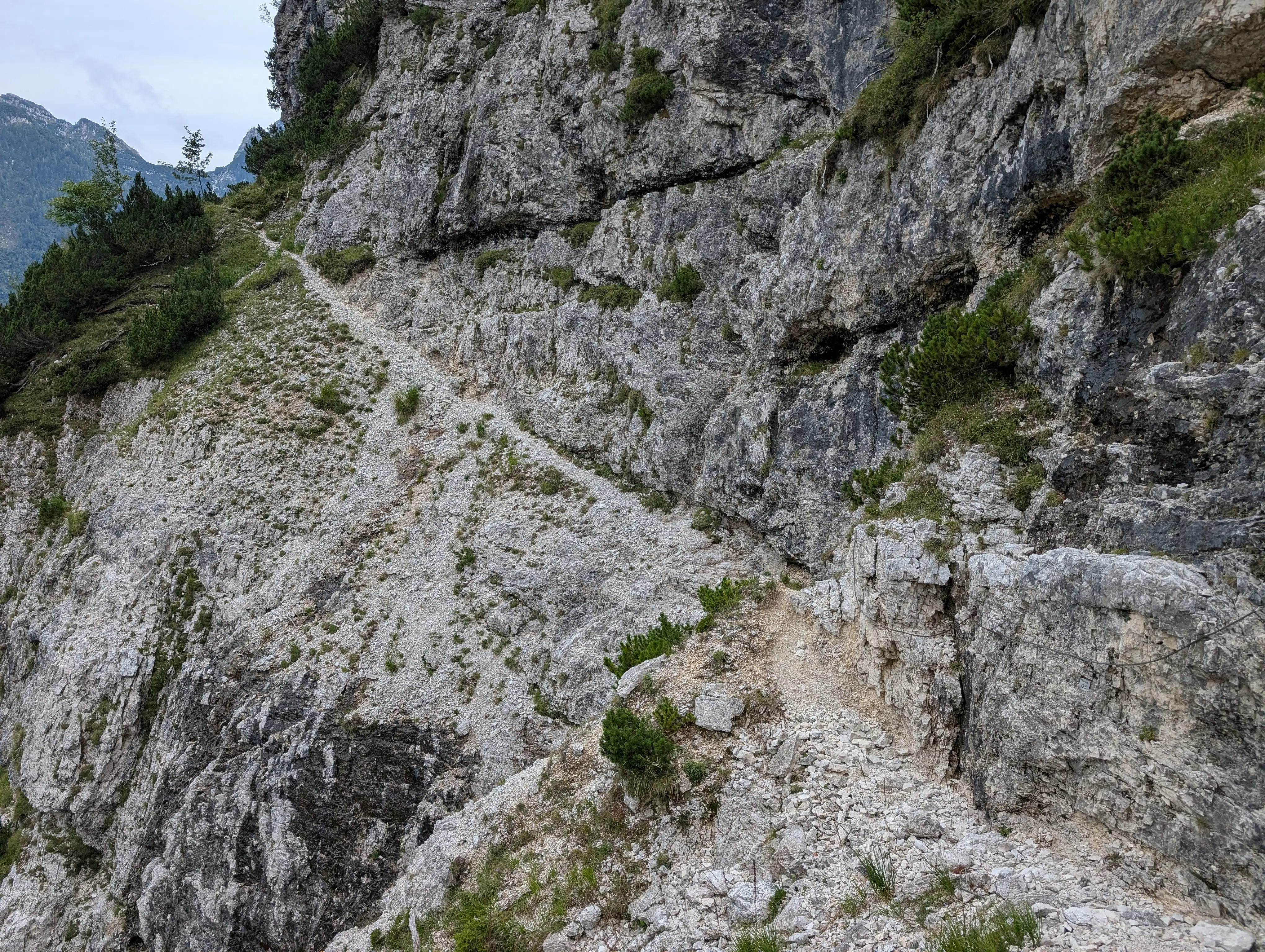 Down and past Capanna Brunner lodge, start into Re di Sassonia route.
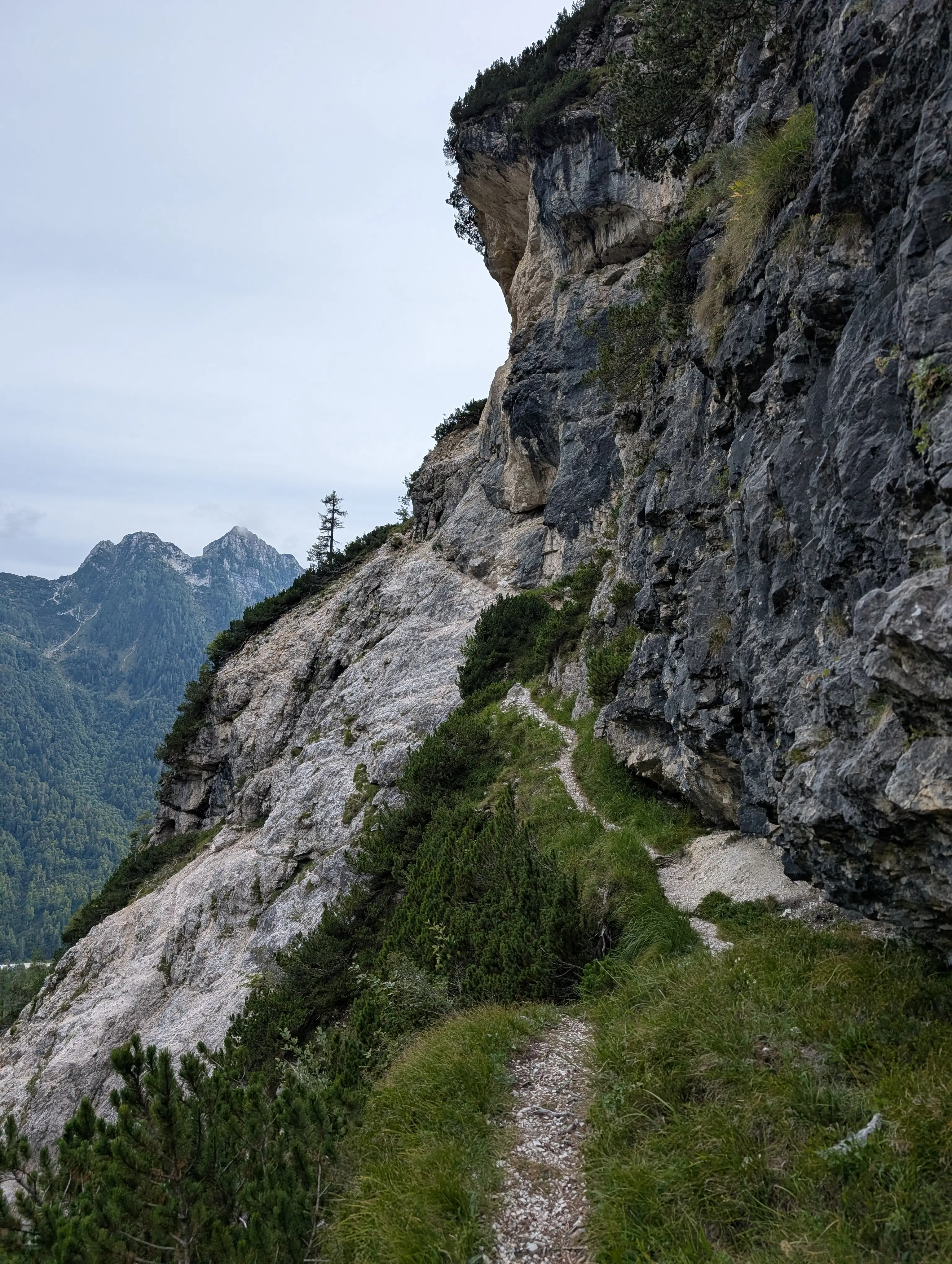 Soon will be approaching the hardest spot on the way and no more green grass.
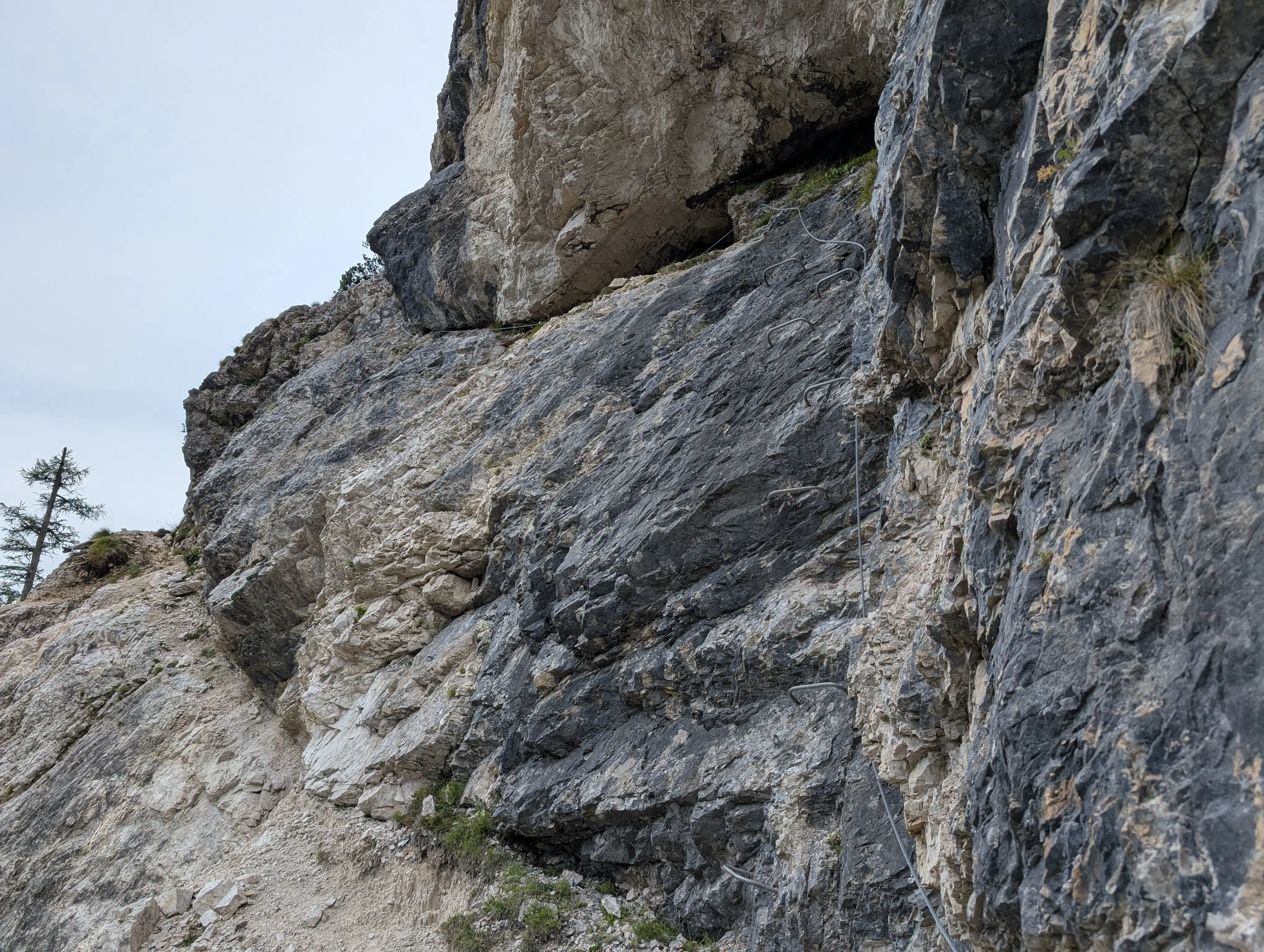 Exposition and vertical climb make this the most difficult stretches of Re di Sassonia route - rated C.
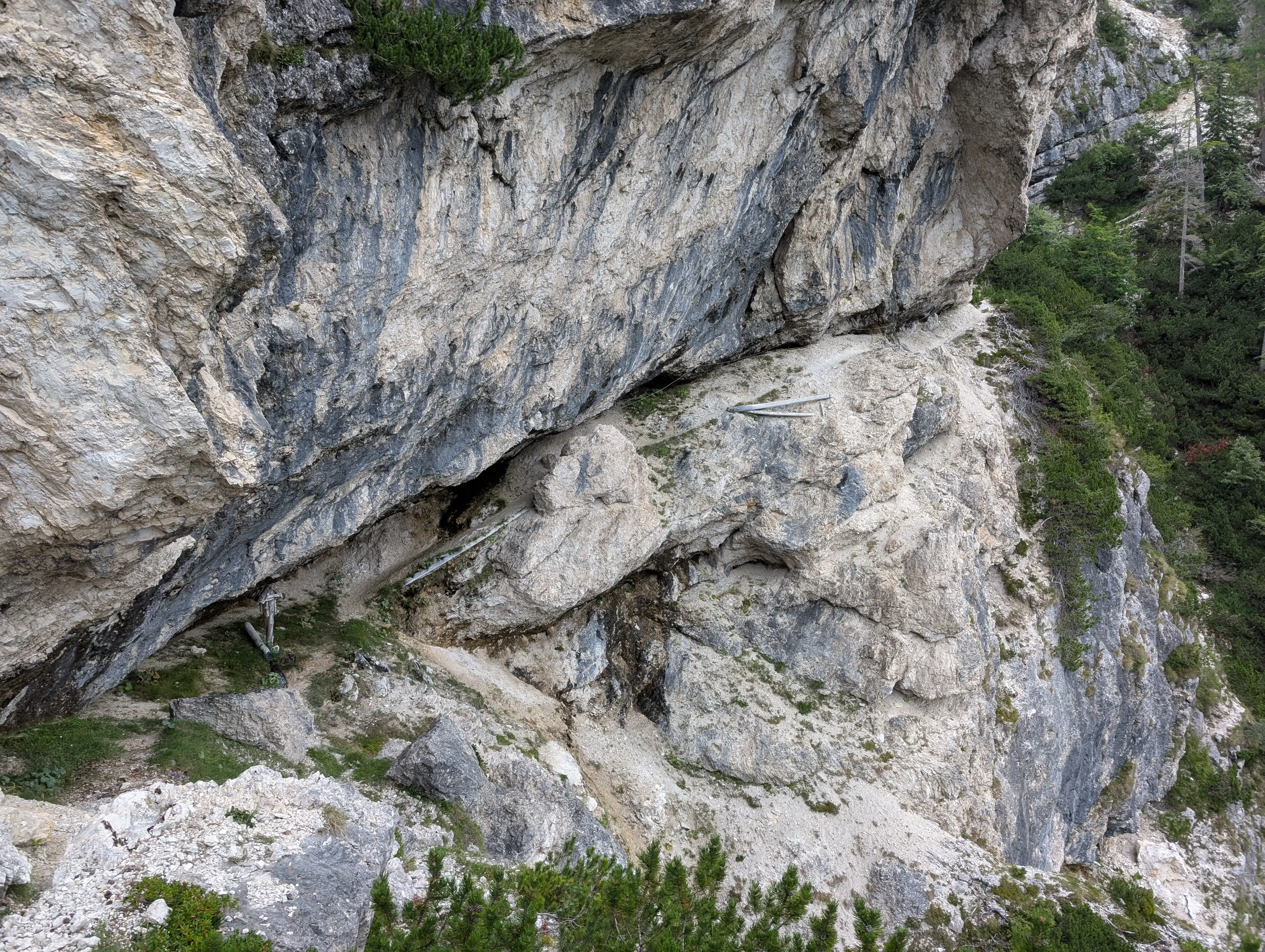 Sneaking under overhanging walls, watch out for dripping water.
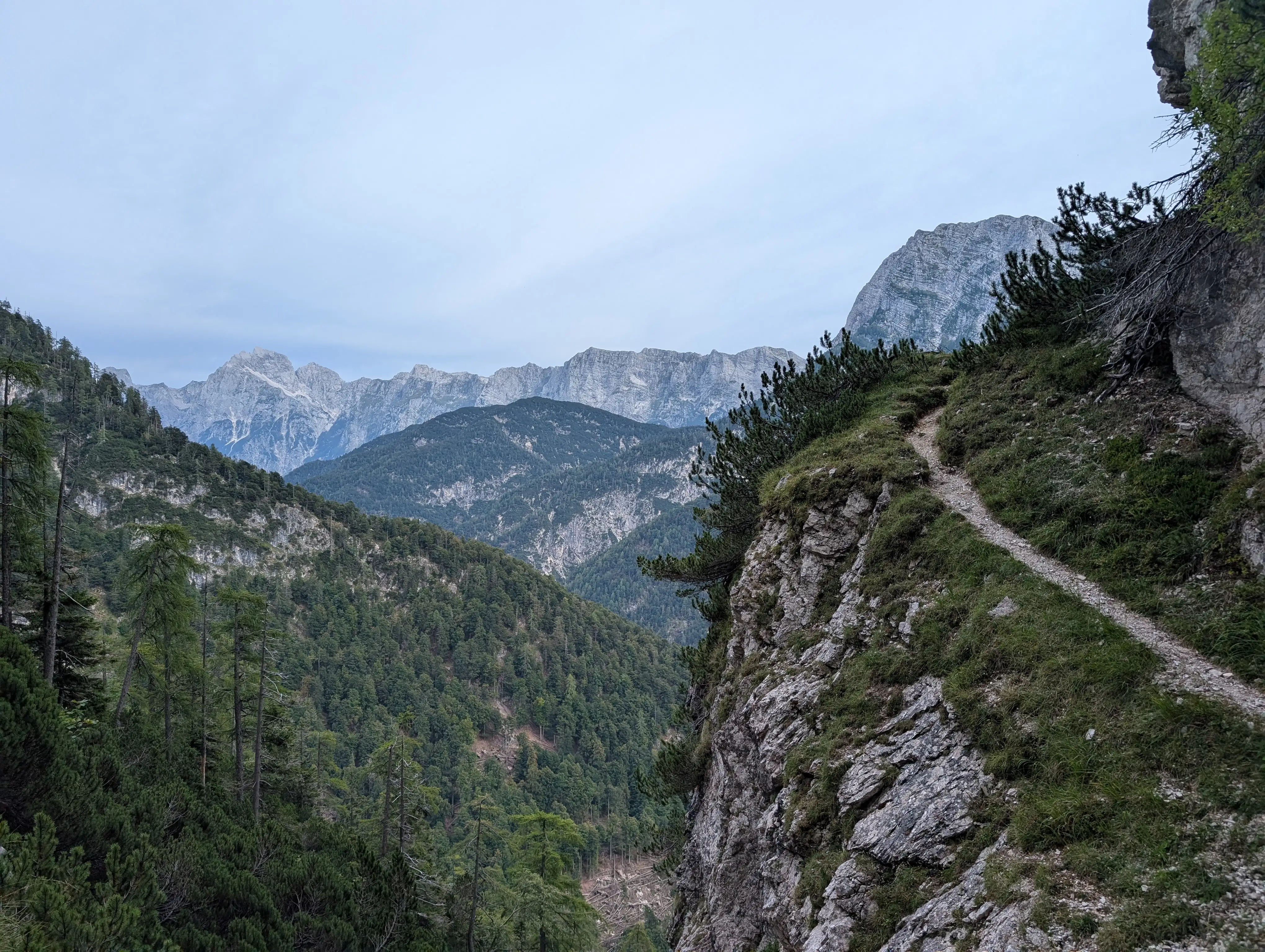 Traverses always offer some new perspective on the surrounding peaks.
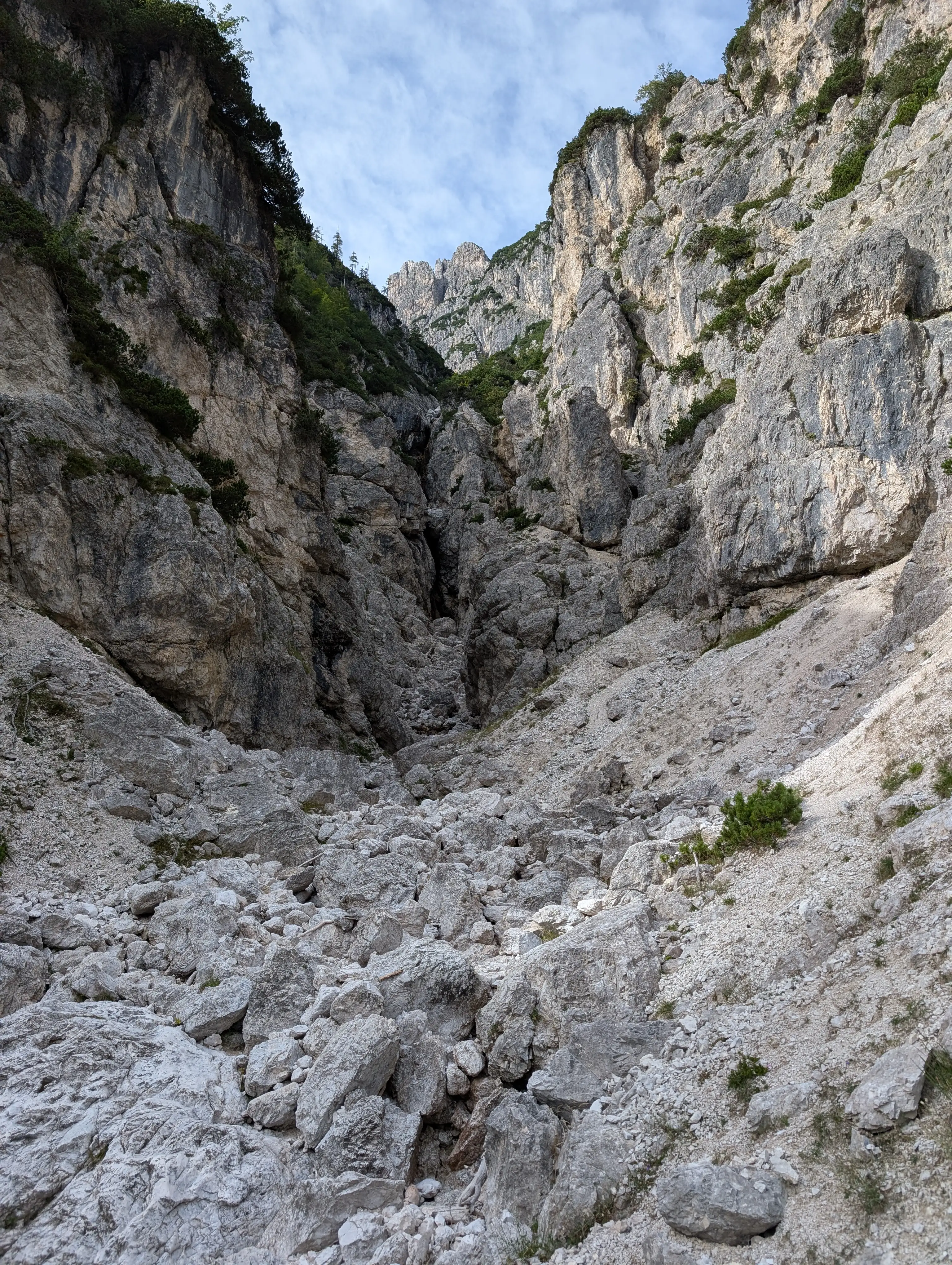 One of the dry streambeds we need to cross. This is the less pleasant part of the Re di Sassonia route because there is lot of loose rock material.
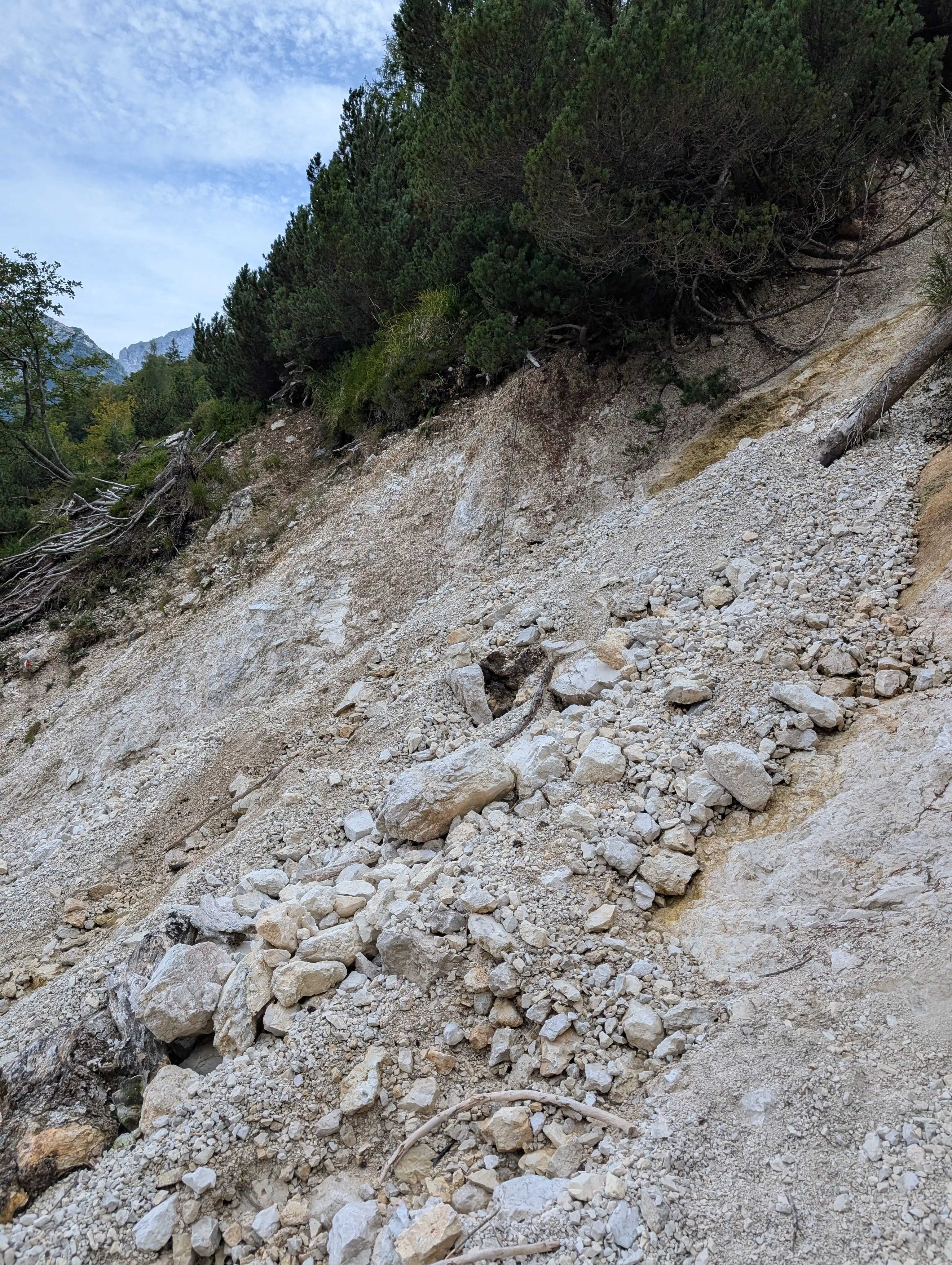 Erosion is a real thing here in places and is mitigated with cords, wires and detours. All in all Re di Sassonia route is safe as a whole.