Jôf Fuart via Gola Nord Ovest
Route scheme
Trip overview
Jôf Fuart (also known as Viš or Wischberg) is a 2,666-meter peak located in the Italian Julian Alps, near Tarvisio. Its massive limestone walls and exposed ridges make it a demanding mountain for climbers and mountaineers. During World War I, the surrounding valleys and ridges were part of the Italian front, and traces of military paths and fortifications from that period can still be found. The mountain can be climbed from the north and south using marked trails - Gola Nord Est (northeast gorge) and via normale (partly Anita Goitan via-ferrata) respectively. There are also numerous more demanding routes to the top and gola nord ovest (northwest gorge) is one of them. It’s a truly solitary climb through the wild landscape of the northwest gorge.
Gola nord ovest takes approximately 700 meters of elevation gain and another 1000 meters to get to its start. The ascent is pretty lengthy and located in a remote area of Saisera valley. Together with not that obvious orientation on the way and spots with a climbing grade of III, gola nord ovest is quite a challenging mountain adventure but totally worth the invested effort. Majestic rocky landscapes, a unique tunnel at the exit of the gorge and remnants of WWI make it a truly versatile trip.
Route description
Gola nord ovest (III) - access description:
Setting off from Malga Saisera parking lot we follow trail no. 616 (sentiero Carlo Chersi) in the direction of Sella Nabois (1970 m) pass. We go past Dario Mazzeni bivouac and traverse the slopes of Cima de Lis Codis (2380 m). After descending to get past a snow field we go up again and land on a grassy culmination of around 1950 meters with a characteristic larch tree. Here we leave the marked path, cutting through a dwarf pine grove. Then we go diagonally to the right via a ramp and land on a wide grassy ledge that runs horizontally to the wall, we turn left and continue to the foot of the northwest gorge. There are some cairns on the way but the entrance is not really marked. Once we stand under an overhang on the left and slabs in front of us we should go up.
Gola nord ovest (III) route description:
The route is quite long (700m) and many variants are possible. The general rule is to keep to the right side of the gorge. Sometimes that will be immediately close distance to the gorge, sometimes we stray a bit further. There are however three key spots we need to watch.
At an altitude of around 2100m, just next to a snowfield, there’s a rocky threshold that needs to be climbed; there are many variants, the easiest is presumably a 6m long chimney on the right side of the gorge. It is rated as a III climbing grade, for me personally it wasn’t really that pleasant. You can try other spots but these may be more difficult. Just above this threshold the route crosses Cengia degli Dei (ledge of the gods in English) route - which is a ledge system running around the Jôf Fuart massif. There are cairns in place that can lead you off the route - which happened to me. Against intuition, you need to follow the gorge keeping more to the left in here, landing under what seems a vertical wall - according to the descriptions I read before setting off, there is a hidden passage. However, my case showed it can also be bypassed from above - so first going a bit right along Cengia degli Dei and then traversing back in the direction of the gorge. Except for the mentioned rocky threshold, climbing difficulty does not exceed II+ grade. However, that is dependent on the variant you choose, so keep a good eye on the way up.
In the last sections you need to look up and aim for the so-called Jôf Fuart tunnel - an uncanny window that needs to be crossed to get to the ridge. Be careful in the window; there are tons of loose material inside.
Links:Route course - no. 8.11
Gola nord ovest (III) - exit to Jôf Fuart:
Once we climb up through the uncanny rocky window we reach the ridge (and sun again). This is the end of Gola nord ovest route. Next we turn left and use the ledges to climb flat towers. Summit of Jôf Fuart can already be seen from here. In 15 minutes we land on the peak of Jôf Fuart with cross and statue of Madonna, however that is a pre-summit and we still need to walk a bit to get to the actual one.
Gola nord est (II/C+) - descent from Jôf Fuart:
The descent runs along the marked and well-protected trail of the northeast gorge (gola nord est). The first stretches of this route are pretty nasty, with a steep slope descent in crumbly terrain. Lower, once the actual gorge is entered, things get better in terms of rock quality but also more vertical and challenging. The route is protected with wires, metal steps and partly wooden ladders. All these make it an interesting down-climb; however, after all these hours already, they are not that easy to enjoy. A couple of places require moves with some strength involved. Eventually we land in a grassy terrain with some paths, then cross a scree section under a giant snow field and get back to trail no. 616 and follow it in the direction of the Pellarini mountain hut. Then the trail is to be followed to get back to the bottom of the Saisera valley and eventually to the parking lot.
Trip conditions
Weather:
Warm to hot temperatures with storm forecast for afternoon/evening, a bit cloudy. Short sleeve was enough for the whole day.
Trail:
Marked parts of the route are in good condition, the marking is sufficient. Trail 616 - sentiero Carlo Chersi is less frequented in upper parts and a bit demanding. Before Spalla Nabois pass there is a bit of crumbliness while traversing. Northeast gorge (gola nord est), which is a descent route from Jôf Fuart, is really nasty in the first parts below the summit with lots of loose material. When entering the actual gorge it is much better; also the protection is of really good quality in there.
The northwest gorge (gola nord ovest) has an average rock quality; there are sections where we need to be especially careful. Since the route is barely frequented there are a lot of loose rocks - of every size.
Additional information
Tips and author's comments:
Had climbing equipment, however used only a helmet in the end; exposition is rather limited.
The route is recommended to be climbed in late summer to be sure no snow awaits us in key moments. It is also a good proposal for stuffy, sunny days because 80% of the route is done in shade, either coming from trees or rocky walls.
Dangers:
Orientation problems, route is not that obvious to follow in lower and upper parts. It's also not that popular so I wouldn't count on other climbers. Therefore also a stable weather is a prerequisite for the trip. Since we are hidden behind the northern wall more than half of the sky is not visible - thus we might not know what's happening on the other side until we get to the top.
Gear used:
ascent shoes, 20L rucksack, helmet, harness, personal climbing set, 30m rope, couple loops, couple of friends
Transportation:
Starting point reached by car. Access to Saisera valley is protected with barrier and it costs 6 EUR. This does not apply if you show up in the early morning - before 6 AM there's no one to charge you.
Links:Parking lot location
Accommodation:
We can use Luigi Pellarini mountain hut or Dario Mazzeni bivouac that will ease the trip a bit by splitting the effort into two days.
Trip photos
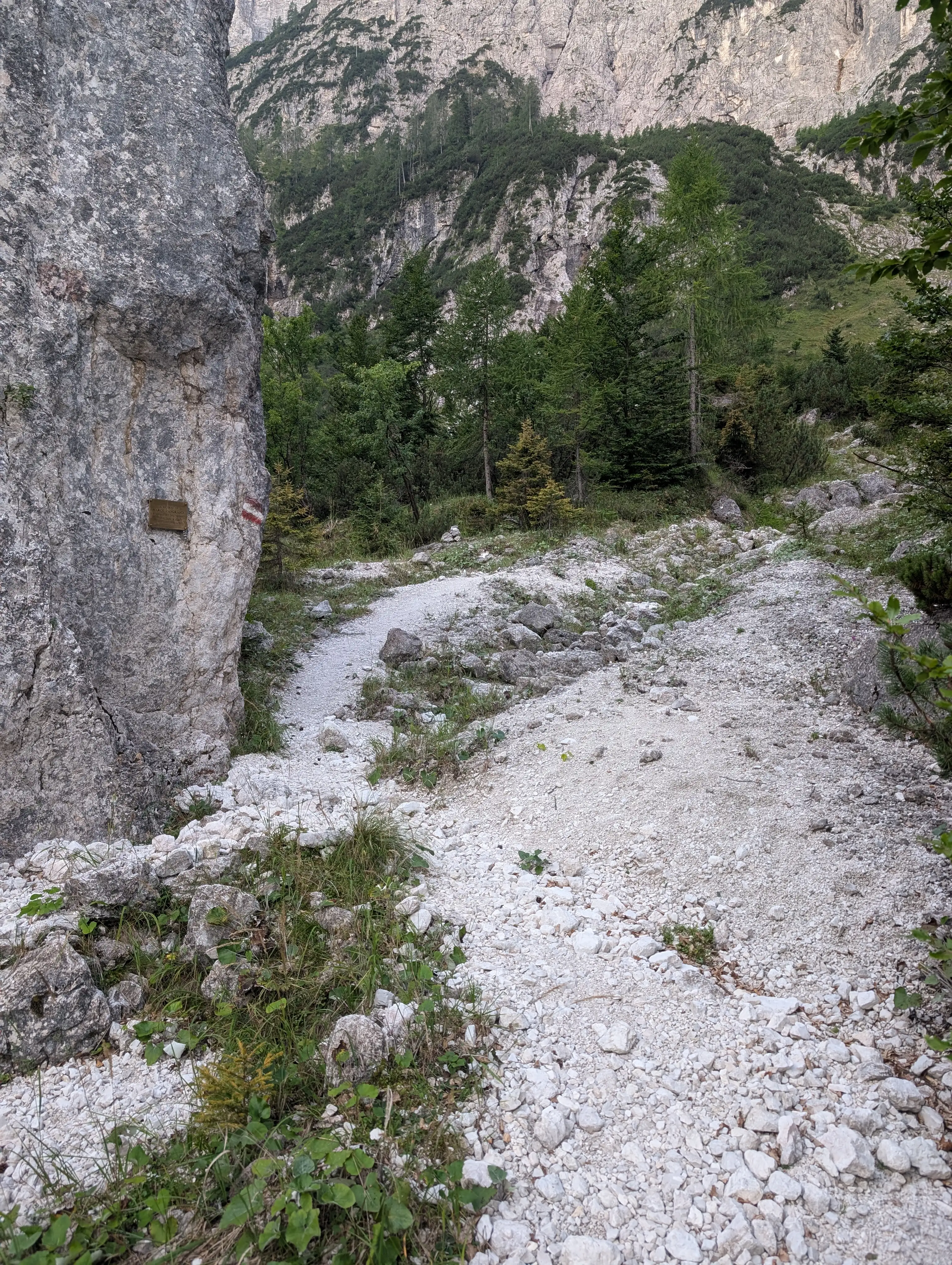 Terrain in lower sections of sentiero Carlo Chersi trail.
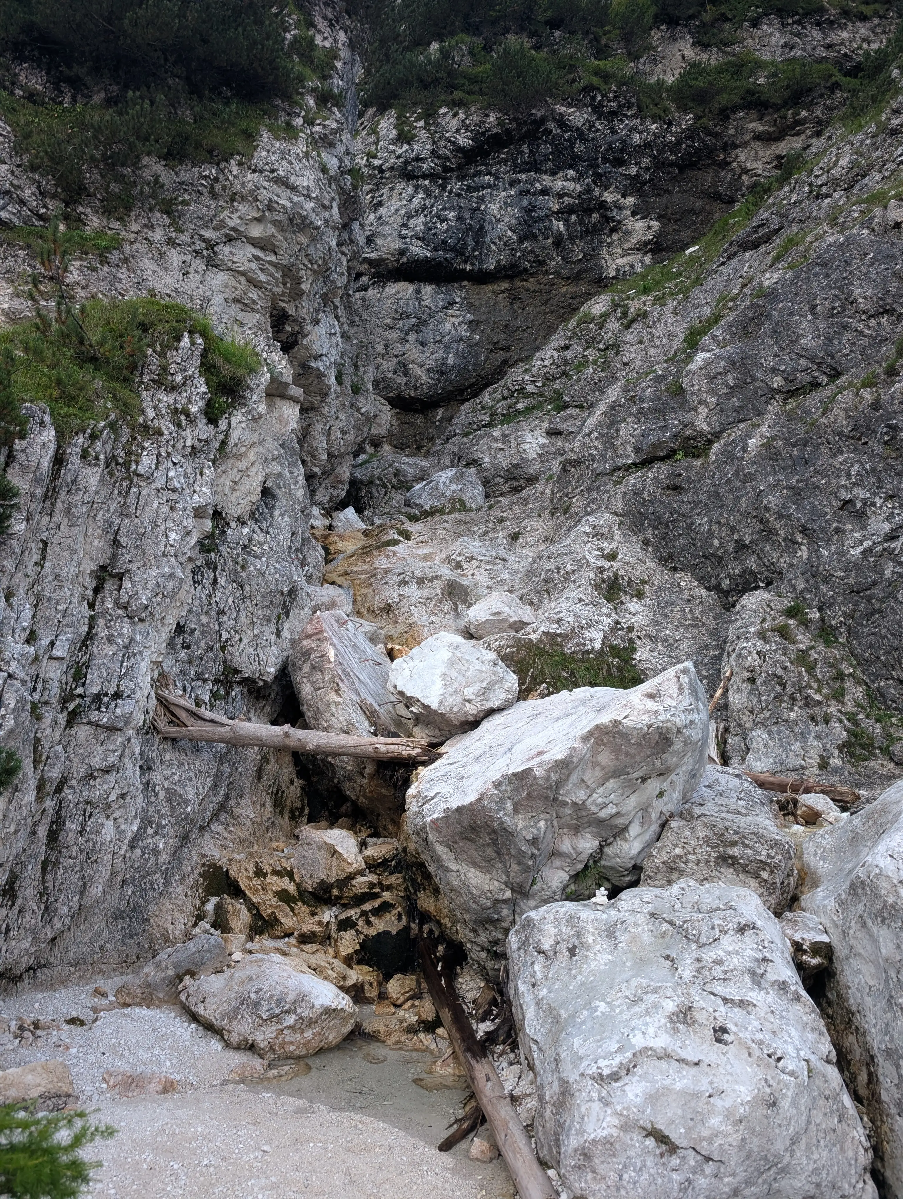 First obstacle on Carlo Chersi trail. There will be more of the like - ladders, metal steps and the need to use hands.
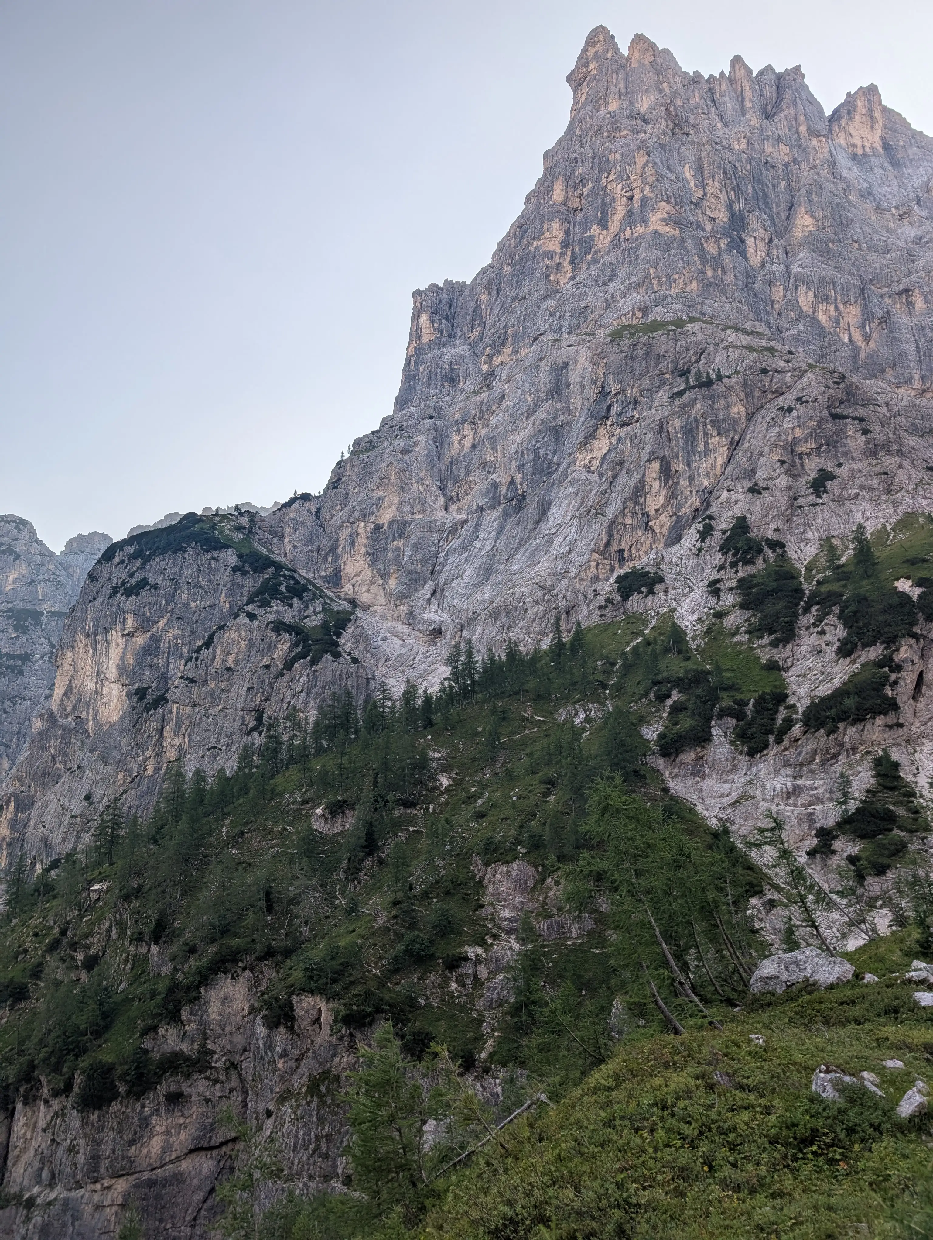 Carlo Chersi path traversing western walls of Cima de Lis Codis. After reaching that green culmination with trees we need to descend again and head for another similar one.
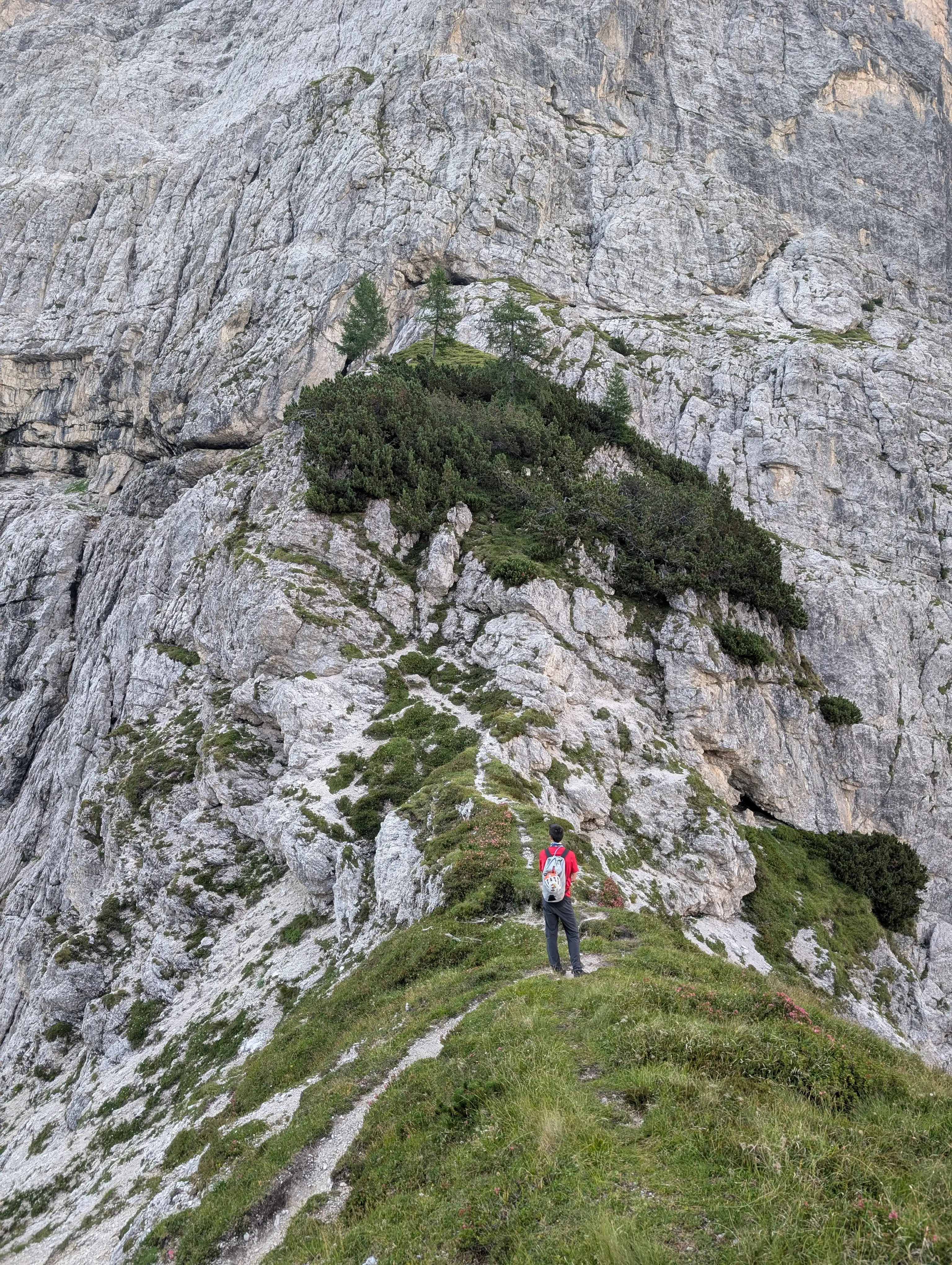 In this spot we need to leave the trail. Follow that path up into the direction of a dwarf pine grove. Can be crossed directly or by-passed on the left (exposed). Then climb on the grassy shelf just above the line of trees, take the diagonal ramp to the right. Once up, turn left and follow the ledge.
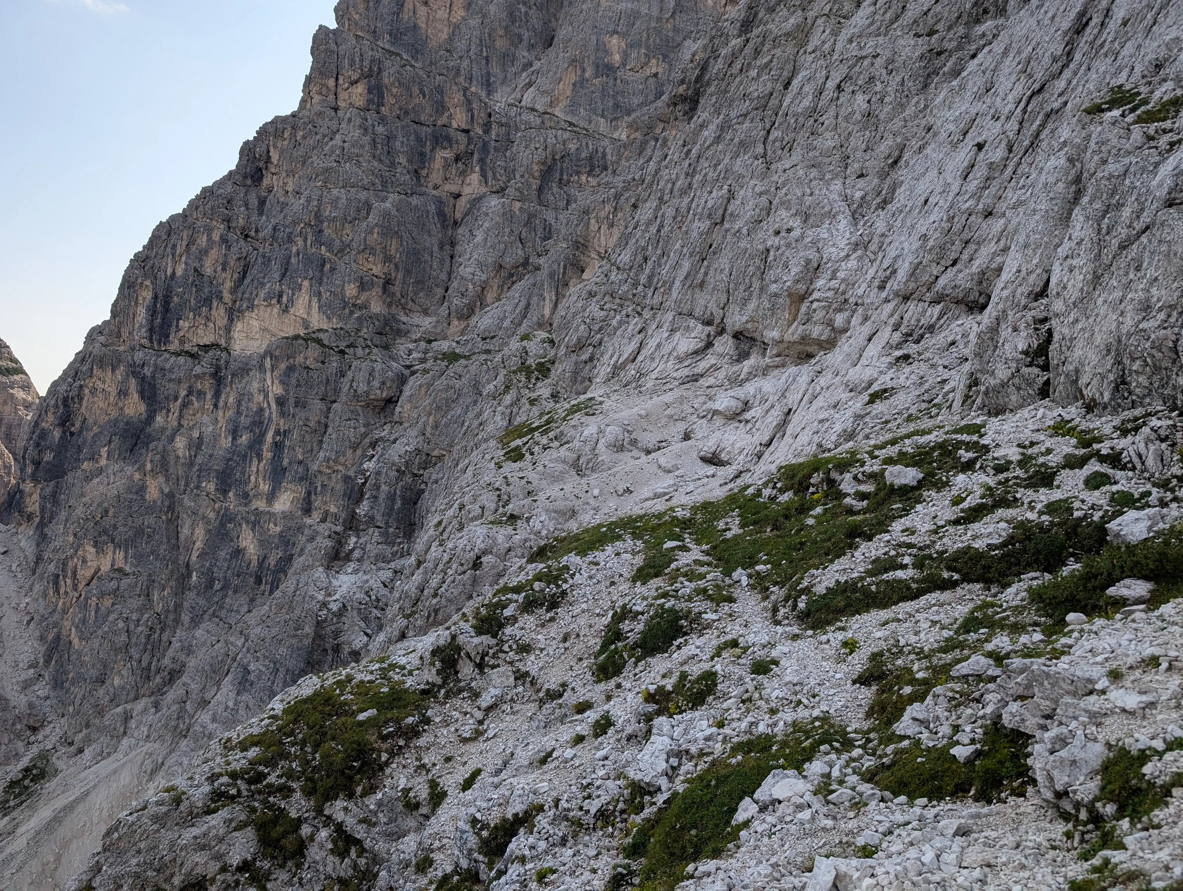 Terrain in Gola Nord Ovest access ledge. Follow it until the gorge exit is reached.
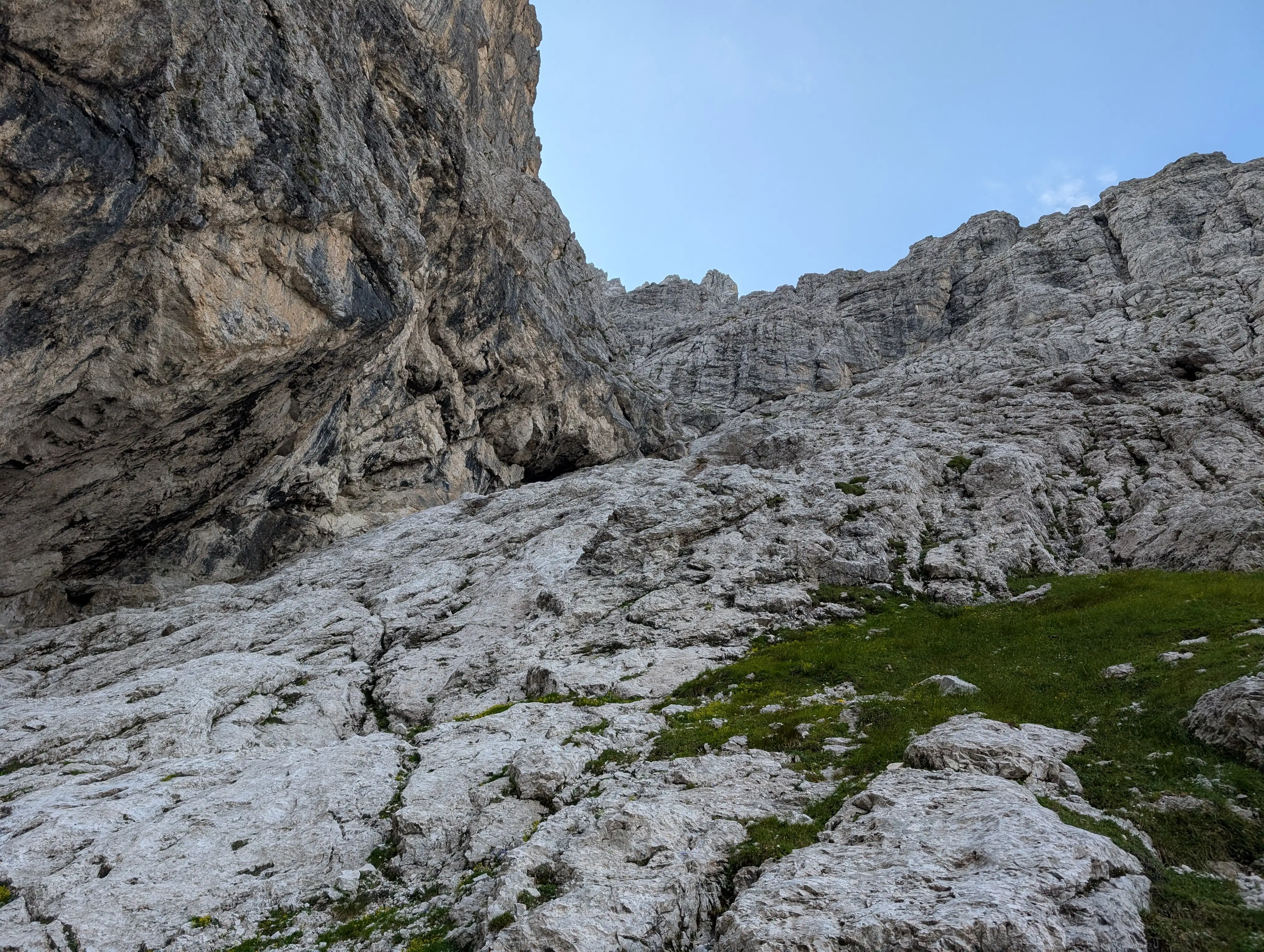 Gola Nord Ovest entrance, slabs on the right are the best to climb (II).
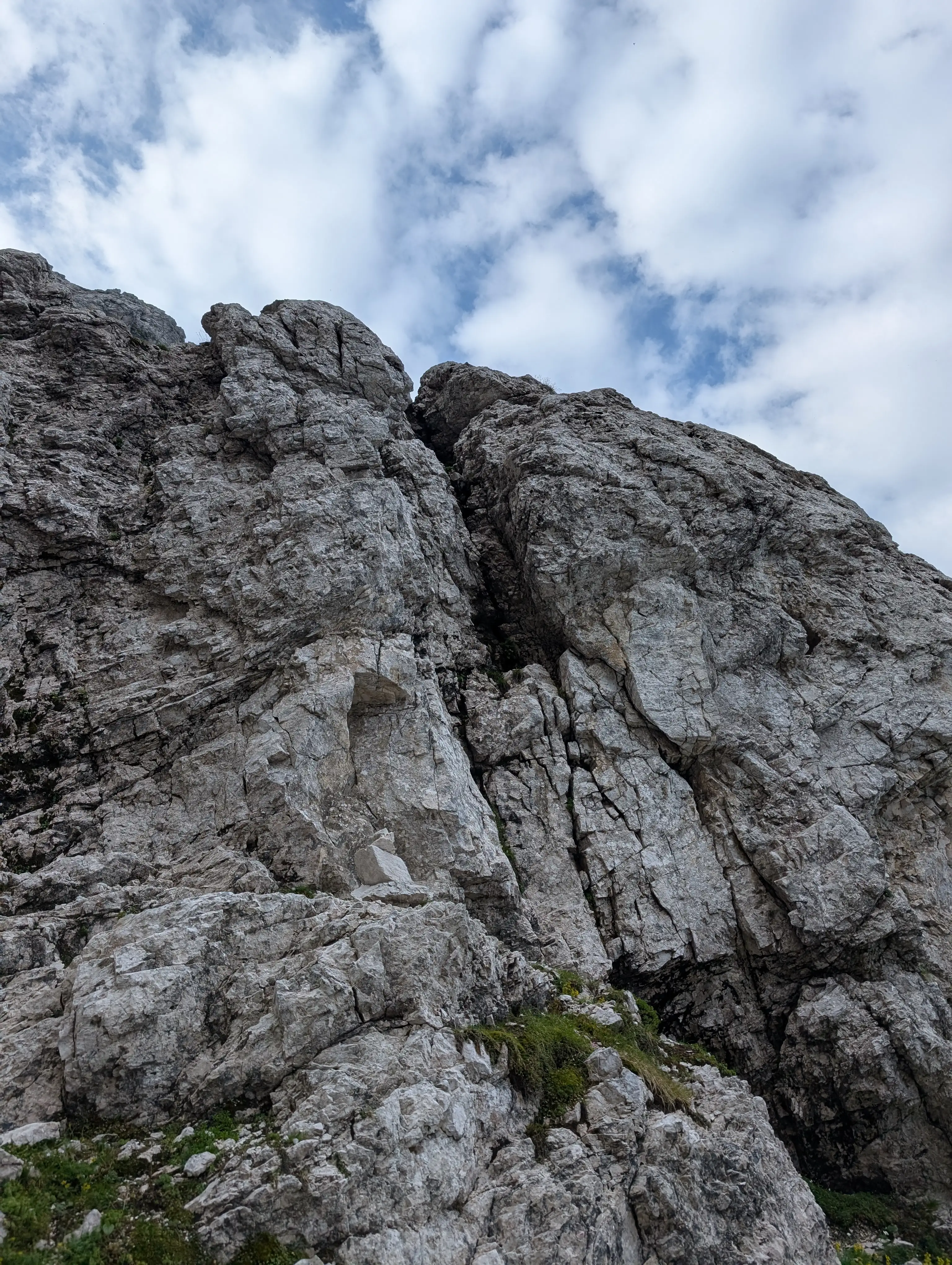 Crux of the route marked with a cairn. The chimney is not that pleasant and a little exposed but not overly difficult (around III). There is an easier dihedral ascent to its right, however the rock is more brittle in there. Other ways might be even more difficult.
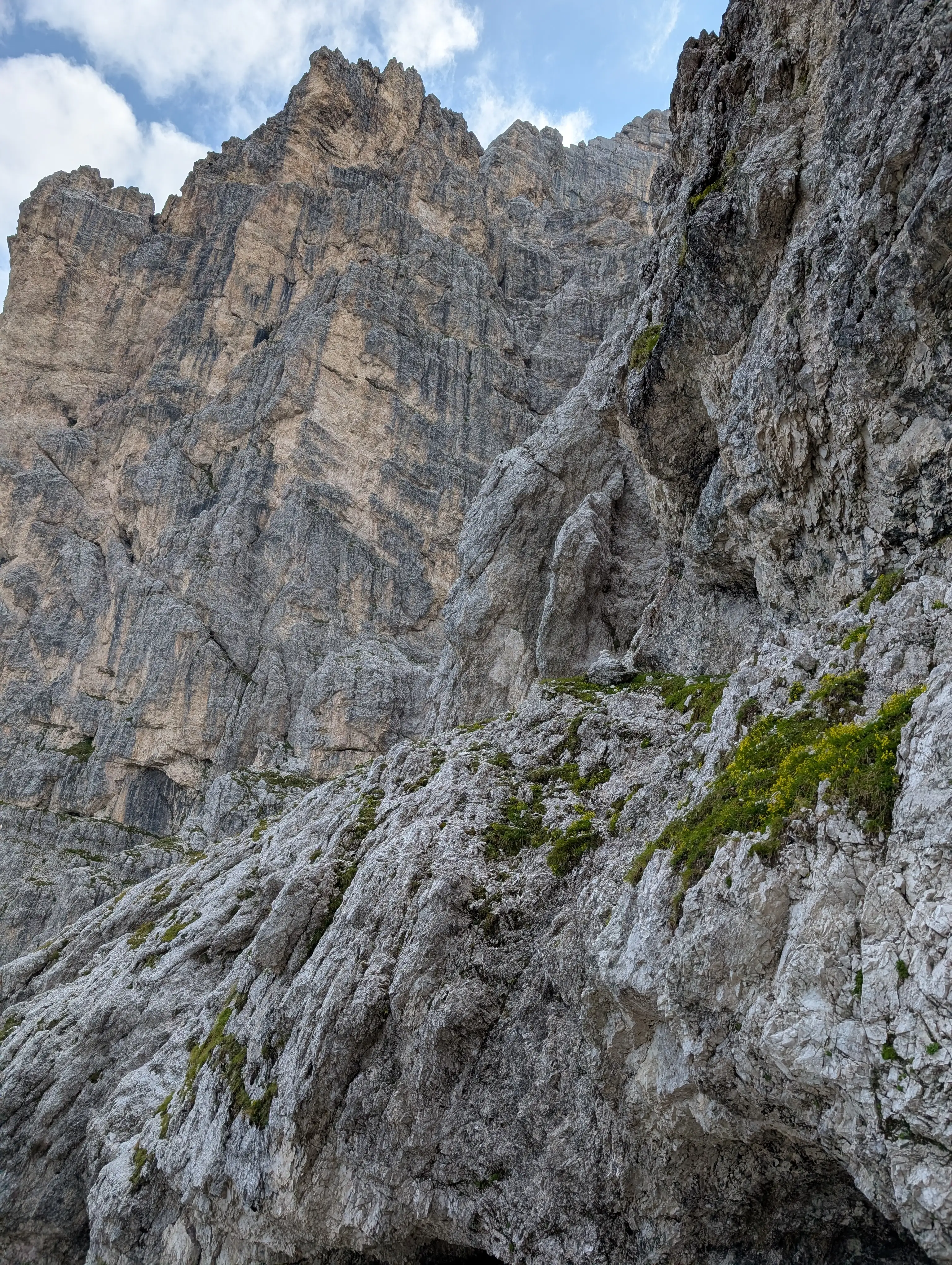 Above the chimney from the previous image you should ideally keep a bit to the left and end up by this cairn; however, we somehow by-passed that part and needed to traverse back, which is also possible.
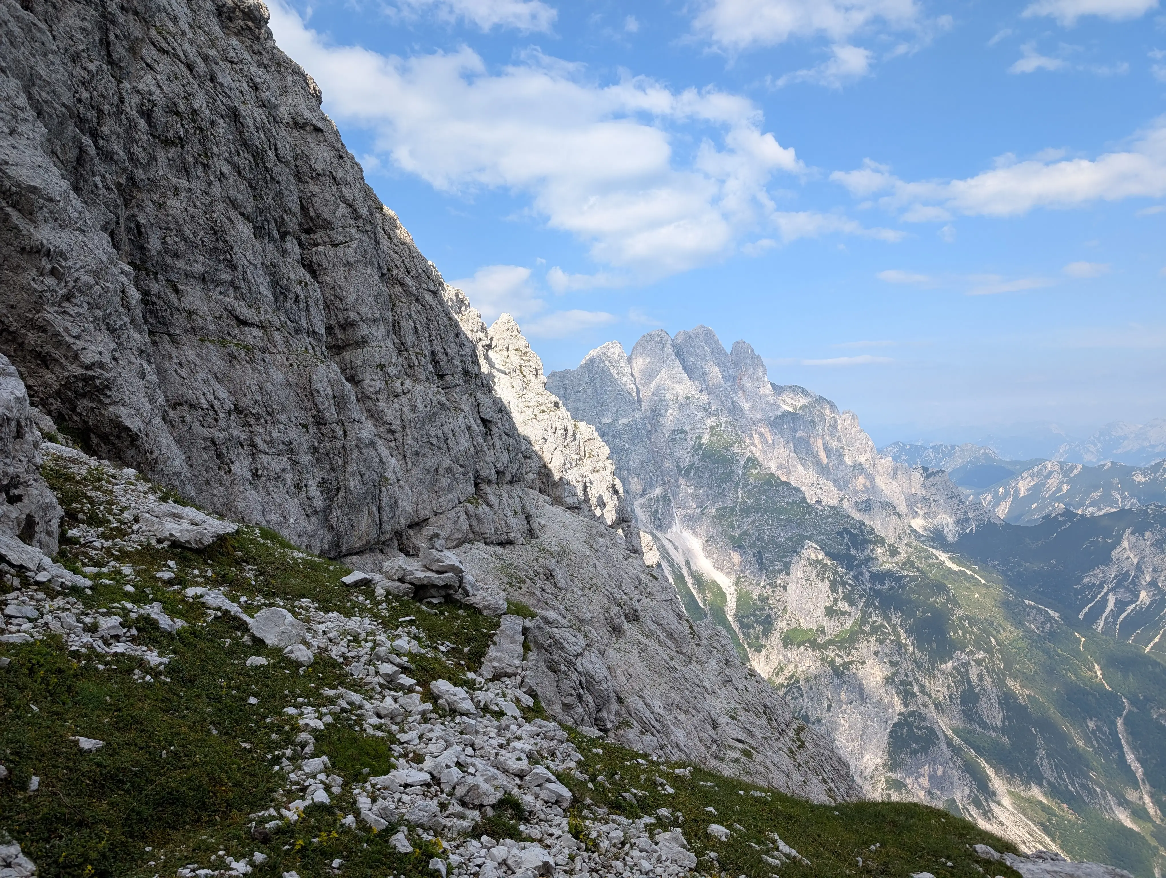 Same cairn as above, just seen from behind it.
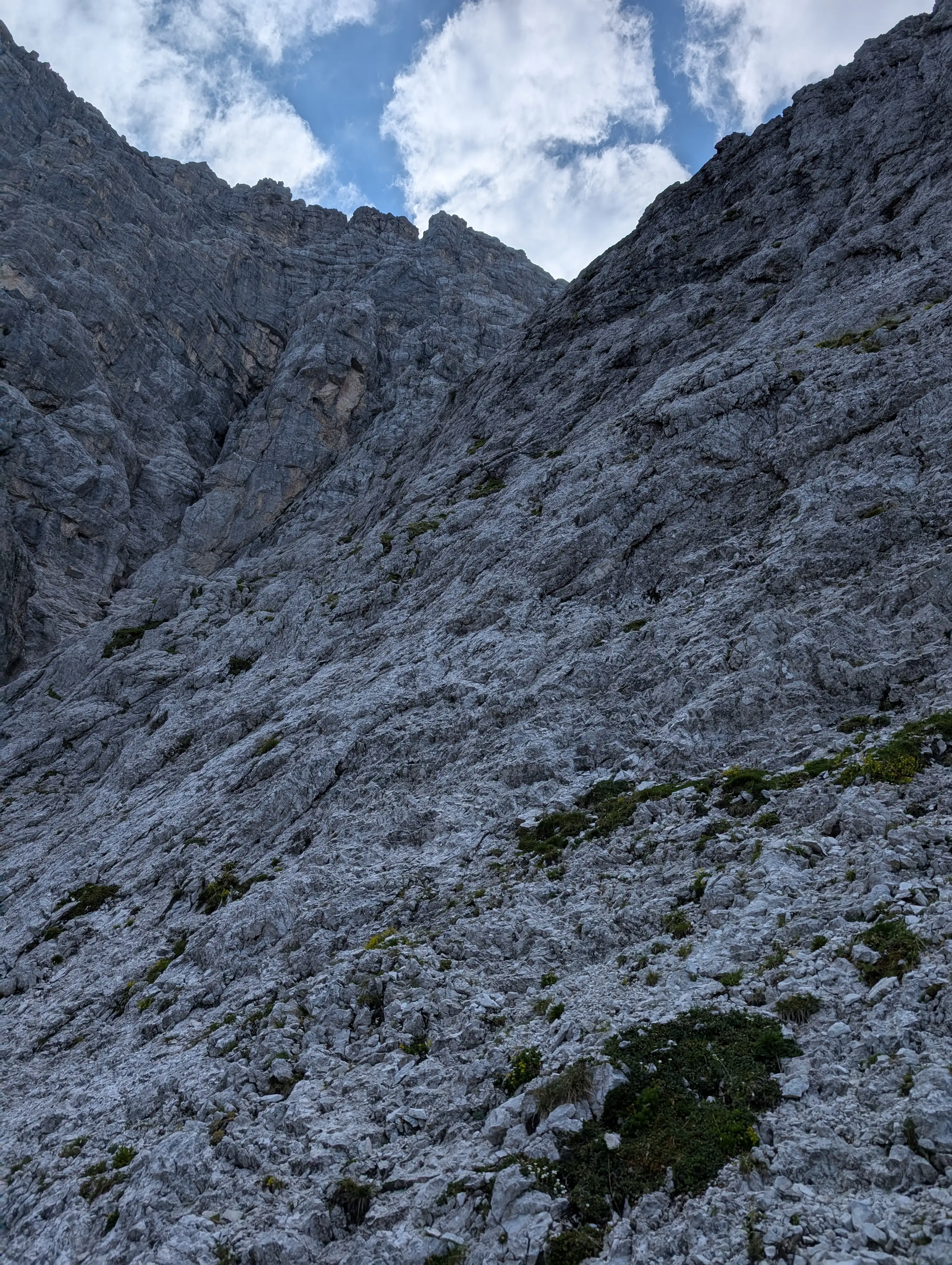 Main part of the climb, trying to find the most approachable way in direction of the tower with yellow broken rock. Doesn't look difficult however gets a bit exposed in the upper part (II).
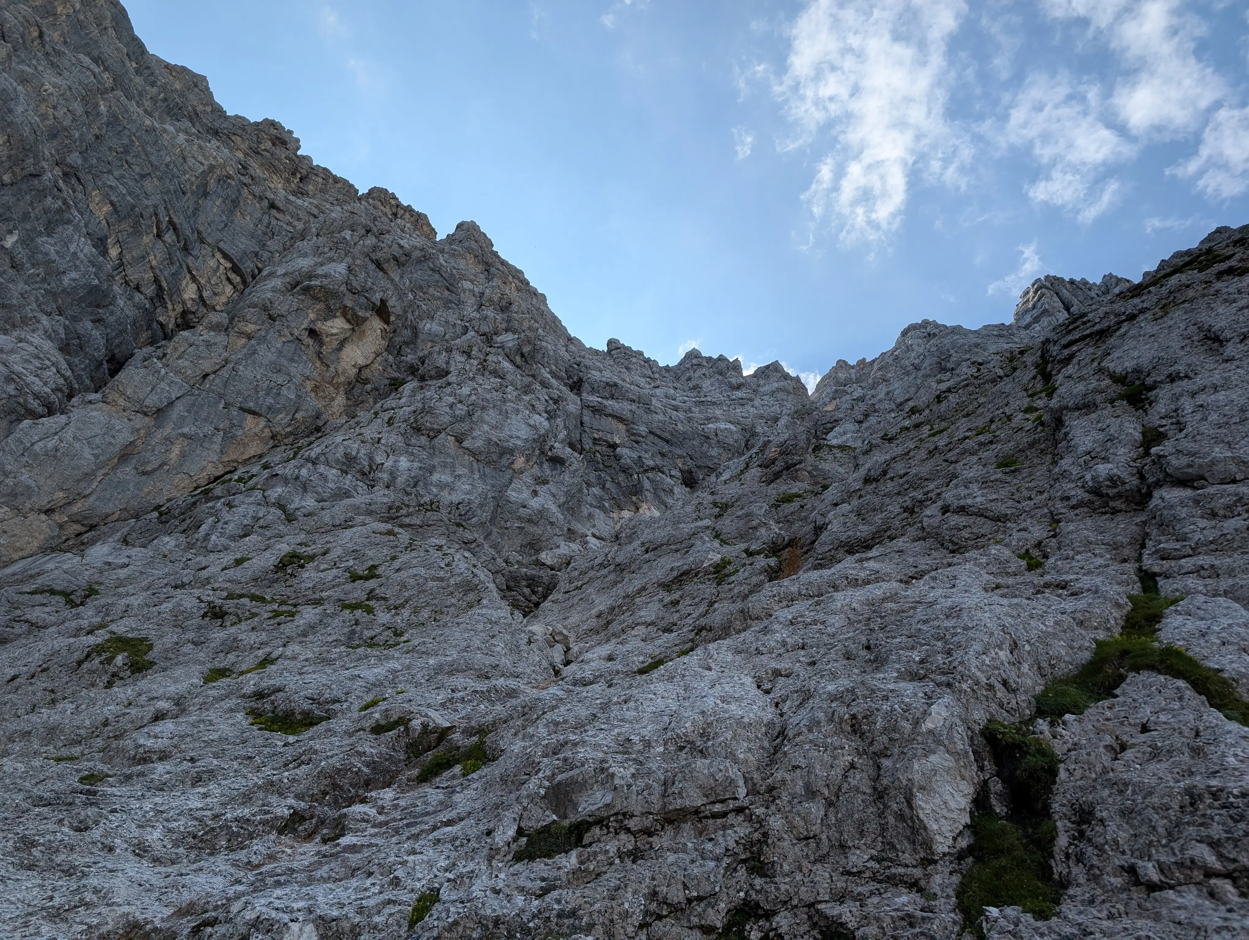 Climbing up, approaching tower with yellow broken rock.
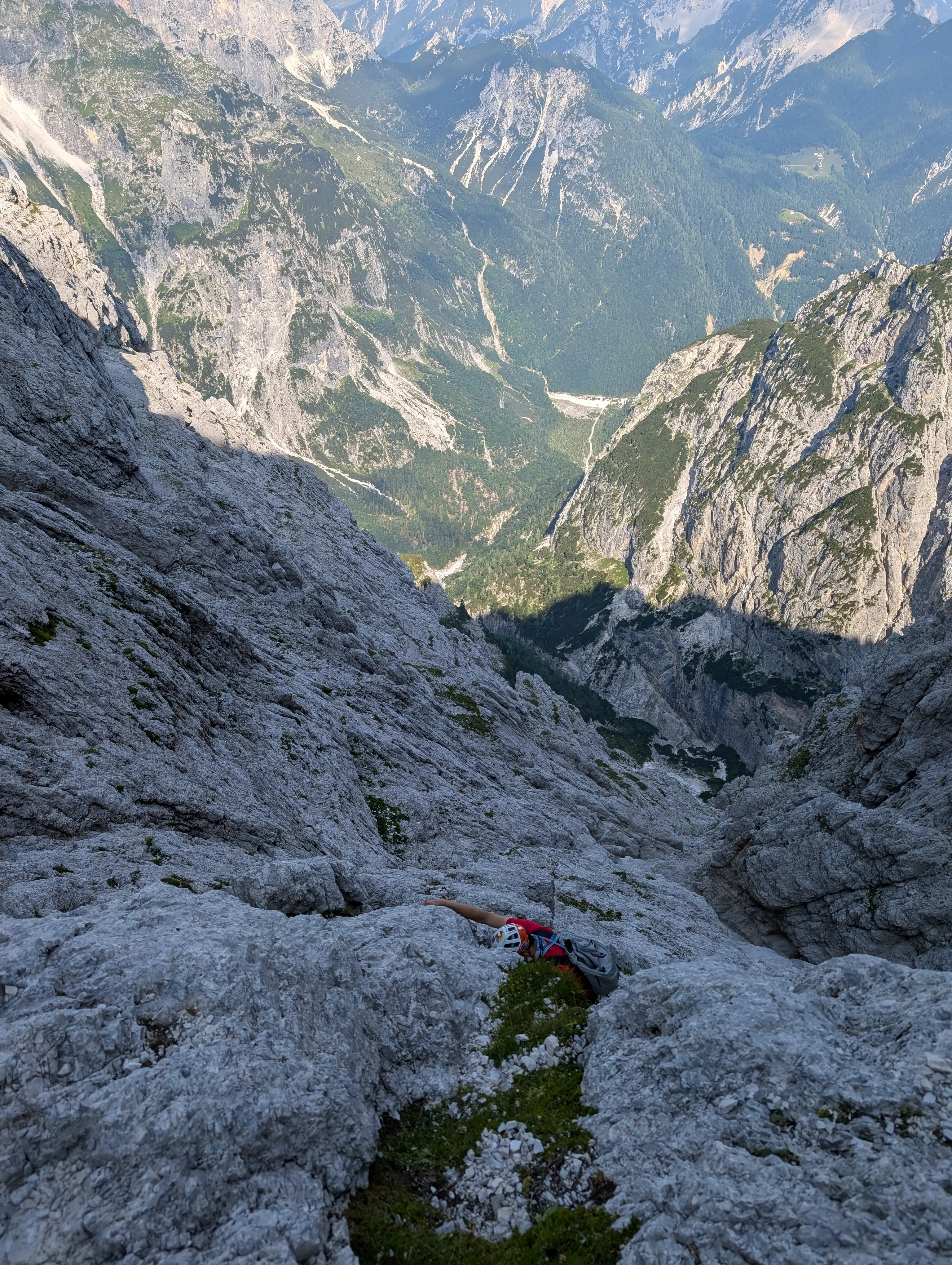 A look back, terrain gets vertical a bit.
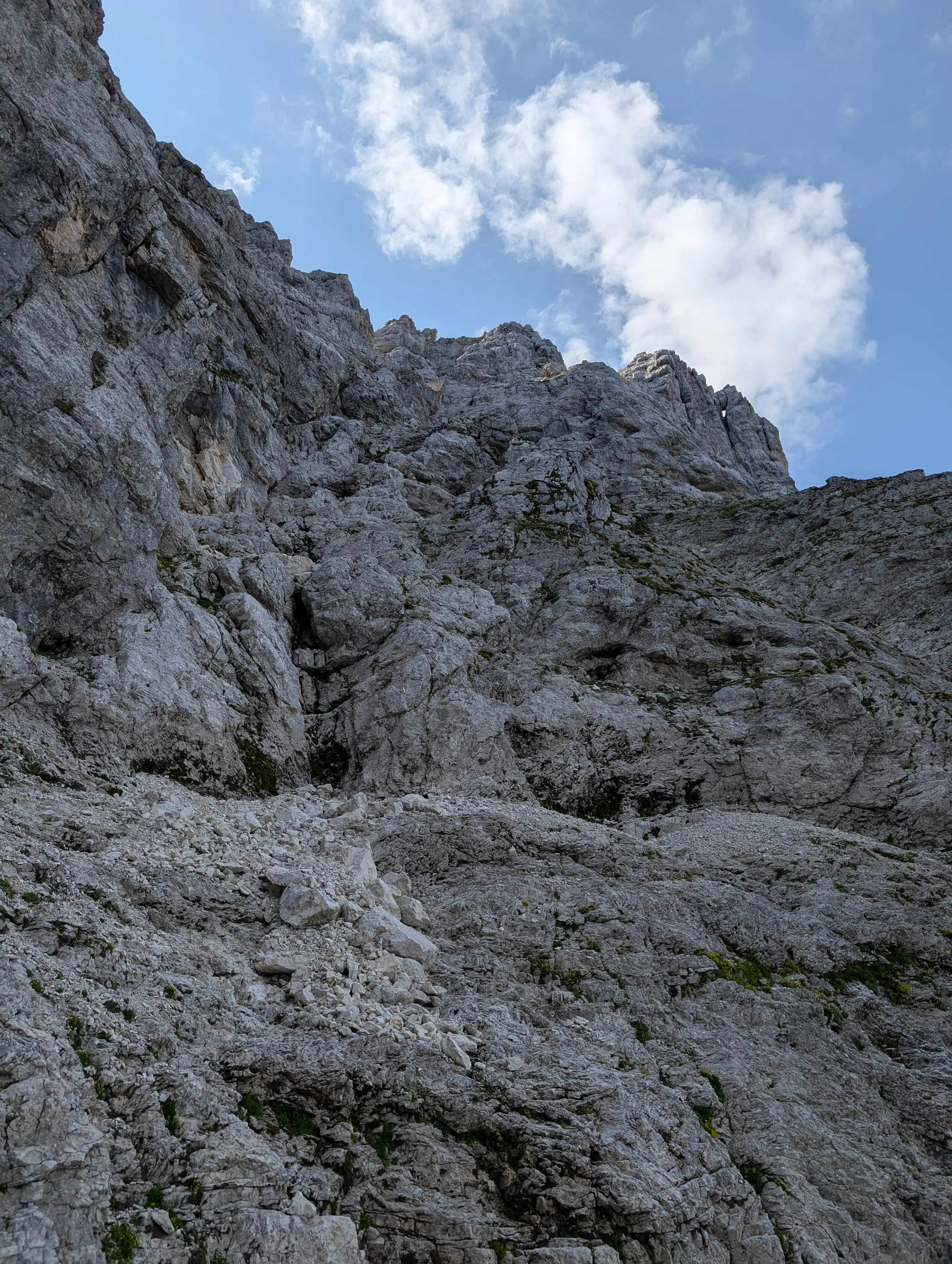 Getting closer and closer to the exit tunnel window (not visible from here). Here a couple of variants are possible. We kept left and the climb was easy; however, it might be a good idea to look for a way and cairns a bit to the right - to avoid a delicate traverse in the upper part.
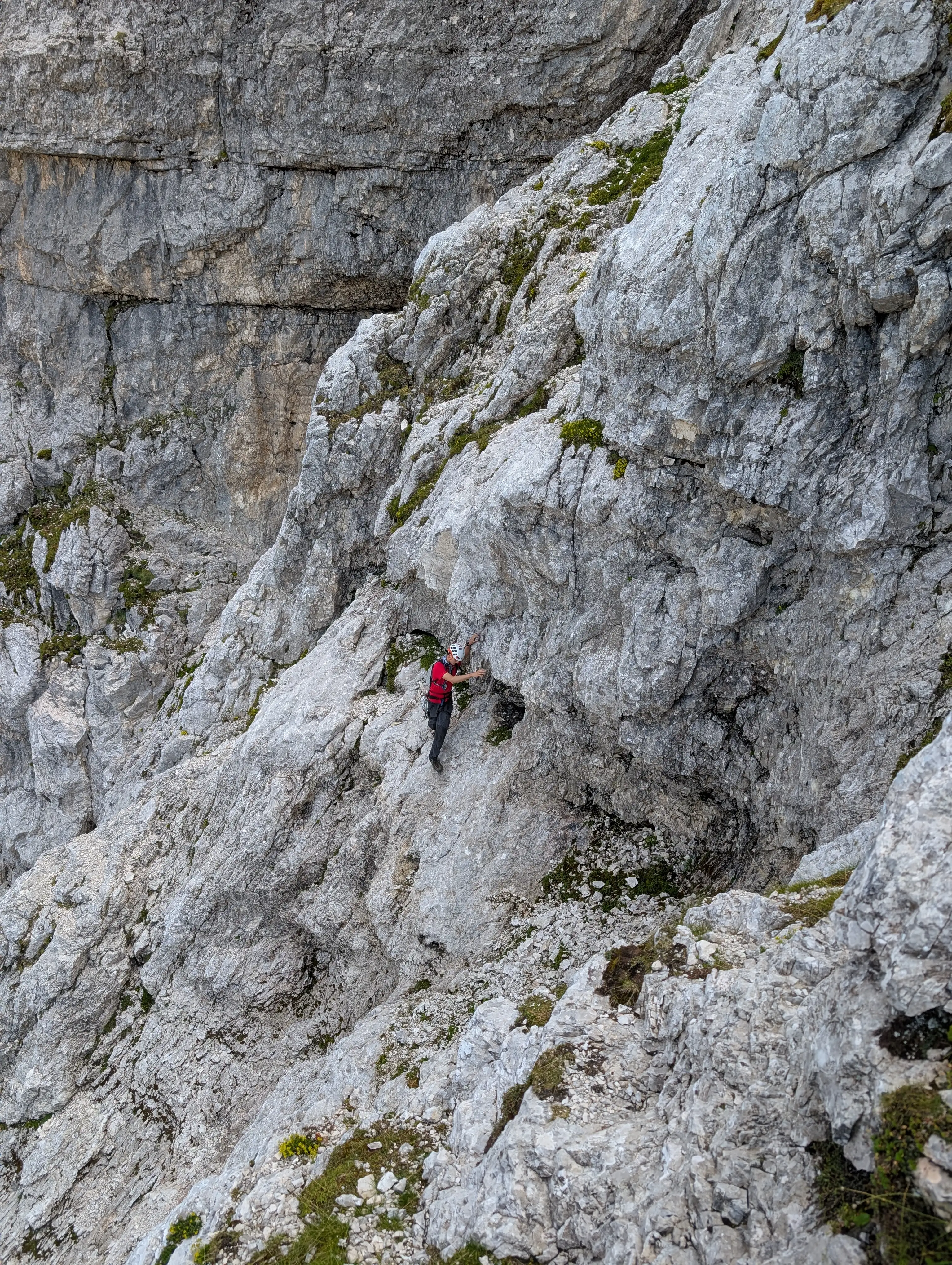 Cautious traverse as a result of chosen variant mentioned above.
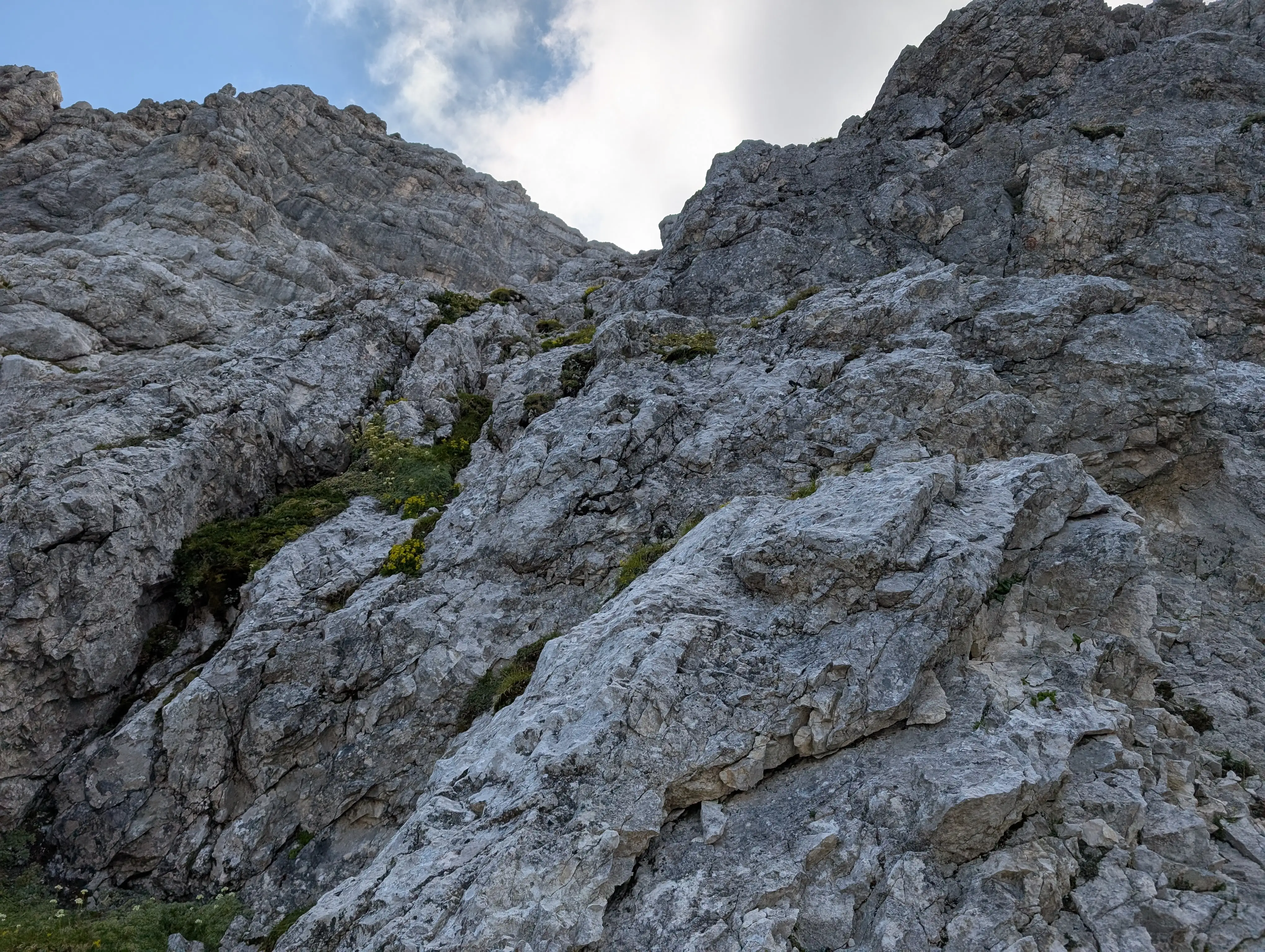 Last climbing section - passage below overhanging rocks and a slab scramble (II+)
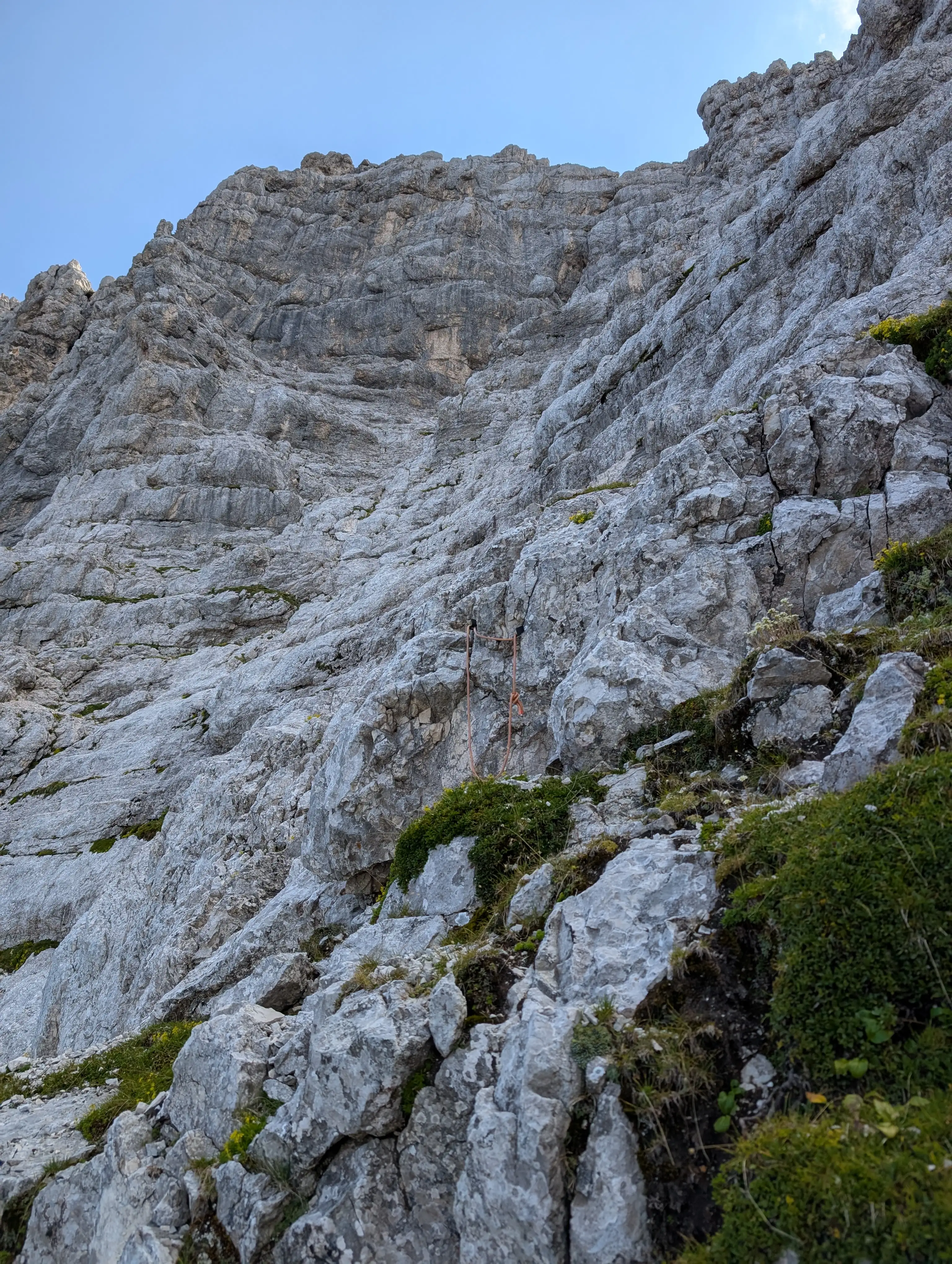 There is some fixed protection in place if needed. To the right we continue ...
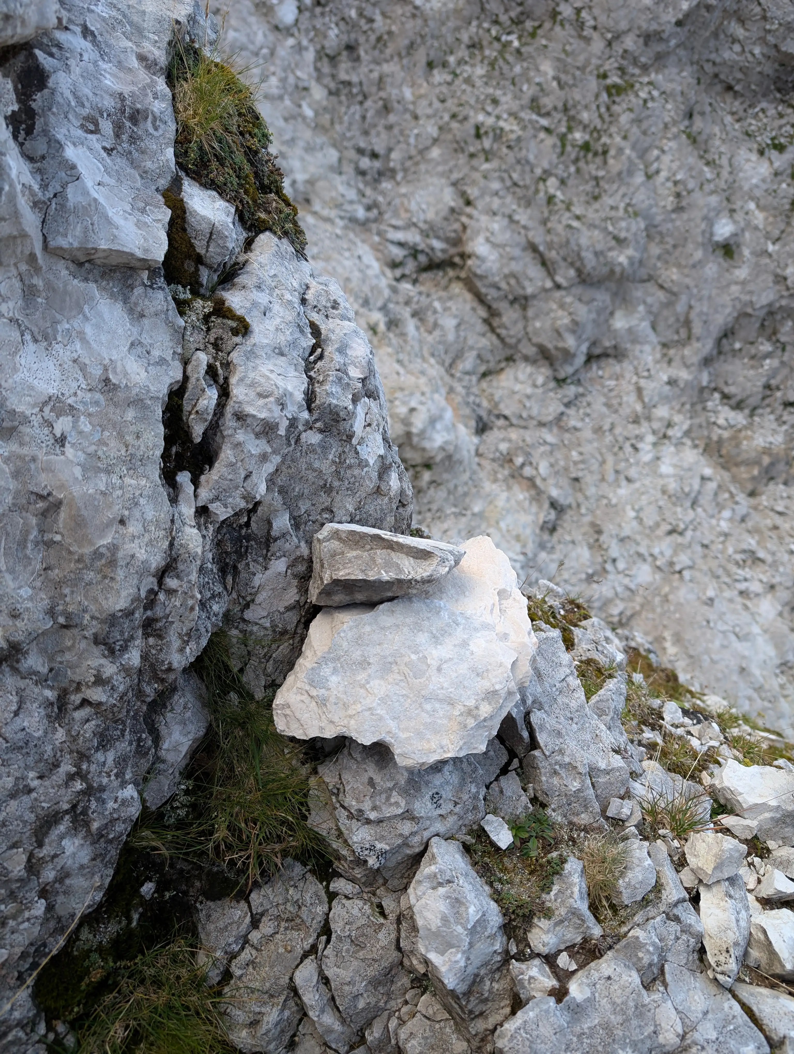 They don't come in great numbers here and make you smile whenever you see them.
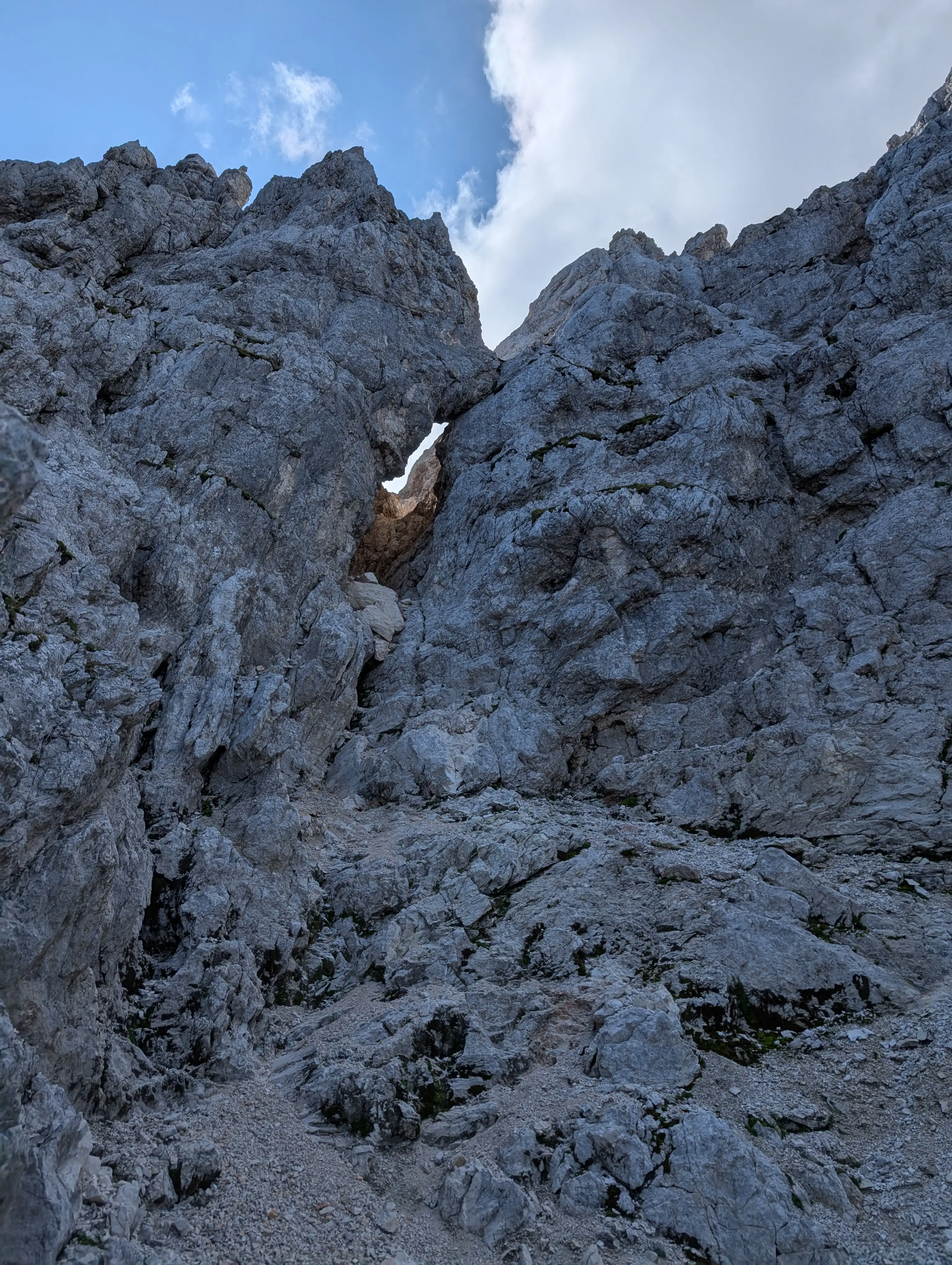 Famous Jôf Fuart tunnel window. We still go up from here and keep to the left to start a slightly descending traverse.
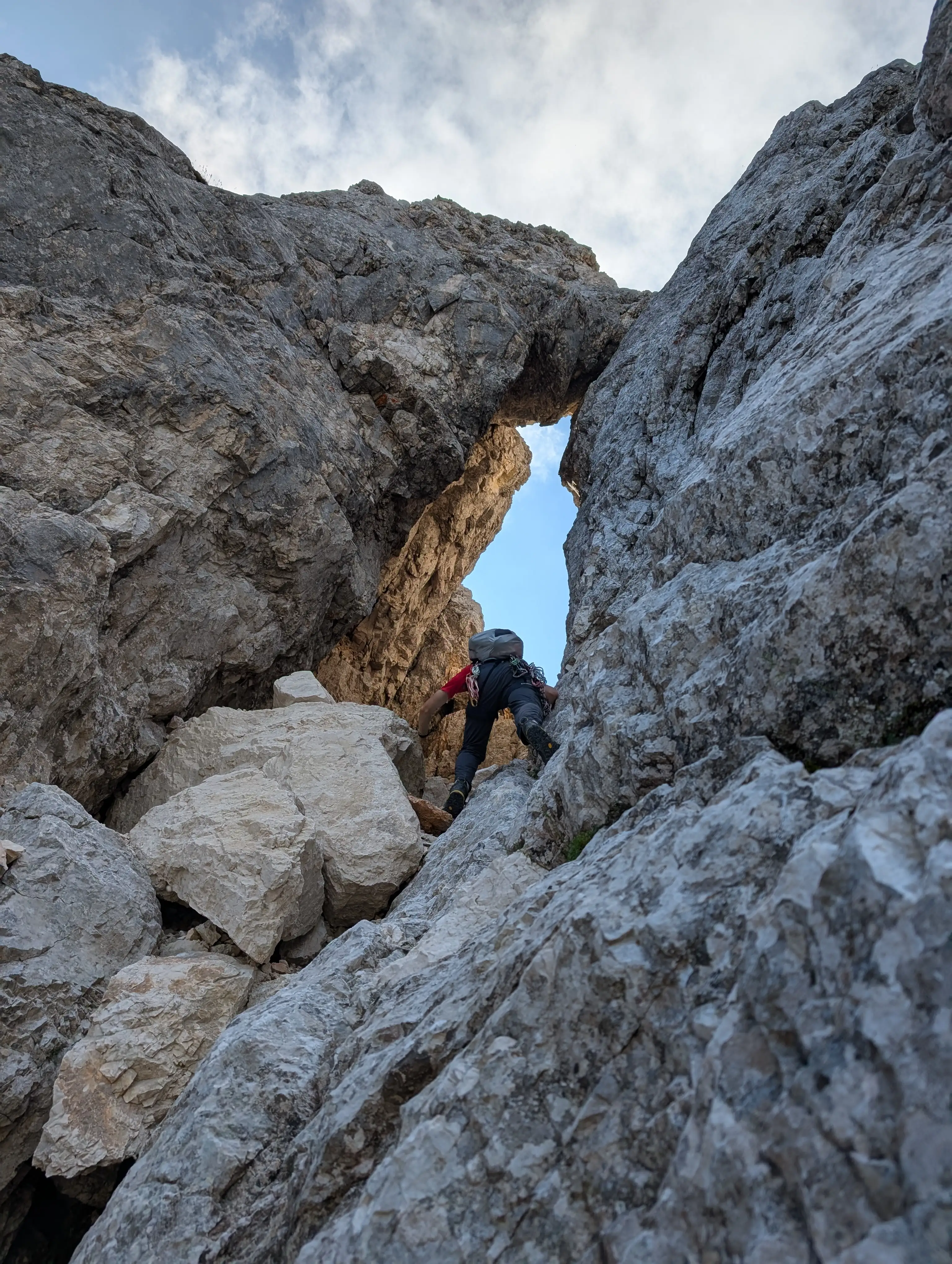 On entering the window stick close to each other when climbed in a team, it's really easy to trigger rock material. There is about 30 meters up to be covered to get to the end of the tunnel.
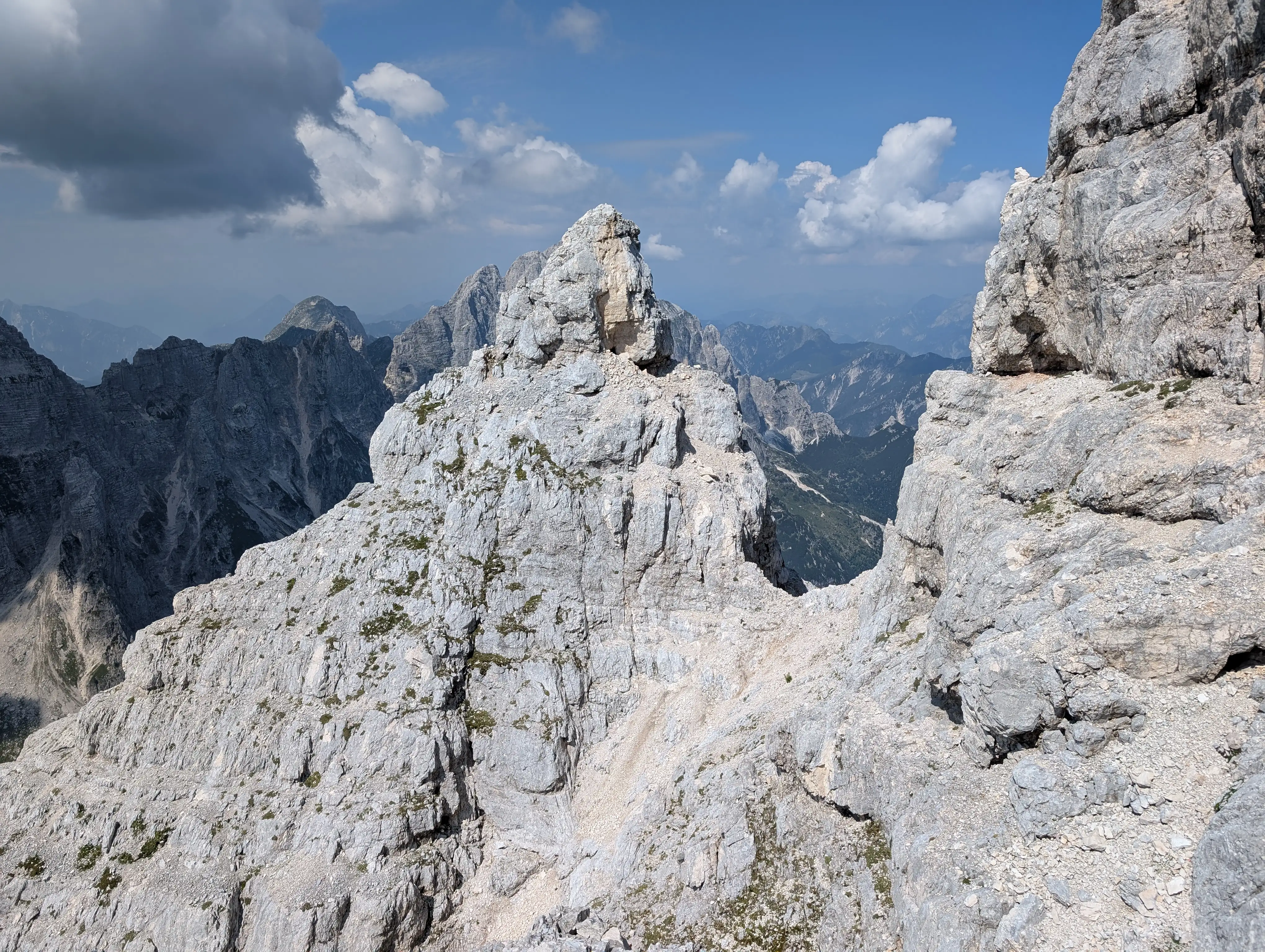 This small col marks the end of gola nord ovest. Once in there, turn left and look for most approachable passage to get to the spot from which this photo was taken.
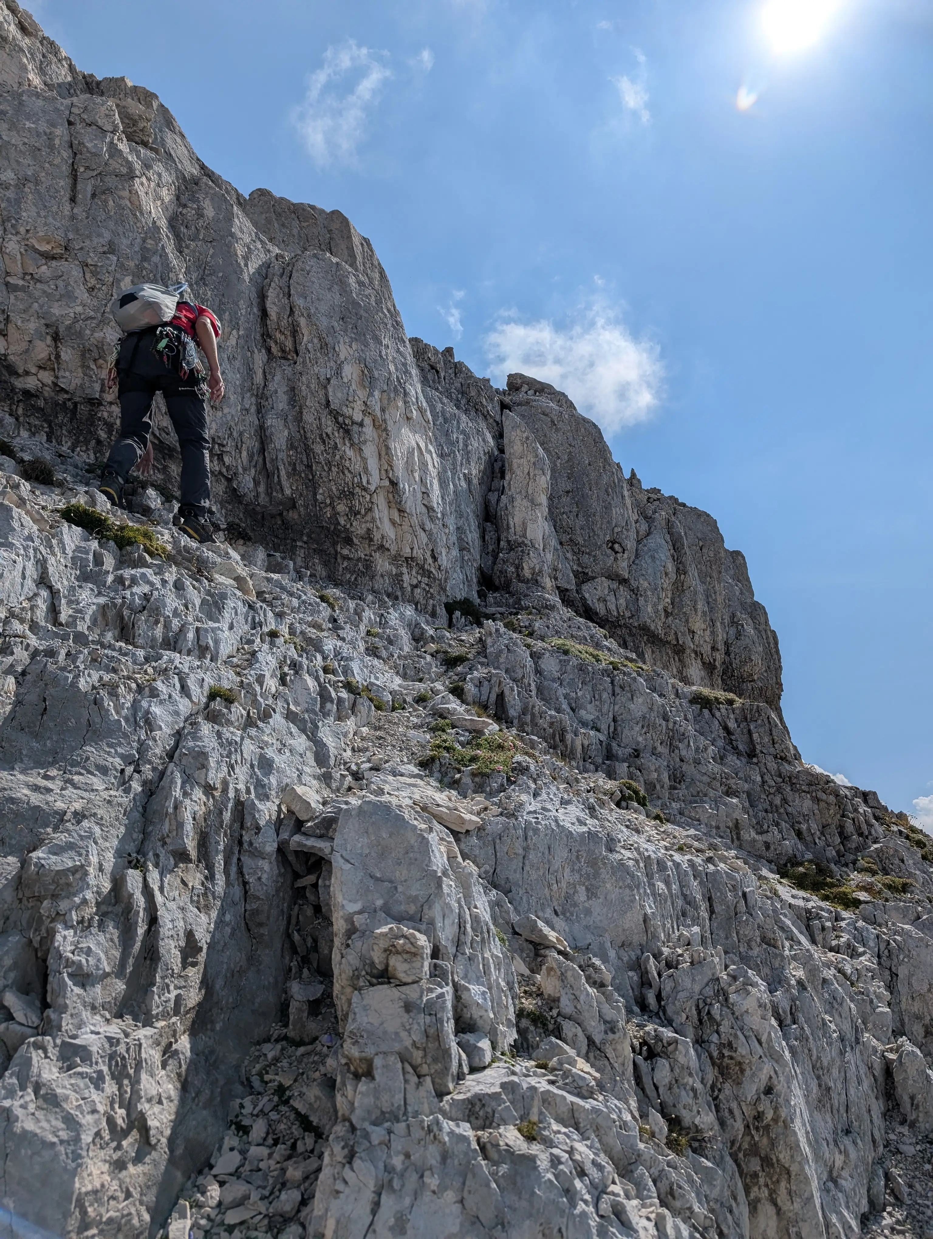 Searching for a path to enter the main ridge. Sun shines again, we are on southern side.
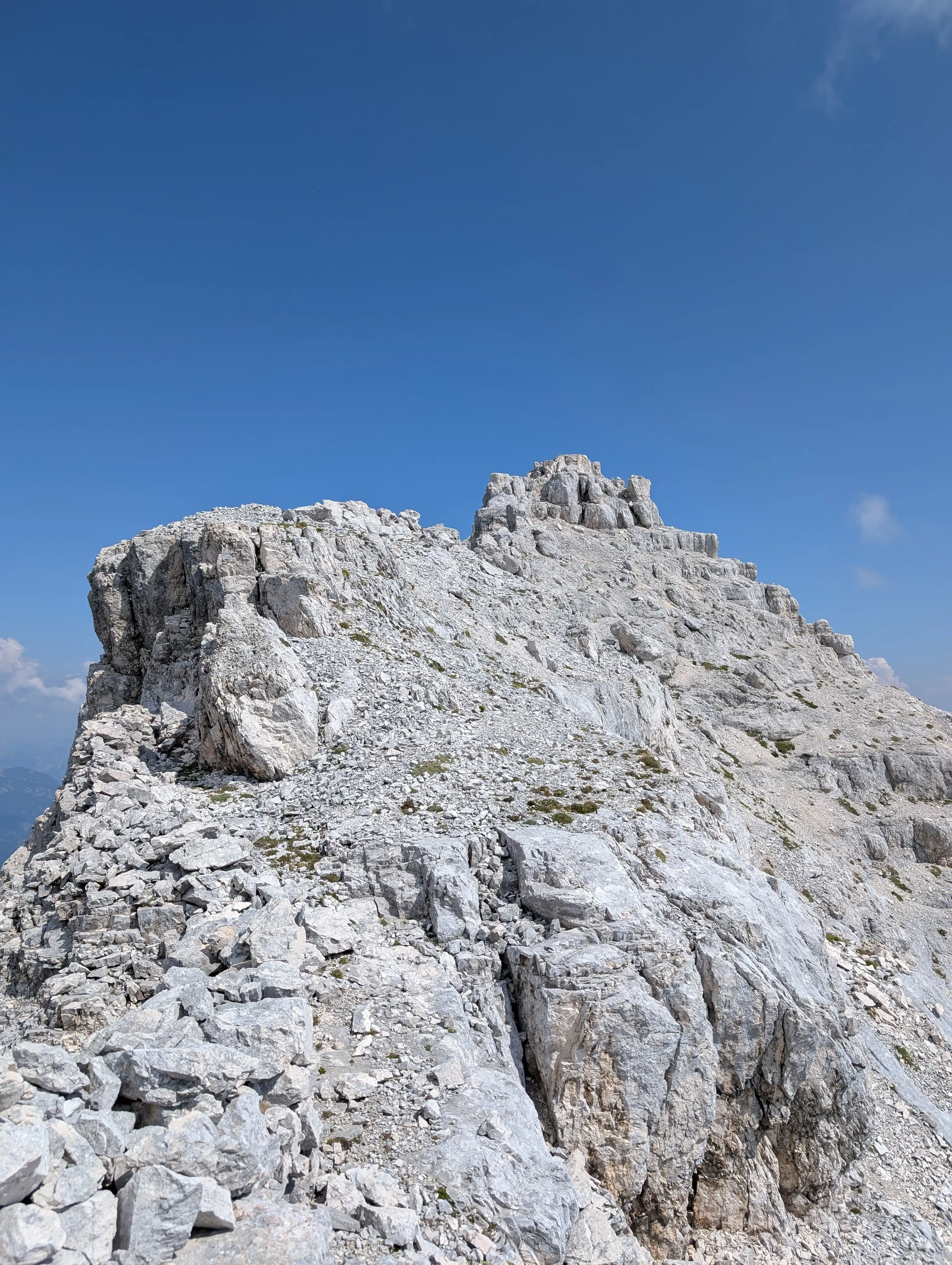 Walking on the ridge, remnants of WWI trenches still visible. From here the pre-summit with Madonna and cross is reached in 15 minutes.
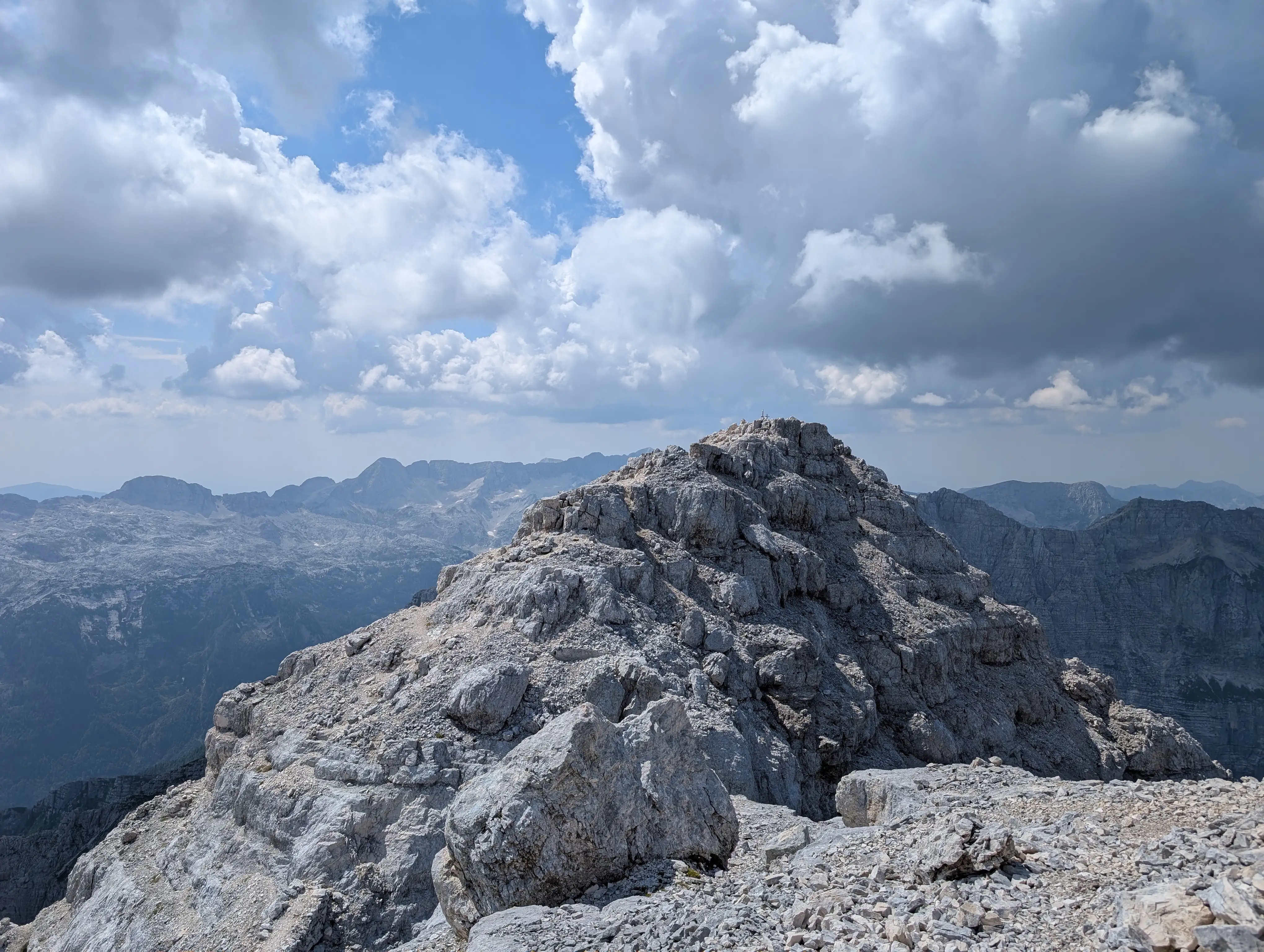 Pre-summit with Madonna and cross as seen from the main peak. That's it, Jôf Fuart is yours!
 To get back to Saisera valley we need to use the only marked descent path that goes in a northeastern direction - Gola Nord Est.
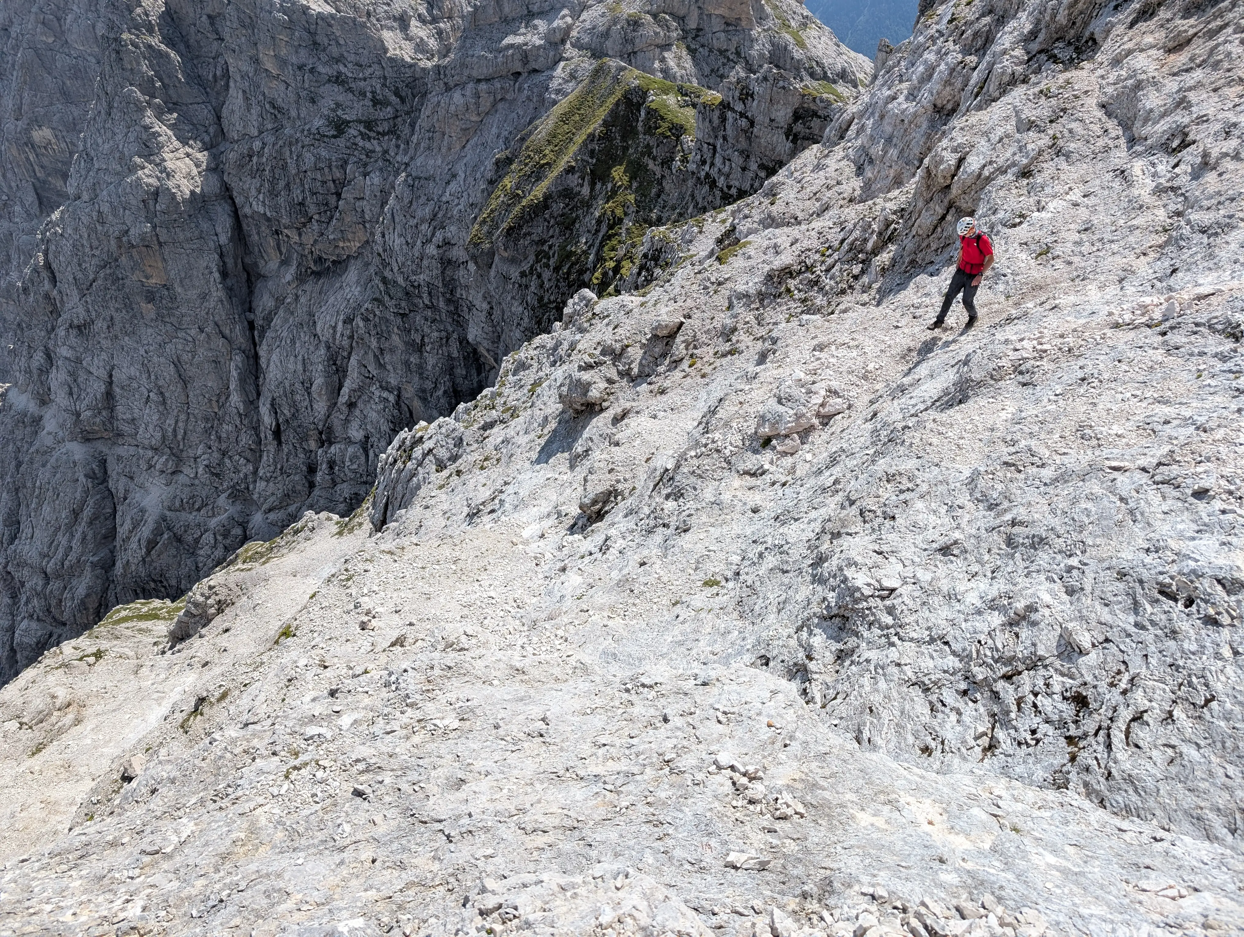 The first sections of Gola Nord Est are nasty, slippery, and with injury potential for those below us.
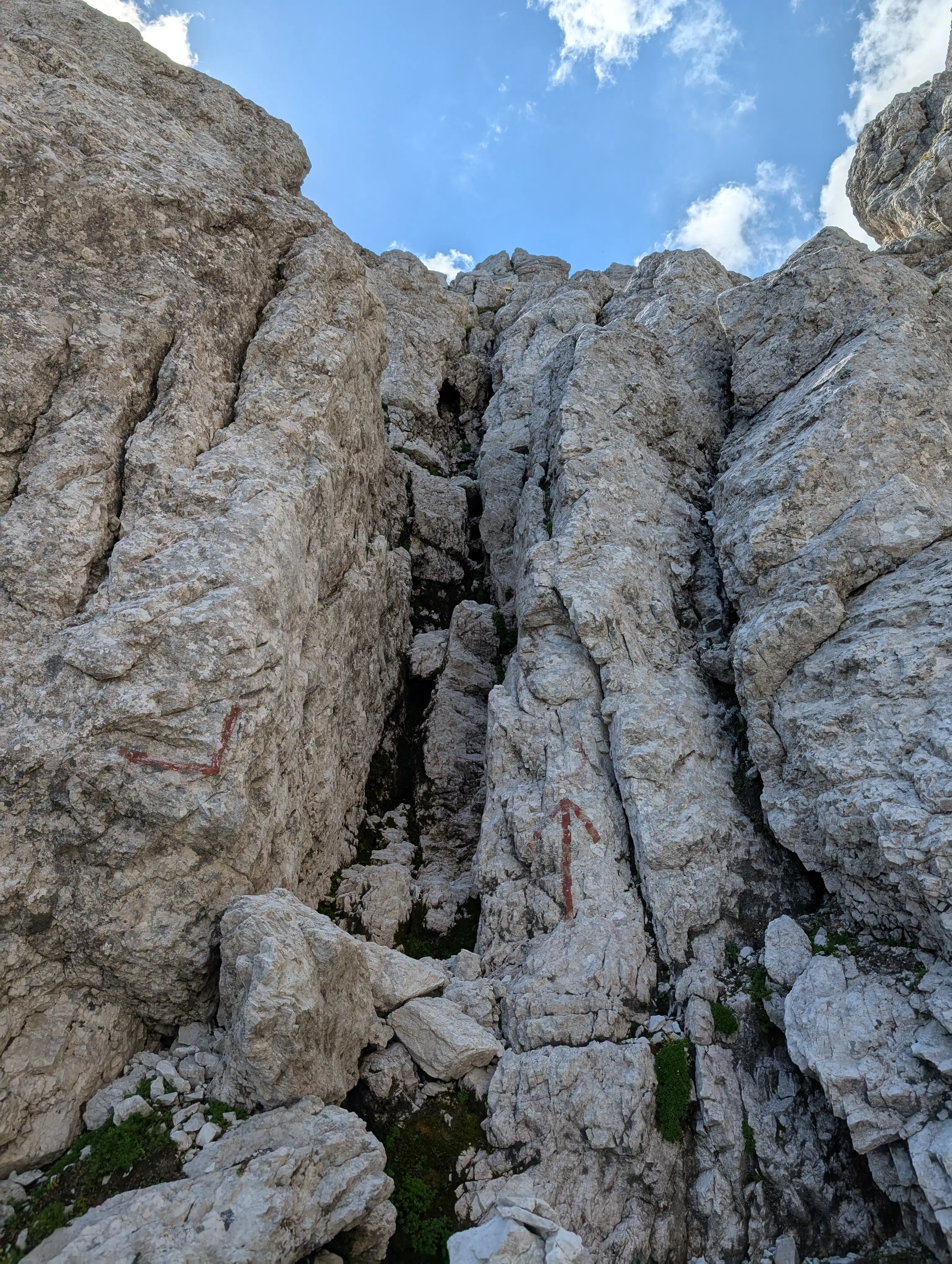 Eventually the rocks gets better and we need to use our hands. Don't miss this chimney when down-climbing (I did).
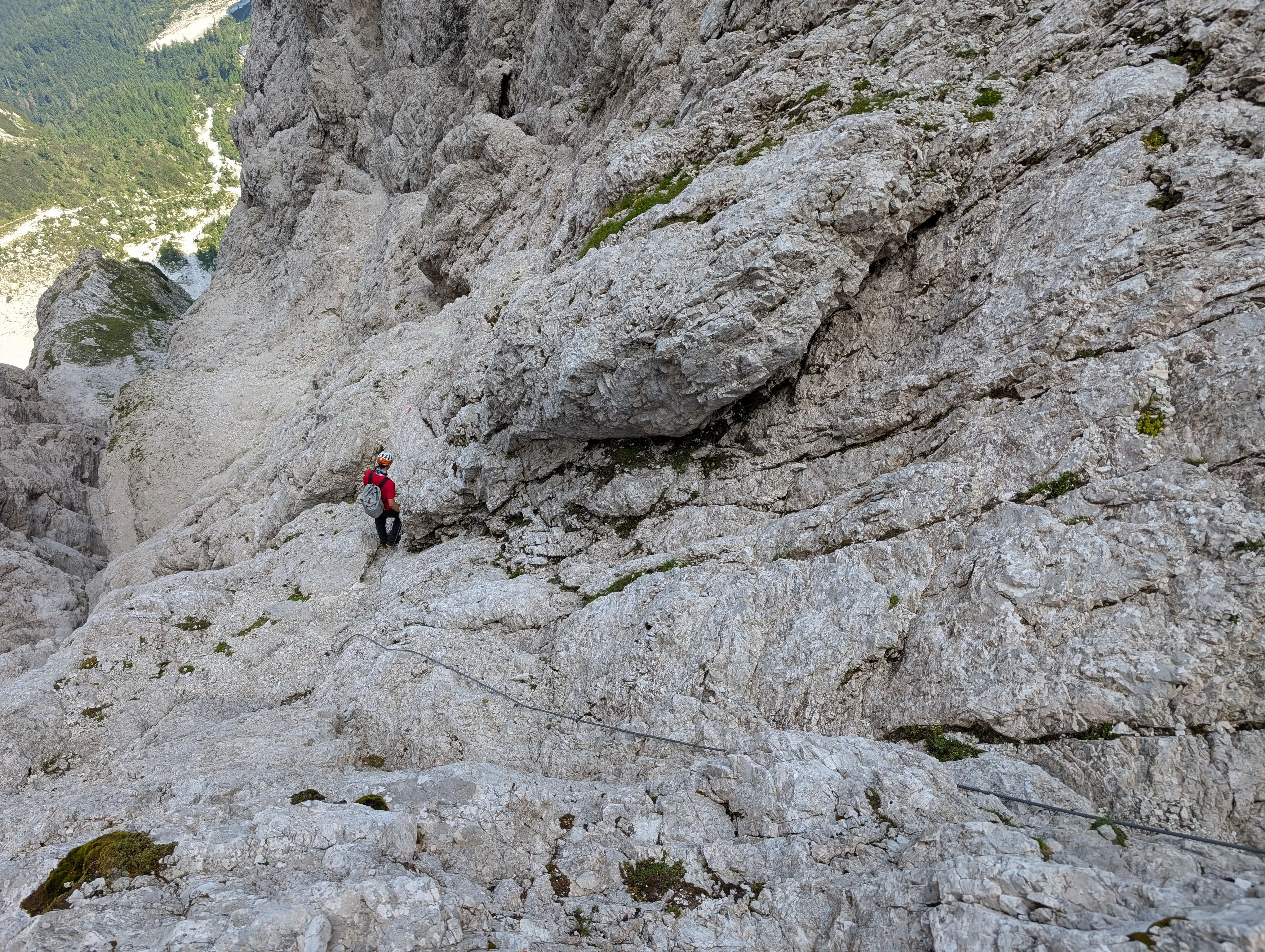 Entering the actual gorge means walking on ledges and using a bit of wires.
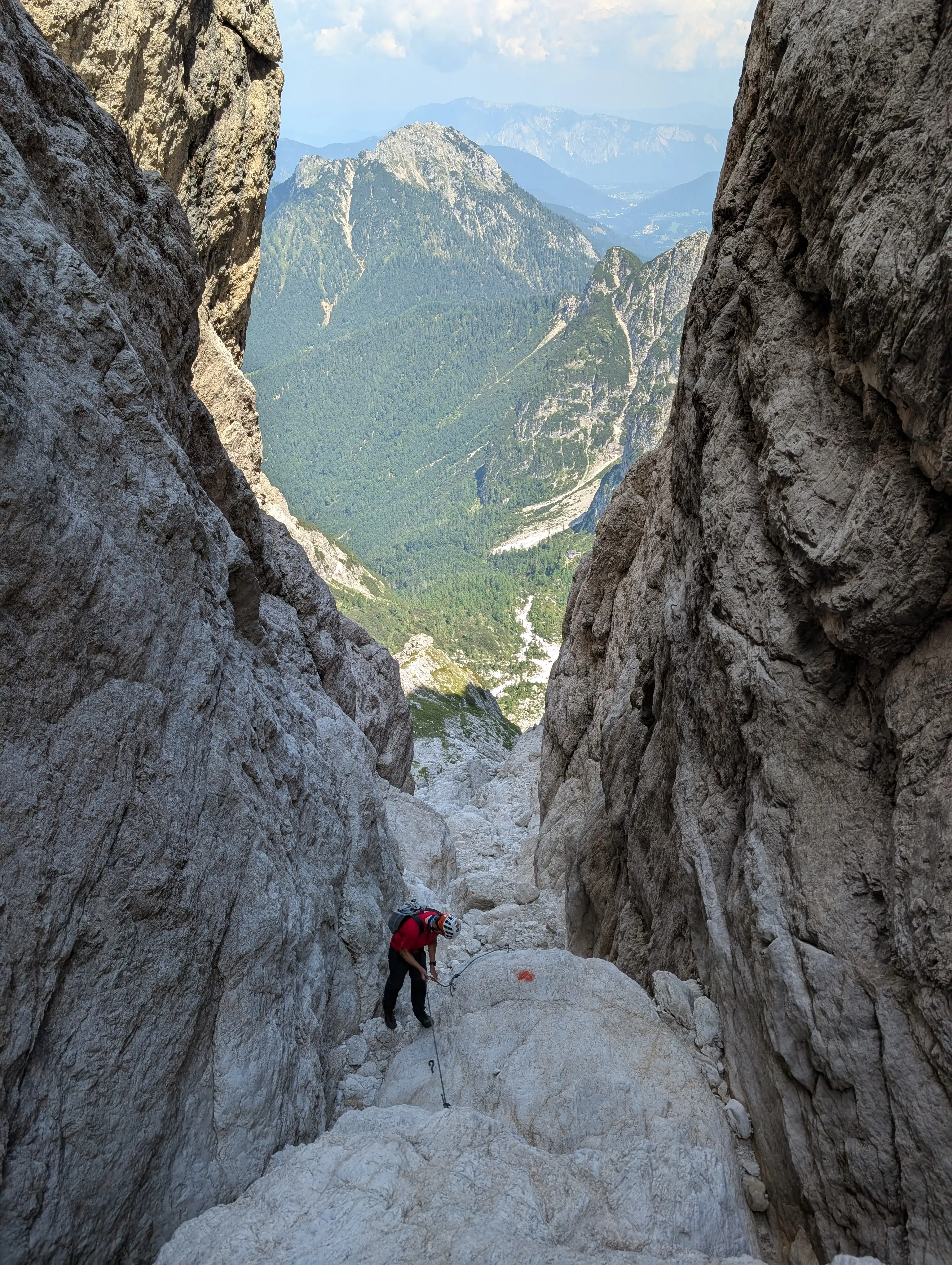 These are also present inside the gorge. Here the rock quality is satisfying.
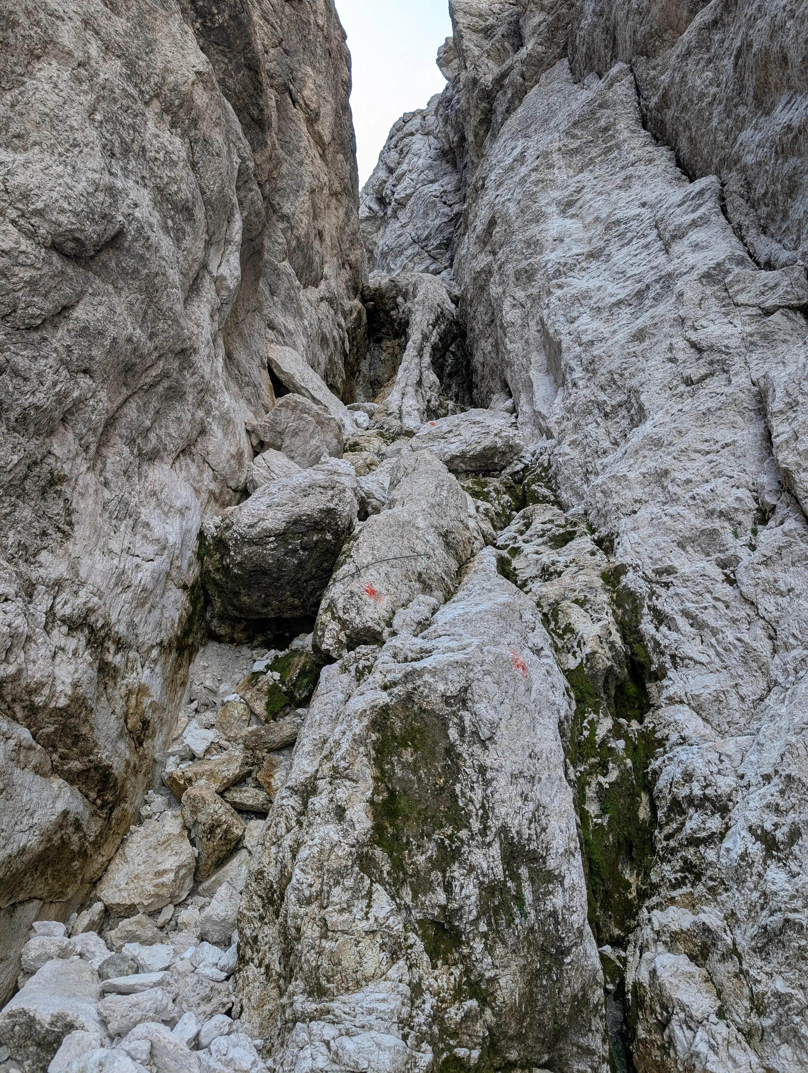 Lots of wires to use, the difficulty is around C, some small overhangs in there, so keep some arm energy in reserve for these!
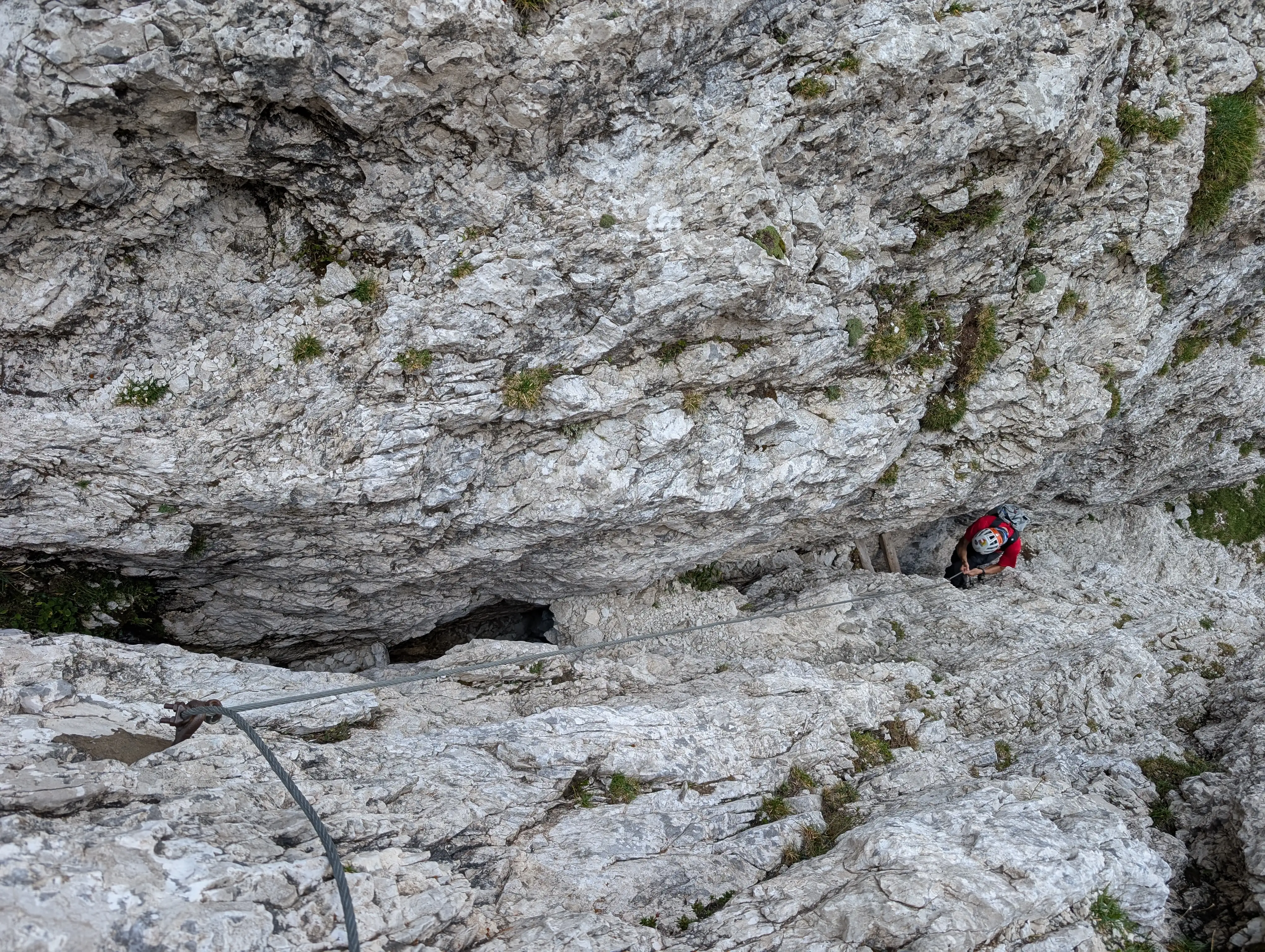 Wires lead us to a narrow chimney with wooden steps as aids.
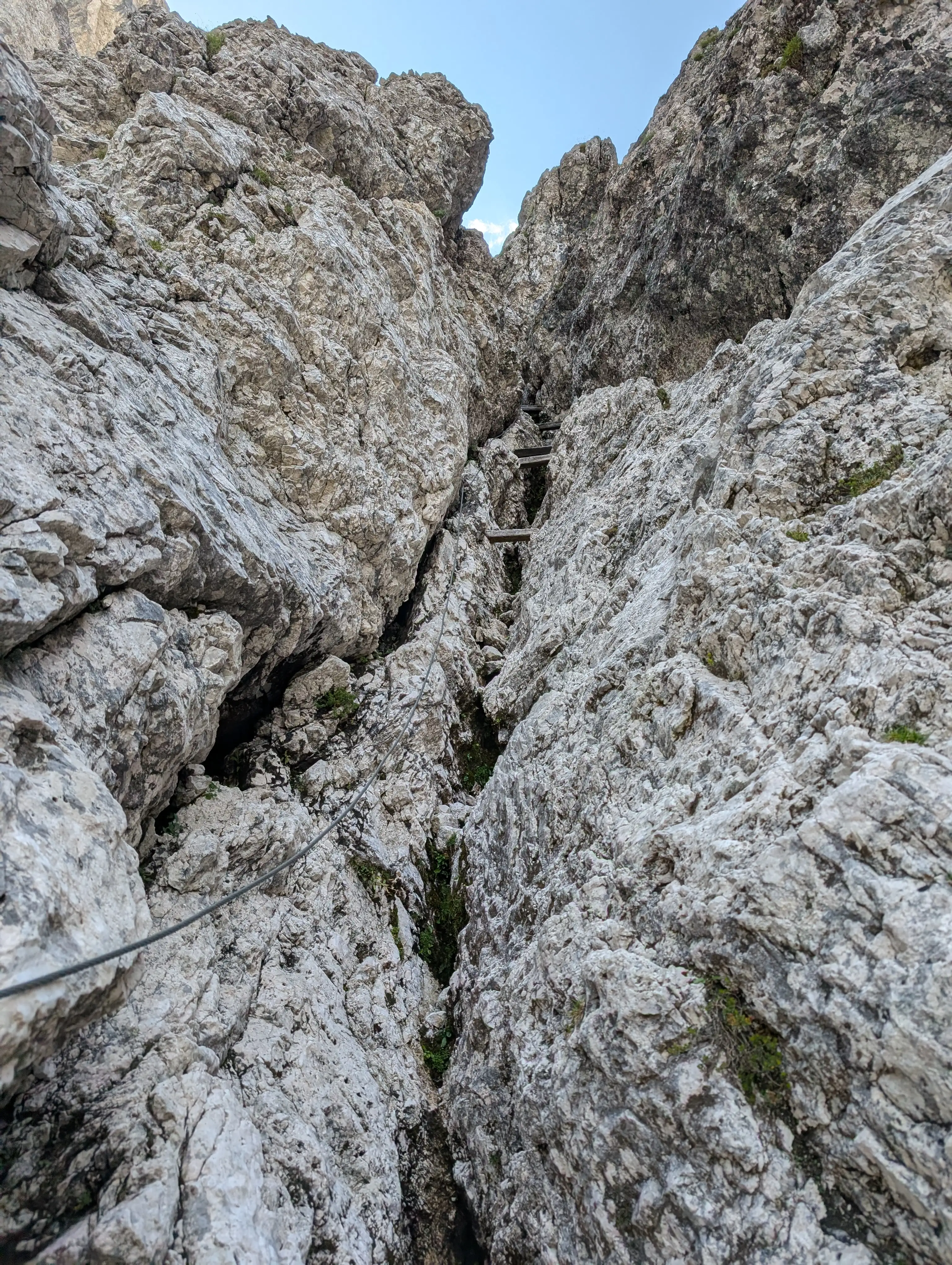 Doesn't look like it but getting down here is a bit challenging, lots of bodywork.
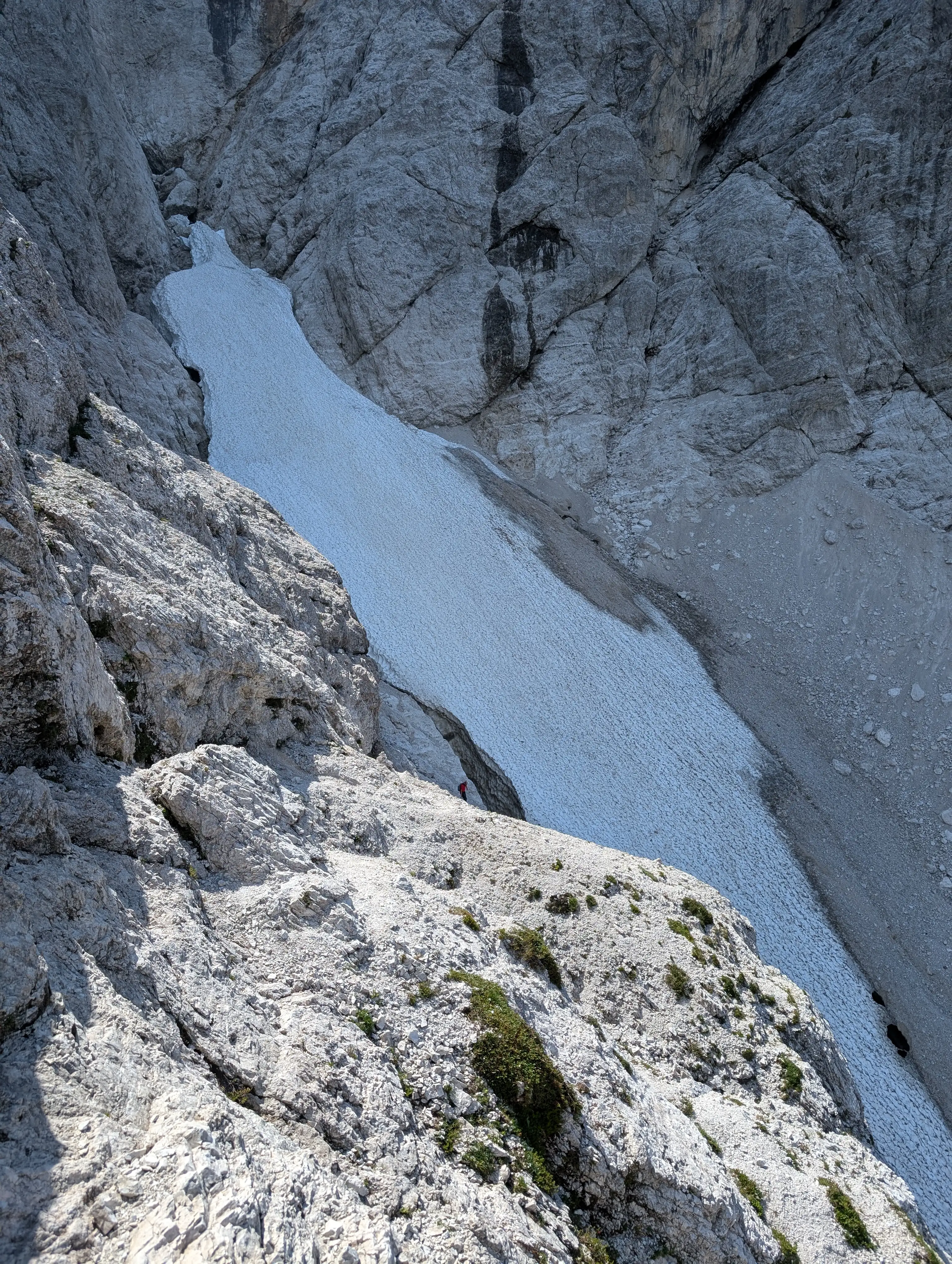 Last brittle sections, by-passing the snow field ...
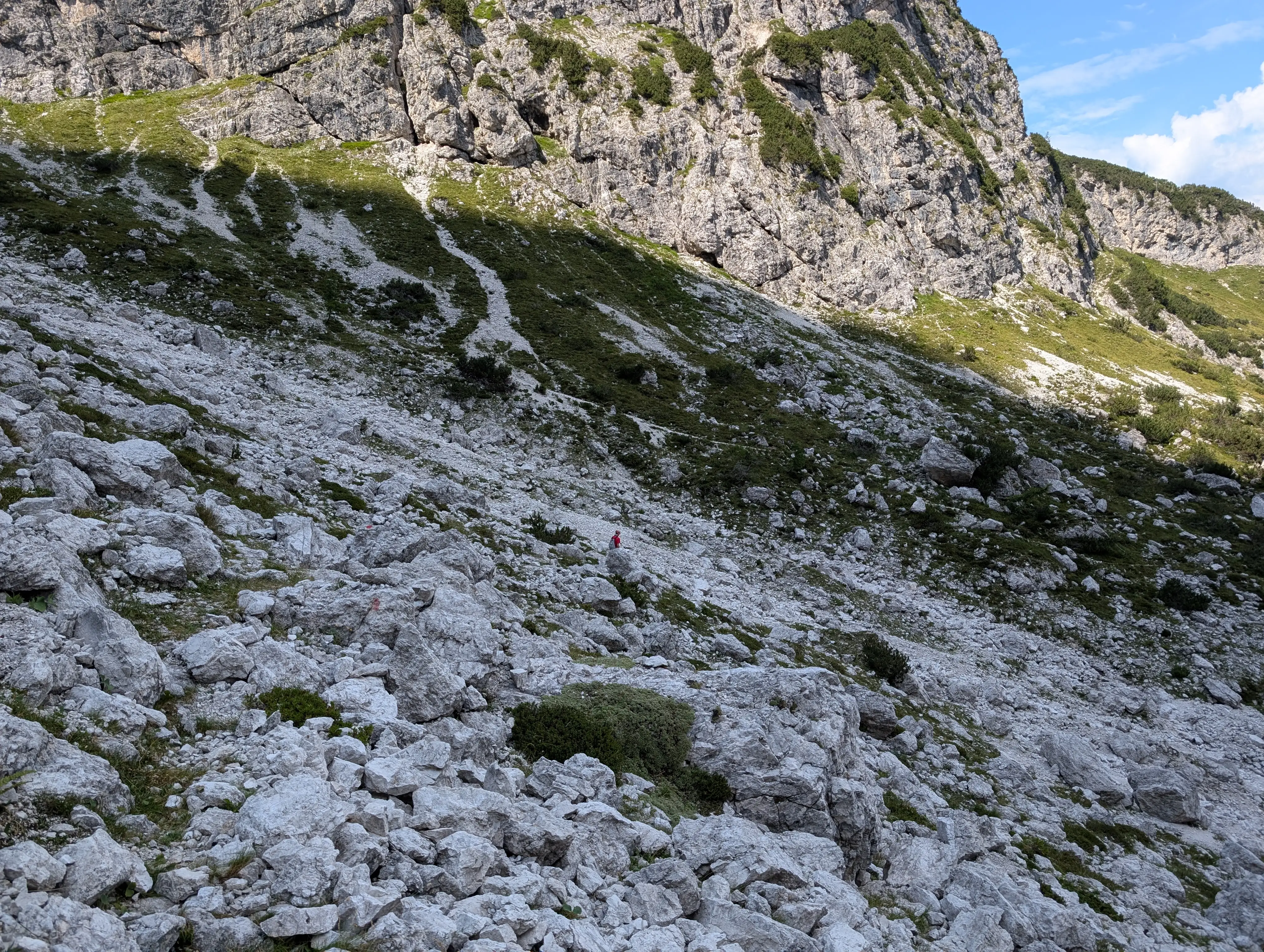 ... crossing a giant scree and we land on a more humane trail. Slopes of Grande Nabois in the background.
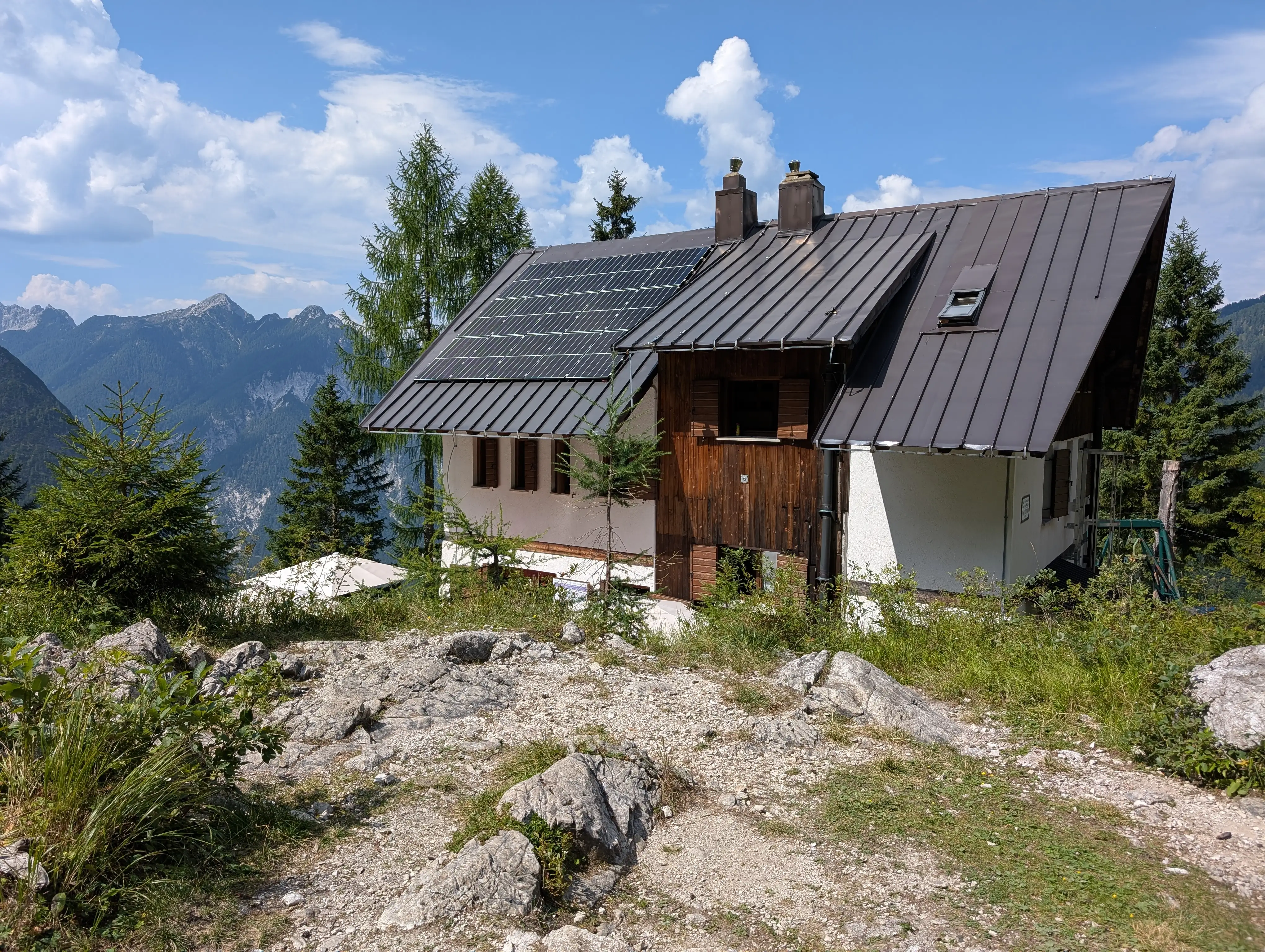 Building of Rifugio Pellarini mountain hut that we go past by.
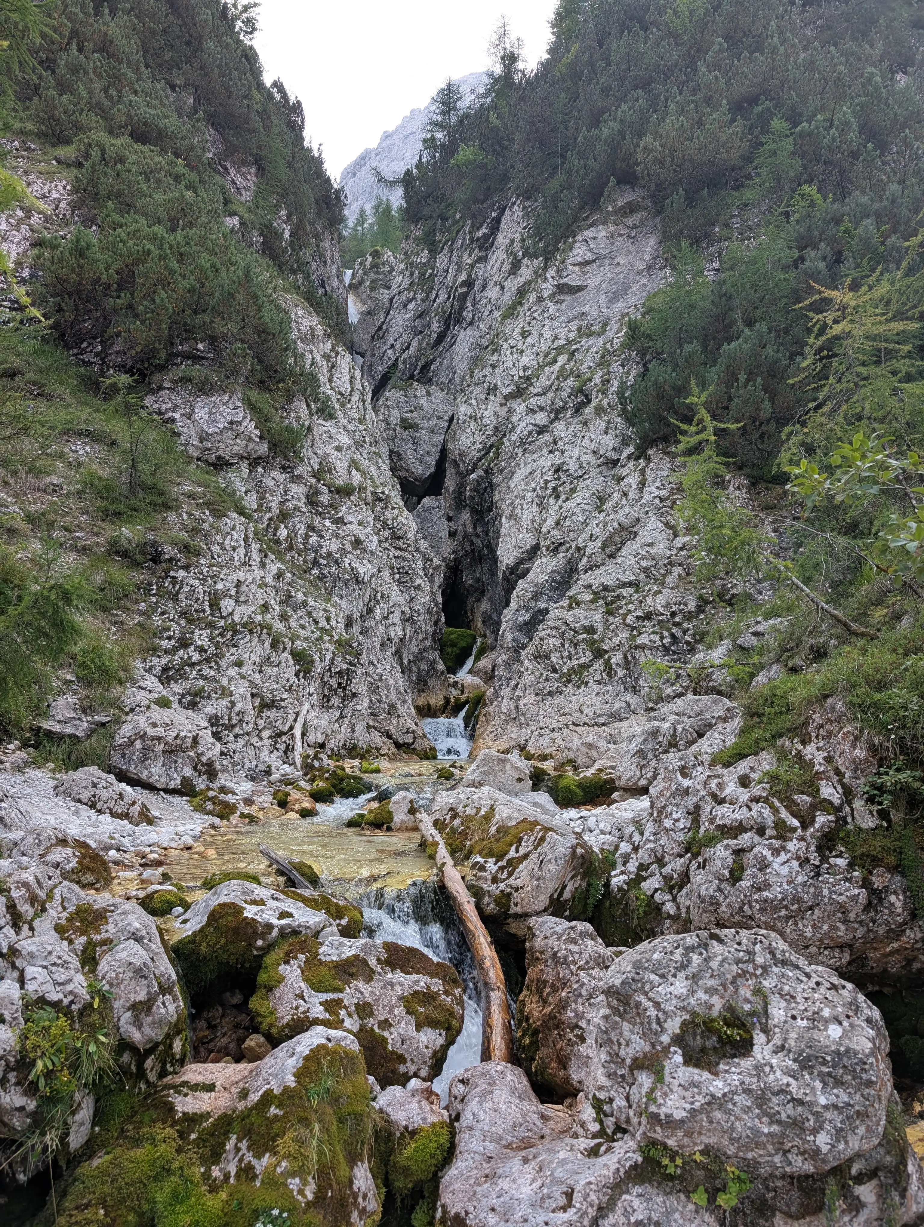 Waterfall below Rifugio Pellarini mountain hut, absolute refreshment guaranteed.