Matterhorn via Lion Ridge
Trip overview
The Matterhorn rises to 4,478 m on the main ridge of the Pennine Alps, straddling the border between Switzerland and Italy. Its north face overlooks the Zermatt valley, while the south face drops toward Breuil‑Cervinia. The mountain stands isolated above surrounding glaciers including the Gorner Glacier to the northeast and the Matterhorn Glacier systems at its base. The four ridges are named Hörnli (NE, Switzerland), Lion/Leone (SW, Italy), Zmutt (NW, Switzerland), and Furggen (SE, Italy), meeting at the sharply defined summit. It is undeniably a dream target for every accomplished alpinist thanks to its nearly perfect pyramidal shape and the legend accompanying its first ascent.
This climb is split into two days, on the first we get to the Oriondé-Duca degli Abruzzi mountain hut, on the second day we actually climb the Matterhorn.
Route description
Oriondé-Duca degli Abruzzi hut - access description:
Starting from Breuil-Cervinia we take trail no. 13 and climb up mild slopes to the mountain hut of Oriondé-Duca degli Abruzzi located at 2810 meters. No difficulties here, just making room for waves of tourists going down. This is the end of day one.
Matterhorn Lion Ridge (III+) - getting to Carrel bivouac:
Starting from the Oriondé-Duca degli Abruzzi hut, first follow trail no. 13 west, it runs as far as the Carrel cross at 2950 meters. Here the marking ends and we need to follow the path and look for the cairns. The path is not the easiest to follow in the dark, the most important thing to remember is to make sure we enter a gully with the Carrel bivouac board. This gully is on the left side when we face a rocky wall in front of us. There is a path to the right here that goes through the pass gully (check the topo) but that route is not advised due to rockfall danger. So we continue turning left up that mentioned gully and then zigzag up, first on nice plates, then some passages with more loose rock await us. Like that we reach the Testa del Leone traverse (some snowfields to cross) and land on the Col du Lion (3579m) pass. From the pass, we won’t have to worry about brittle rock anymore, but it’s not the time to hide hiking poles yet, one will still be helpful as there is a bit of scramble and walking until the Carrel bivouac.
This part is rather pleasant and the not-so-steep plates already give an idea of how the rest of the ridge will look like. There are fixed hemp ropes in place where needed. Just below the bivouac, there’s a vertical wall that would need climbing shoes to be climbed if not for these ropes. Personally, that was the hardest spot on the whole ridge. During our climb, the Carrel bivouac was under renovation, the estimated time for reopening is 2026. We passed the building from the left side.
Matterhorn Lion Ridge (III+) - route description:
Past Carrel bivouac, the main climb begins. First, we use chains to ascend to the right of the big tower above the bivouac. Next, we continue the traverse on the right side (pleasurable!), climb up again, traverse with via-ferrata-like cables, and finally approach a series of chains that take us to the ridge (the chains are quite vertical). Now, the difficulties ease off a bit, and we follow the ridge line (directly or sometimes bypassing on the western, left side) up to the Pic Tyndall (4241 m) peak. There is a series of towers that we need to cross and down-climb—they are not that difficult and have lots of good, firm holds to support us. We don’t really descend much in terms of losing elevation. Rappelling is also an option here; there are fixed bolts for that.
After crossing all of the Pic Tyndall towers, the final part of the climb awaits us. Here, technical difficulties shine because elevation gain and altitude kick in really hard. Operating with these thick ropes is rather painful; try to use the rock as much as possible. Also, use the ladder on the right. It is a bit overhanging but still better than the exposed and vertical option with ropes only. There’s also the biggest chance for traffic jams here, but I did not complain about having to wait a little, as I could finally catch my breath. After 200m of climbing, we land on the Italian peak (4476m), and 2 minutes of walking separate us from the Swiss one. Congratulations, a dream come true.
Matterhorn Lion Ridge (III+) - descent:
As much as climbing the Matterhorn via the Lion Ridge was a physical effort (and a considerable one), the descent seemed more of a mental one. Sharp focus is needed at least as far as the Carrel bivouac—a journey of around 5 hours, a duration we also needed to consider. The route down is not as obvious as the way up; on the ridge, there are more variants to be taken at times. Then there is also the dilemma of rappelling: most of the spots can really be climbed down; however, fixed points are in place and are commonly used by guides. These are the pain points where you can get stuck a bit. In the end, we rappelled only once—below the Carrel bivouac. A 30-meter rope is enough for that. If you aim for more frequent abseiling, then I would suggest a longer rope, maybe 60m, as some abseiling points can be combined in one shot. With 30m, it wouldn’t make much more sense and would be counterproductive in terms of time.
Trip conditions
Weather:
A western wind with gusts up to 30km/h was still tolerable but made the ascent a bit less pleasant, especially in combination with a partly cloudy sky in the morning. The wind could be felt only on the western, exposed part of the ridge. The eastern side provided good cover, and thanks to the sunshine around noon, it was possible to drop windproof jackets. According to the forecast, it was around -4 degrees on top.
Trail:
Part of the way up is a tourist trail and is marked nicely, up to Col du Lion (3579m) pass there is a bit of loose rock to deal with, above it - just a pure bliss of compact rock on the way.
Path is rather easy to find as on the ridge we don't really have much alternatives. Wouldn't look too much for cairns, they don't come in plenty - watching scratches on the rock and belaying/protection points is a better idea. There were other people on the ridge but it was not overcrowded. Wouldn't call occasional pauses as jams.
Additional information
Tips and author's comments:
The Hörnli ridge, running from the Swiss side, is considered to be the 'normal' route mostly due to the fact that it is the easiest one and the Matterhorn looks best when approached using it. That said, it is not without some major drawbacks which would include some of the following:
- overcrowding of the ridge - leads to traffic jams and slows down ascent/descent.
- more commercial climbers with guides - decreases the pleasure of the climb because guides have priority on leaving the Hörnli mountain hut (in theory you can't leave the place before them in order to not stress their clients!) and they sometimes behave like assholes on the way.
- rock is a bit brittle - combining the two above-mentioned issues, we have a bigger chance to hit/get hit with a rock. Orientation is a bit more problematic - although on a ridge, there are said to be variants in places that will make you lose time or confidence when ending up in greater difficulties.
- logistic overhead - you can't leave for the Hörnli mountain hut leaving your car in Zermatt since cars are forbidden there, you need to take a train from Täsch to get to Zermatt first.
- costs - an overnight stay at the Hörnli hut costs 150 CHF compared to 90 EUR on the Italian side (2025) and you don't even have warm water included. Add the cost of the train and parking and you get a nice sum. This might change a bit once the Carrel hut renovation is completed as it won't be an unattended bivouac anymore and the prices are expected to rise.
Anyway, these were the reasons I wasn't really keen on climbing the Matterhorn from the Swiss side. The lower accommodation price, better rock quality, and less probability for jams on the way won over the fact that I wouldn't be seeing the iconic mountain side while approaching. Also, since the Carrel hut was closed, we had to start from Oriondé-Duca degli Abruzzi hut and deal with 1700 meters of ascent which is quite challenging taking into account the difficulties and the altitude.
Oriondé-Duca degli Abruzzi mountain hut can also be reached by a hut taxi that costs 20 EUR per person, I also saw people using e-bikes - a less deplorable option. During your stay at Oriondé-Duca degli Abruzzi, try to find people who summited that day and ask them for current conditions. It might be a bit of a gamble, but taking approach shoes could pay off really nicely. I wish I had them myself since the ridge was completely free of snow. Plus, you won’t need to carry an ice axe and crampons. A big win.
We set off from Oriondé-Duca degli Abruzzi hut at 3 am, there were teams going before and after us, but from my observation that day it was a rather later start with some people already on the Col du Lion pass. It did not affect our climb in any way though as the weather was stable, and thanks to a long day we were back in Breuil-Cervinia before sunset.
Links:Topo (from Bergsteigen)
Dangers:
Matterhorn has claimed more than 500 human lives till today (2025) which makes the mountain stand out in comparison with other 4-thousanders in the Alps. This tragic number is however a result of the volume of the alpinists that try to conquer it and does not come from the character of the mountain itself. Lion ridge is still as a dangerous route as any other taking us to the top of the mountain of comparable height and difficulties. No need for negative mental setting beforehand. Having said that we can't forget though we are dealing with serious alpinistic challenge here.
The ridge is exposed, and an emergency descent won't be hasty unless you are Killian Jornet. Stable, storm-free, and preferably wind-free weather is absolutely necessary.
Ascent takes 8 hours by the book, exhaustion is a probable scenario in that case - especially that hardest stretches start around 4250 meters. Keep in mind the descent which takes around 5 hours back to Carrel hut and requires all your focus. Prepare well and acclimatize earlier.
Rockfall from above is rather unlikely to happen; make sure not to enter the gully below the Col du Lion (3579m) pass.
Gear used:
20L rucksack, poles, 30m twin rope, personal climbing set, a couple of loops, helmet, crampons, ice axe, mountaineering boots
Transportation:
Starting point reached by car, there is a big parking available, free of charge.
Links:Parking lot
Accommodation:
Oriondé-Duca degli Abruzzi hut
Trip photos
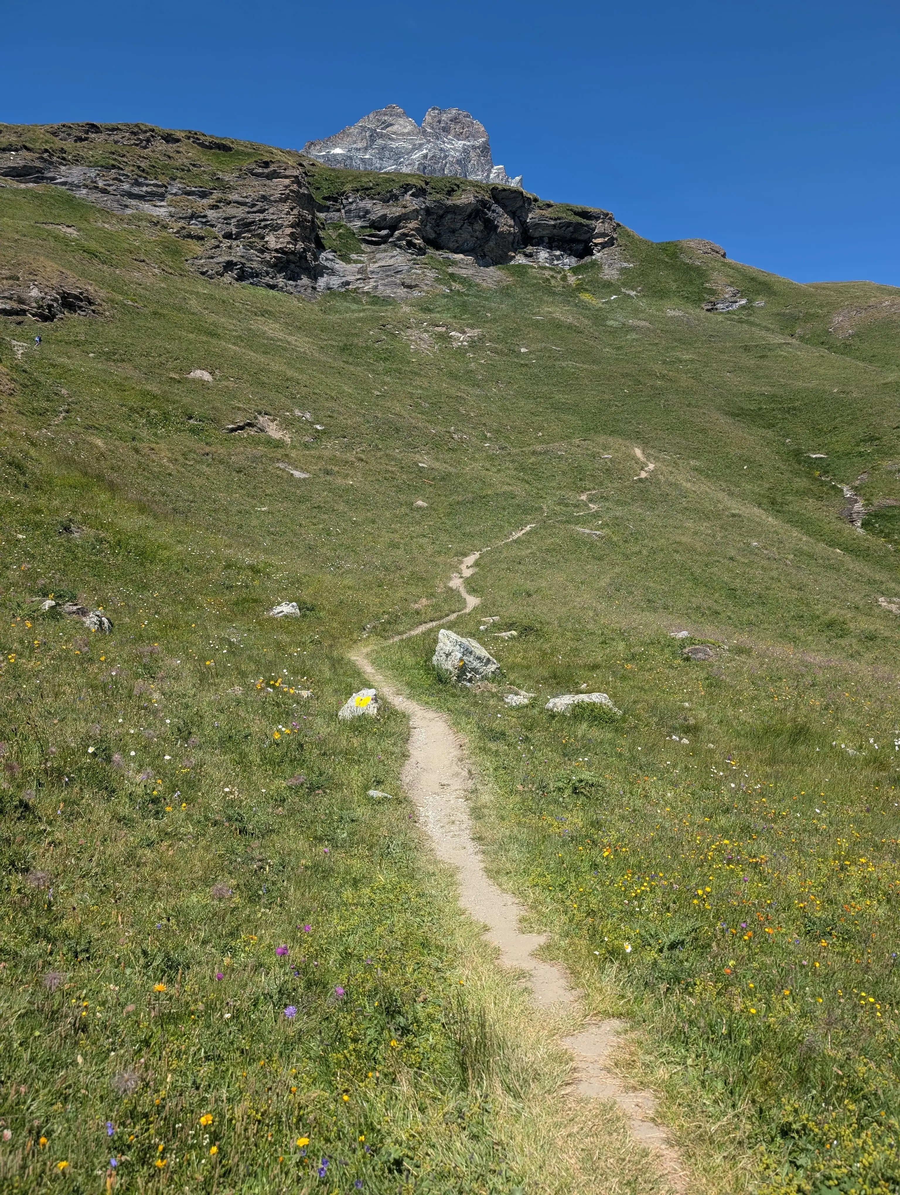 This is how lovely the ascent to the Oriondé-Duca degli Abruzzi hut looks like, not part of the actual summit climb.
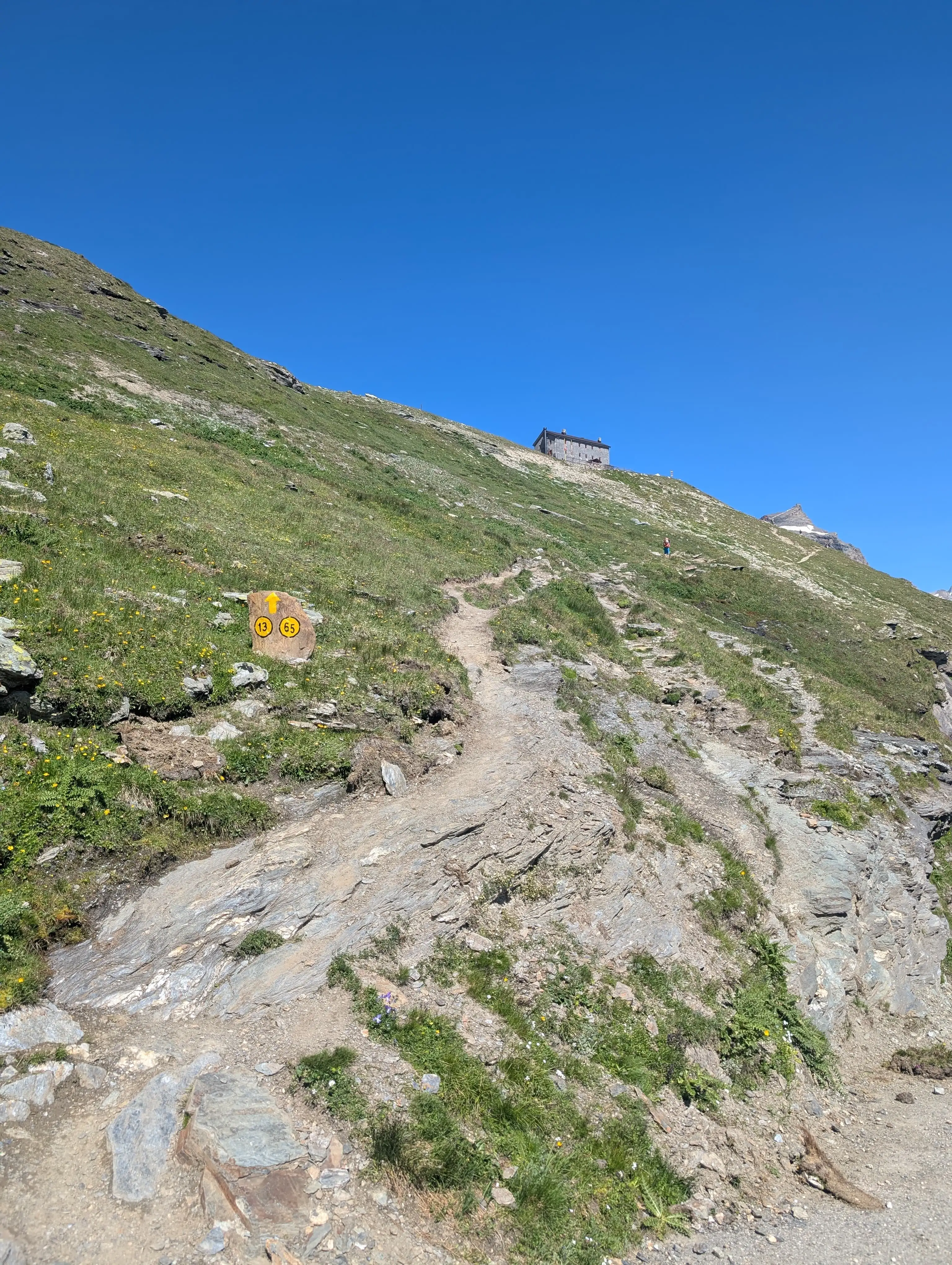 Trail 13 is to be followed till the hut and in the morning as far as 'Croce Carrel' - Cross which is dedicated to Jean Antoine Carrel.
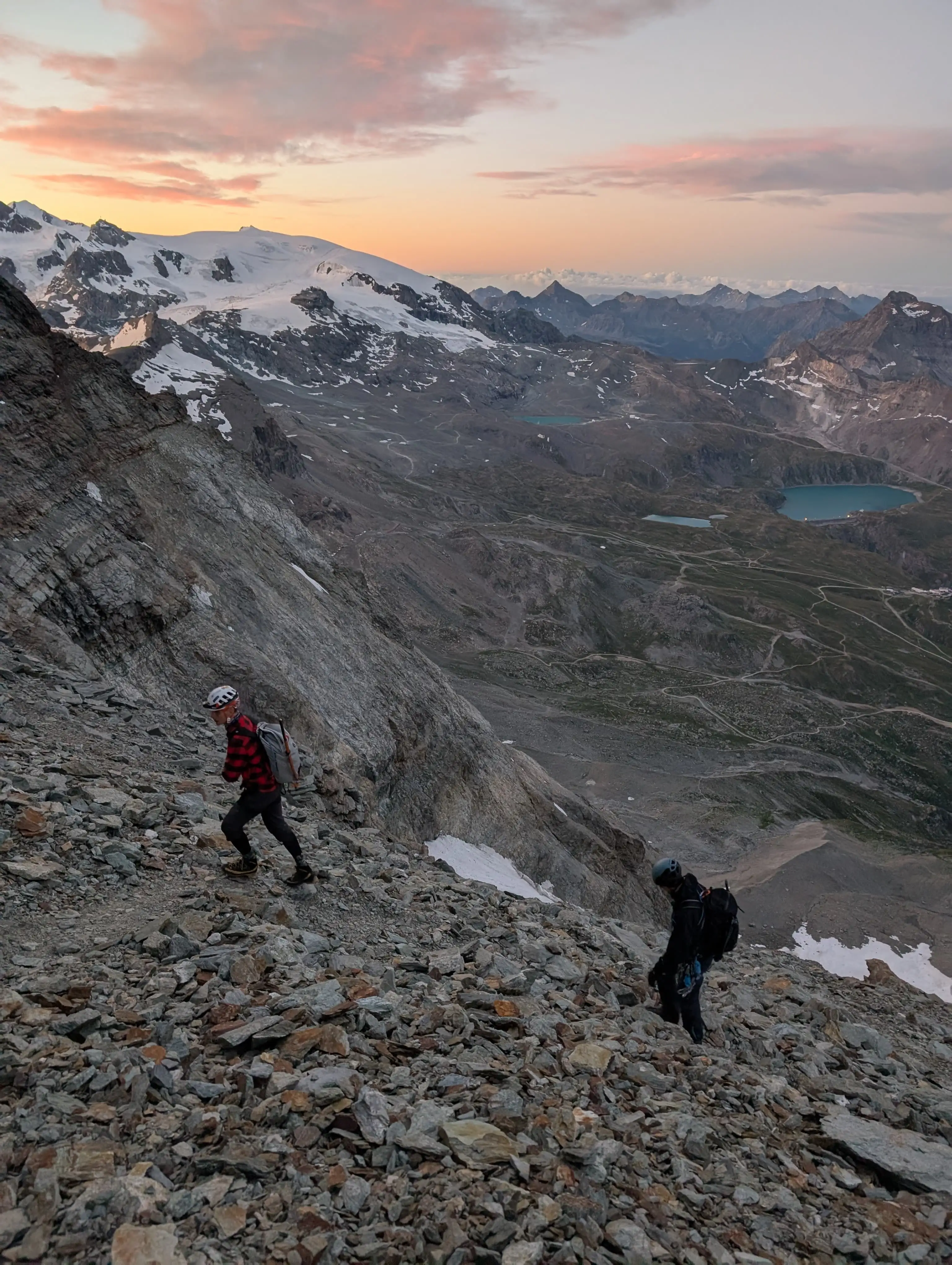 Crumbly terrain above Col du Lion pass. Difficulties are expected shortly after leaving this rubble path.
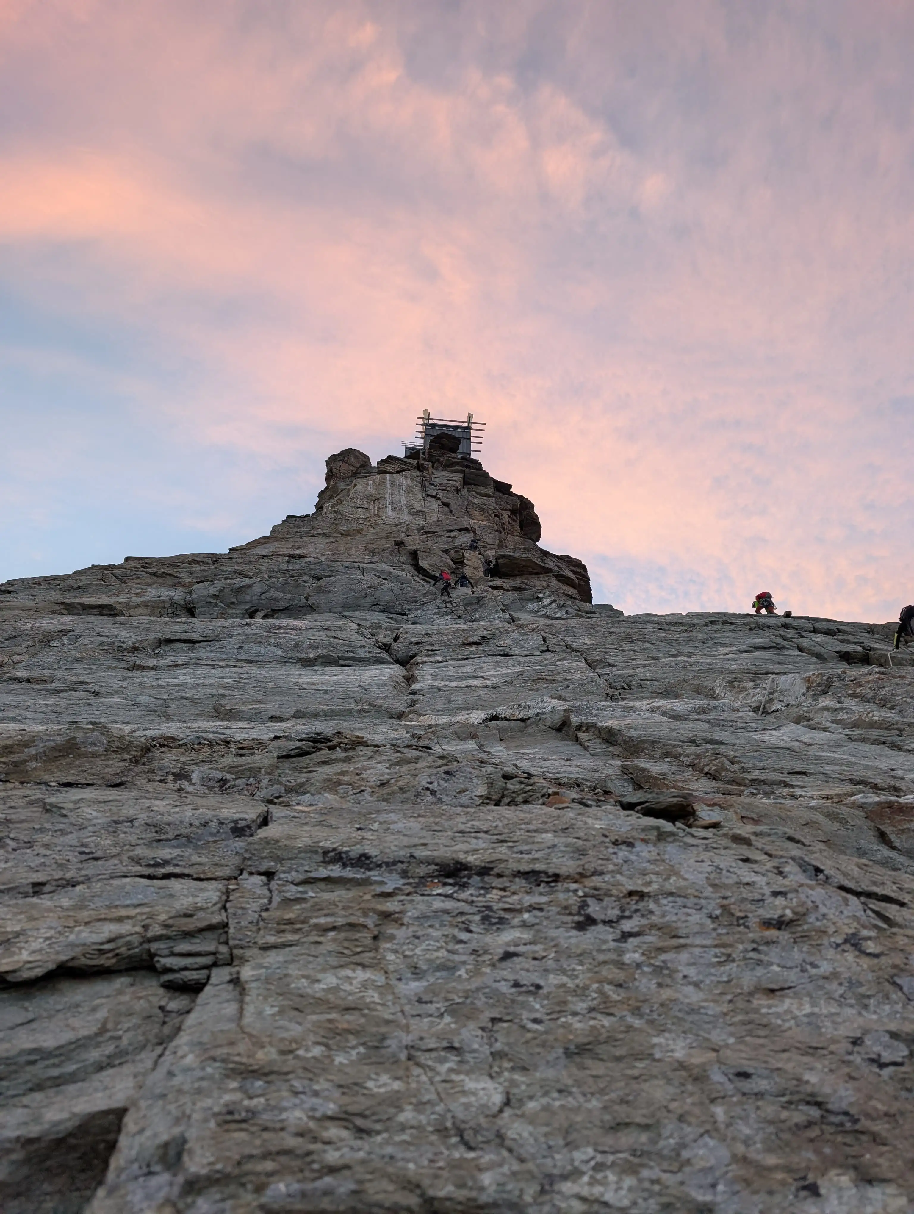 Plate climb to Carrel bivouac. The most difficult part is the vertical plate just below the building (which was under renovation).
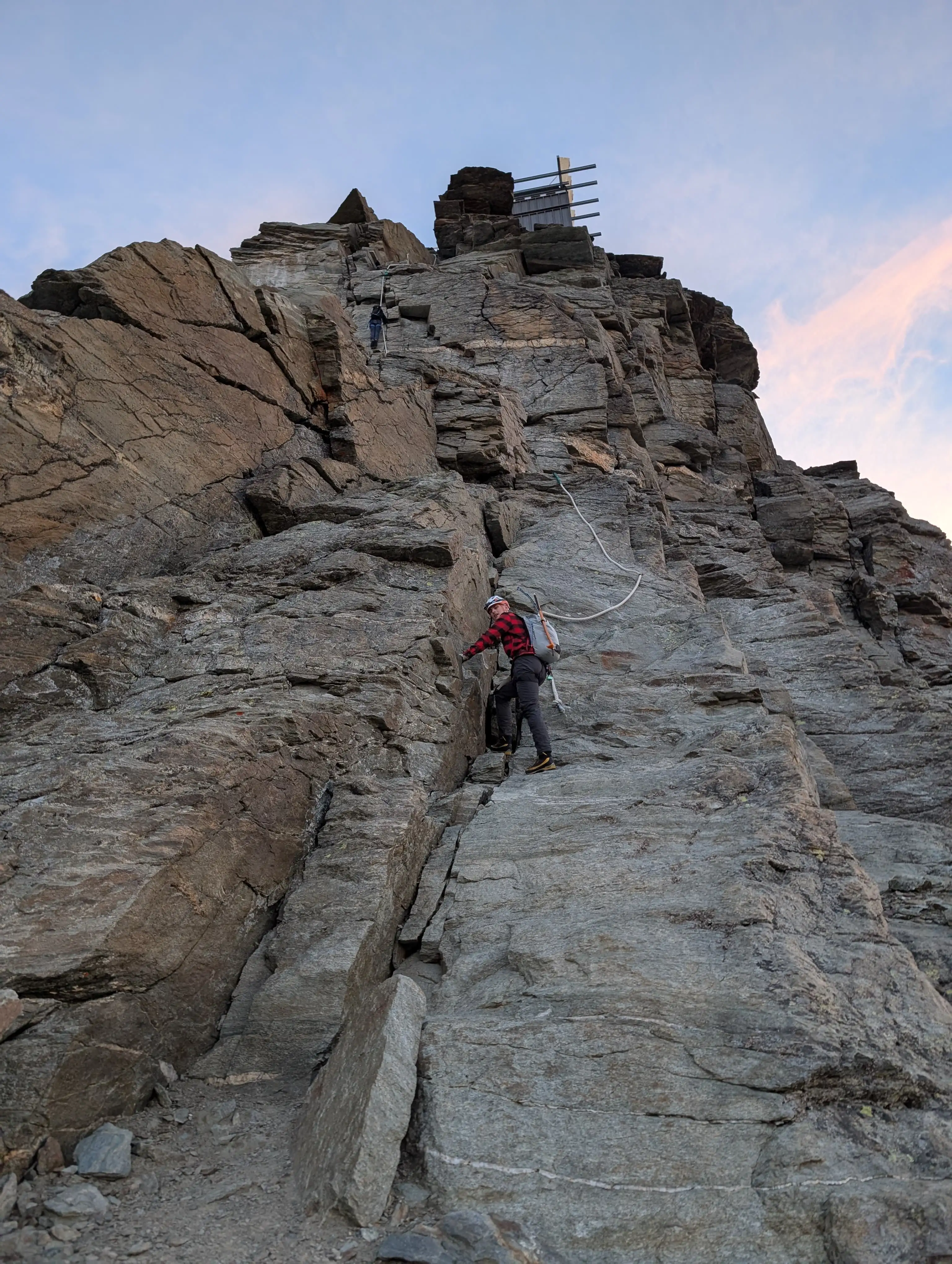 First feel of thick ropes, make sure to get accustomed, they will come in plenty.
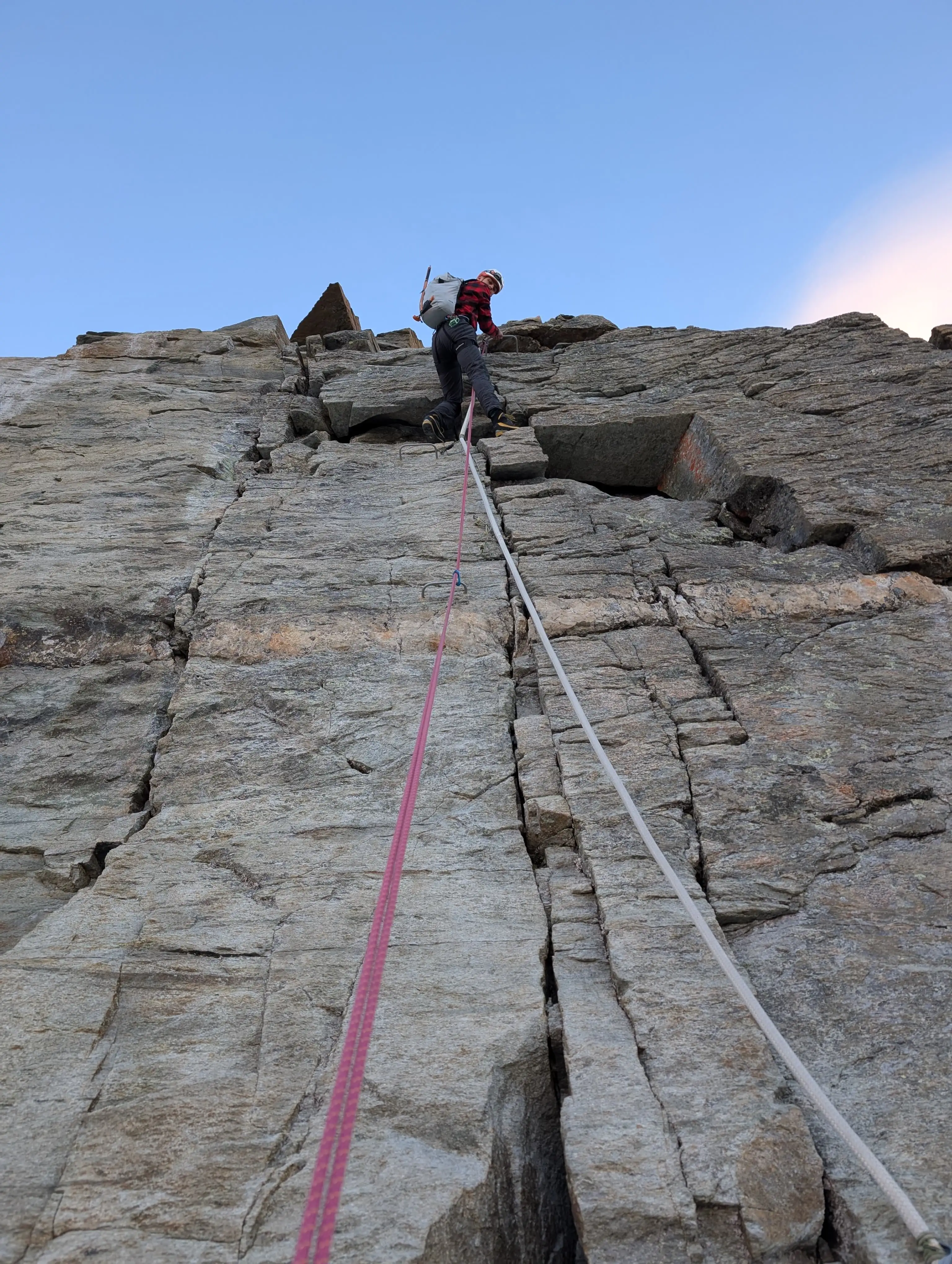 Vertical wall below Carrel hut. Personally, the most challenging part of the climb. Good technique really makes the difference here. I can't imagine climbing it with the overnight gear needed for a bivouac stay.
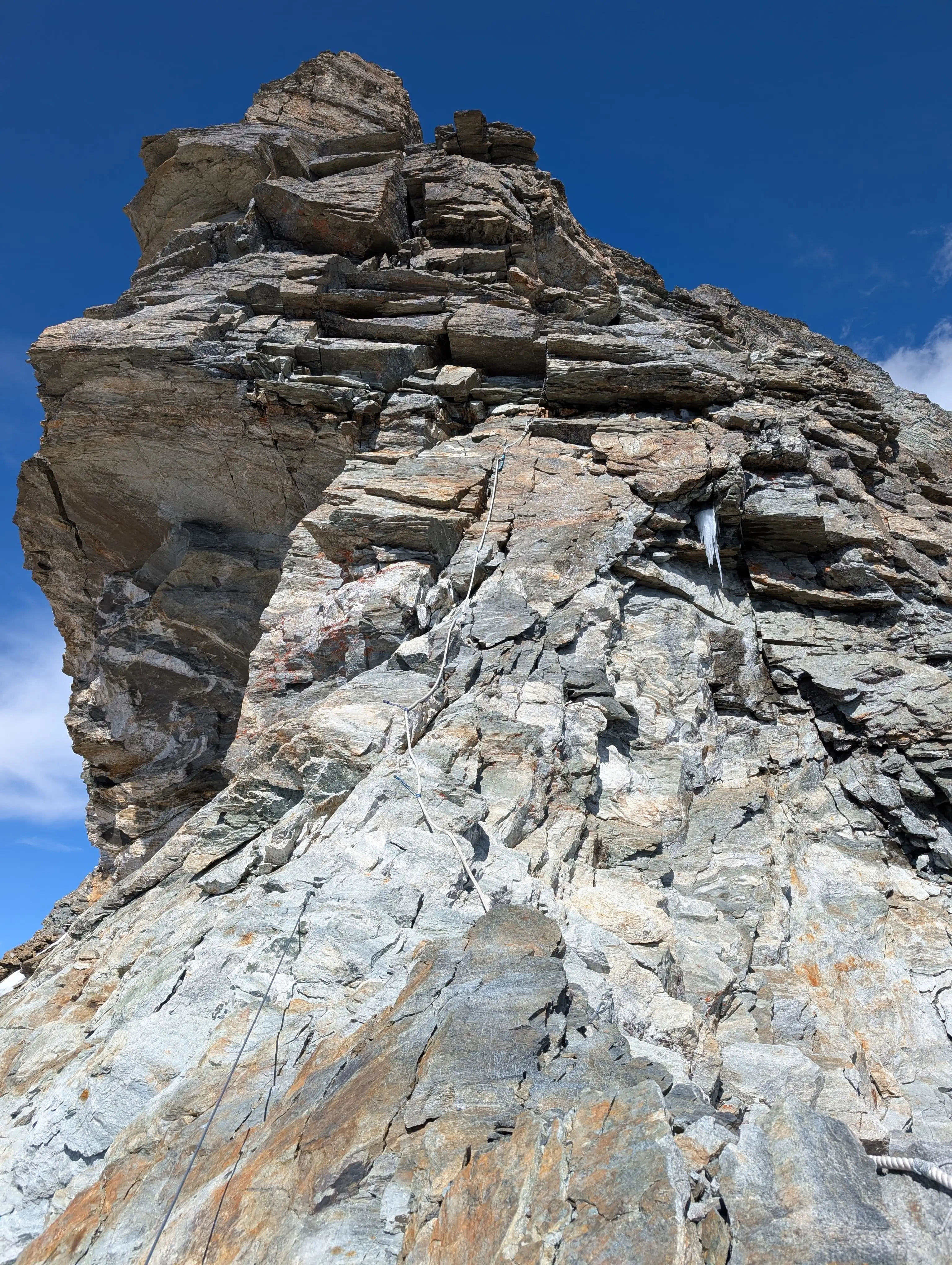 Section just above Carrel hut with a bit of overhang supplied with chain.
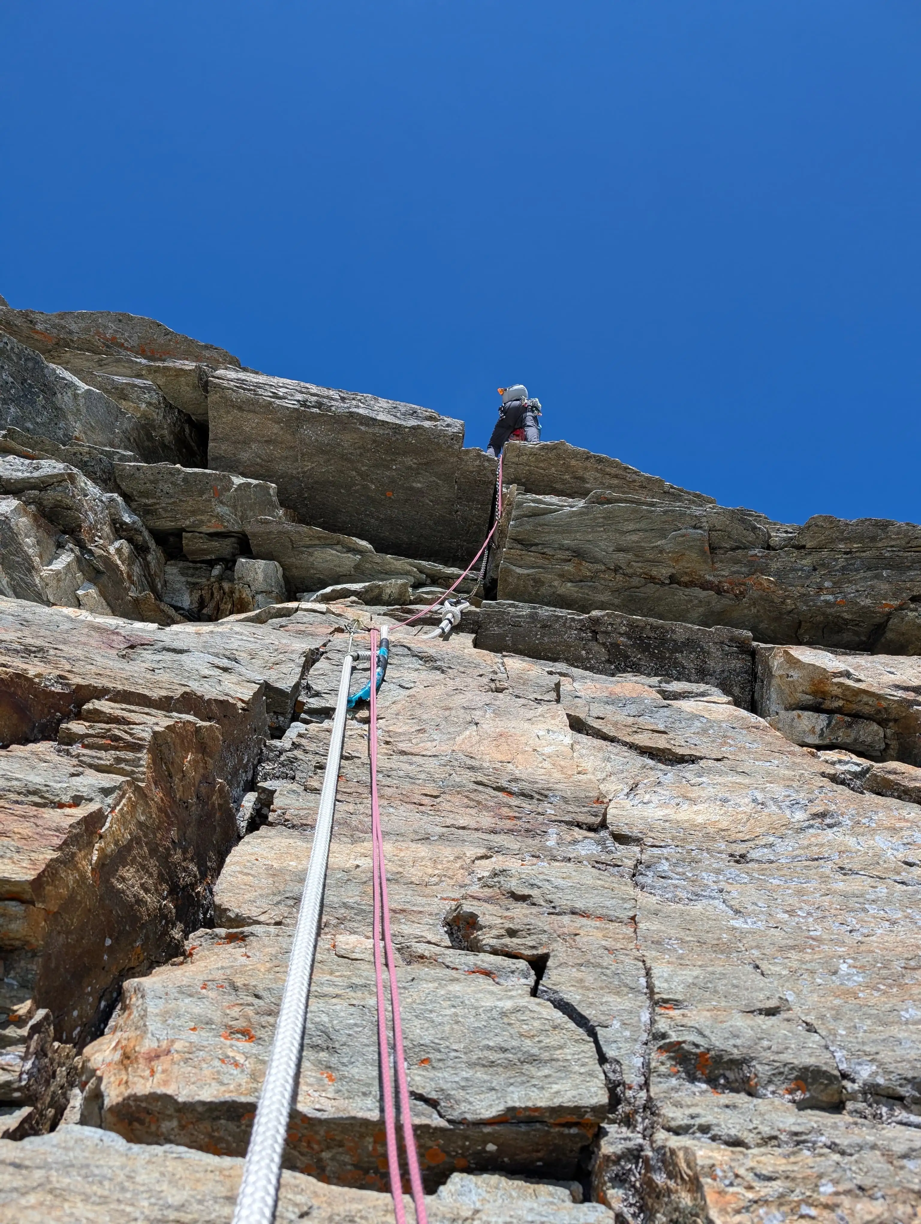 Overhang in detail, easier to use the chain and step to the right.
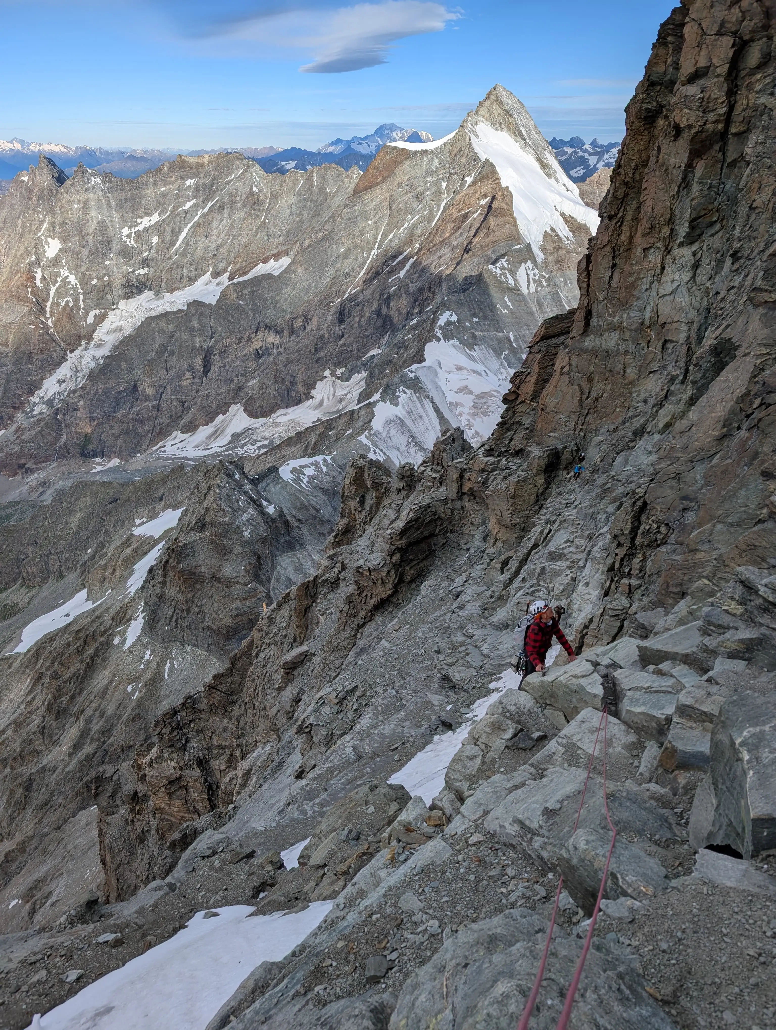 A bit exposed but easy horizontal traverse, fantastic photo spot. There is piton to place your own protection.
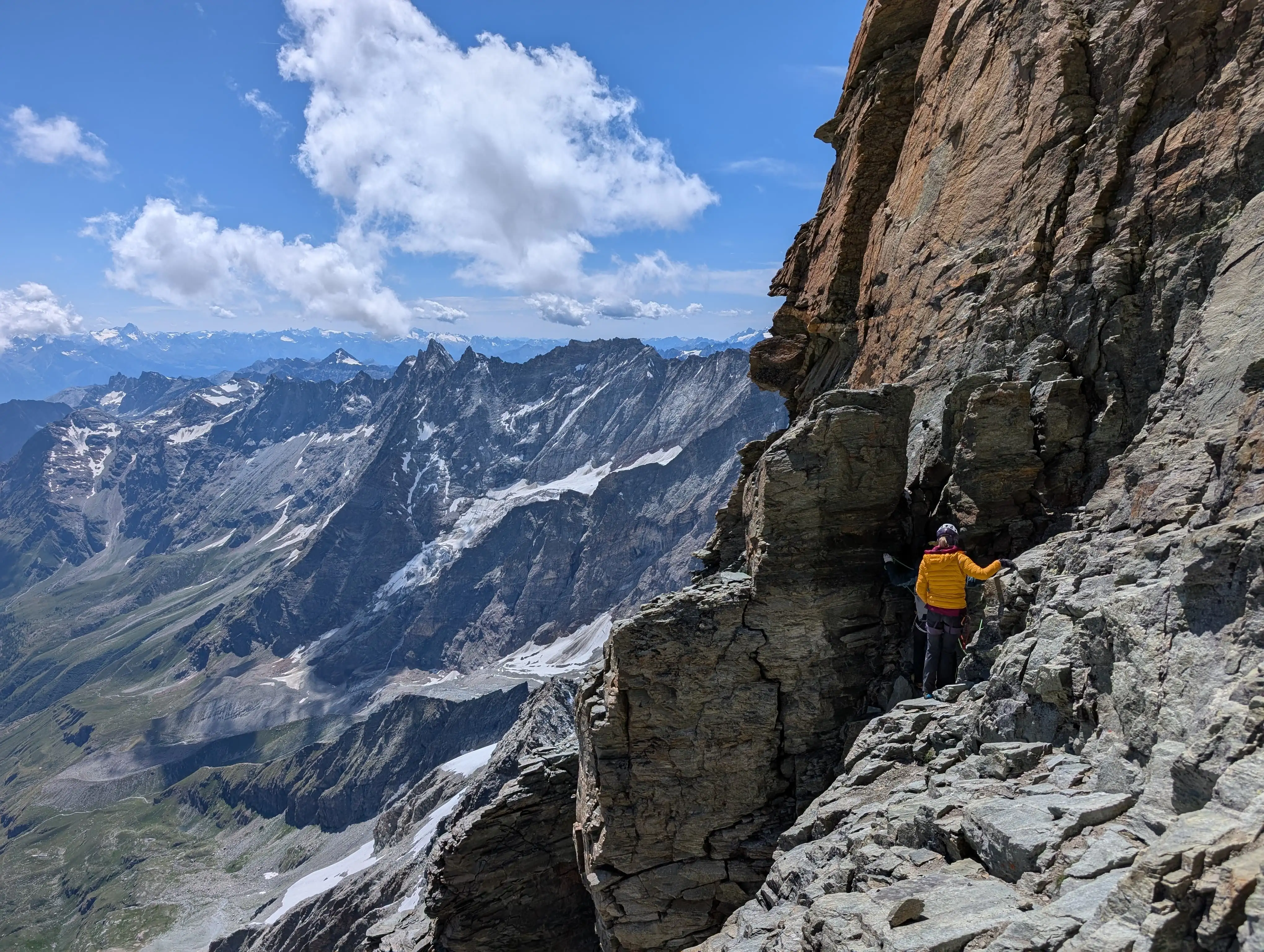 Conspicuous chimney that we traverse rather than climb up.
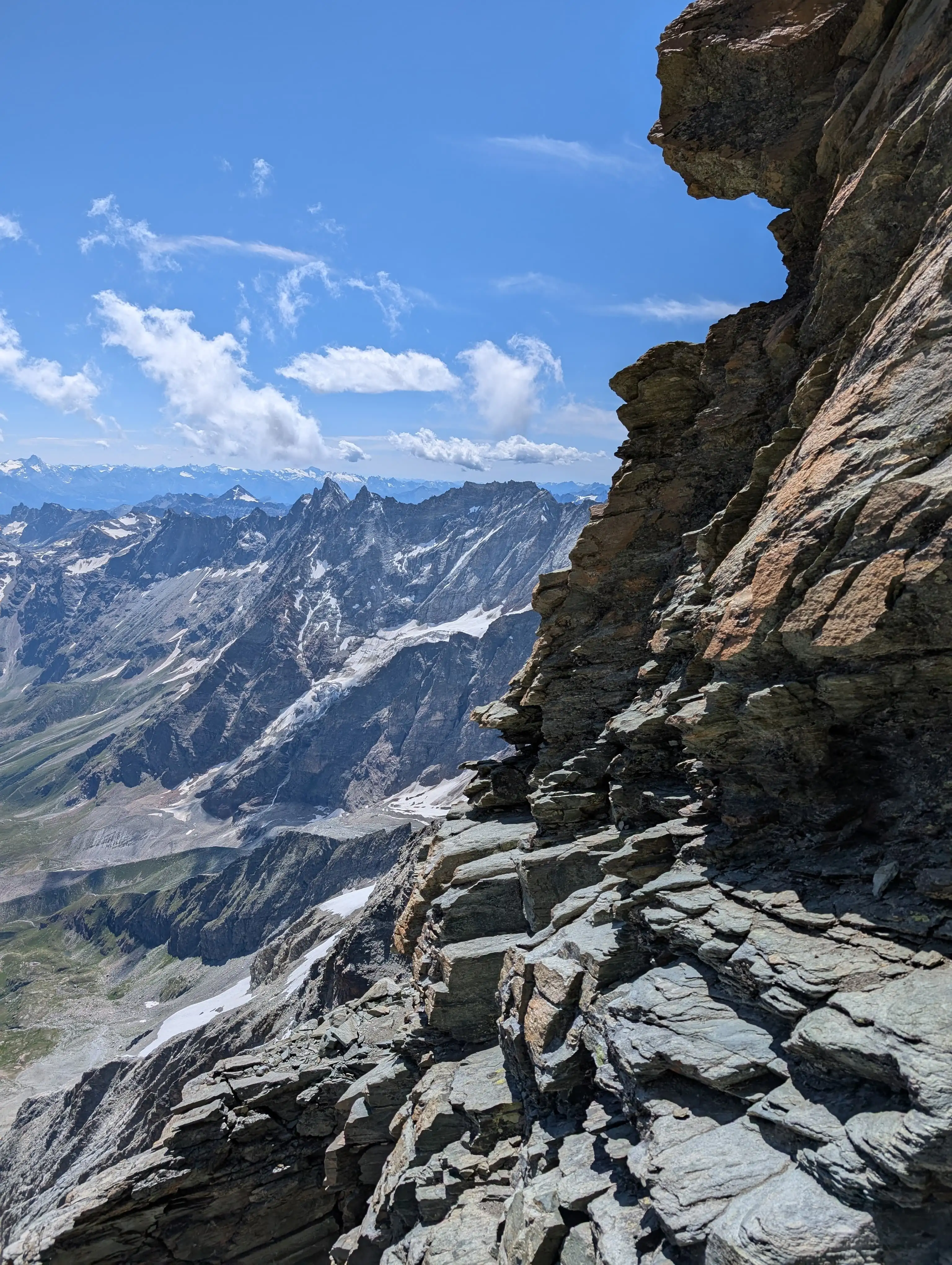 The exposed traverse and chimney from the previous photos can be seen in the background; we were climbing up again in the direction of the ridge just after crossing that snowfield below. It is protected with a via-ferrata-like cable.
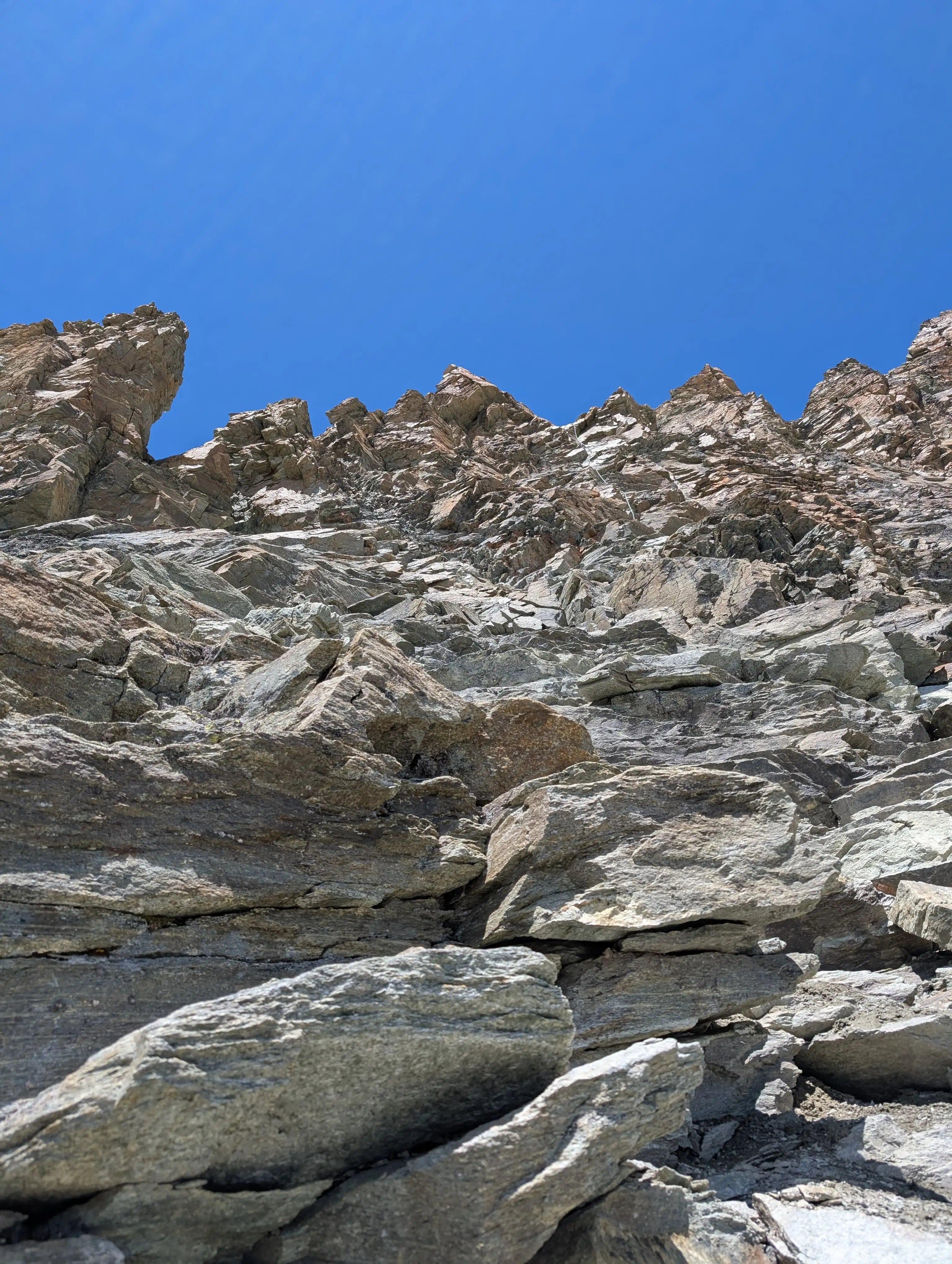 Now up and up to get to the bottom of that 60m chain which leads back to the ridge.
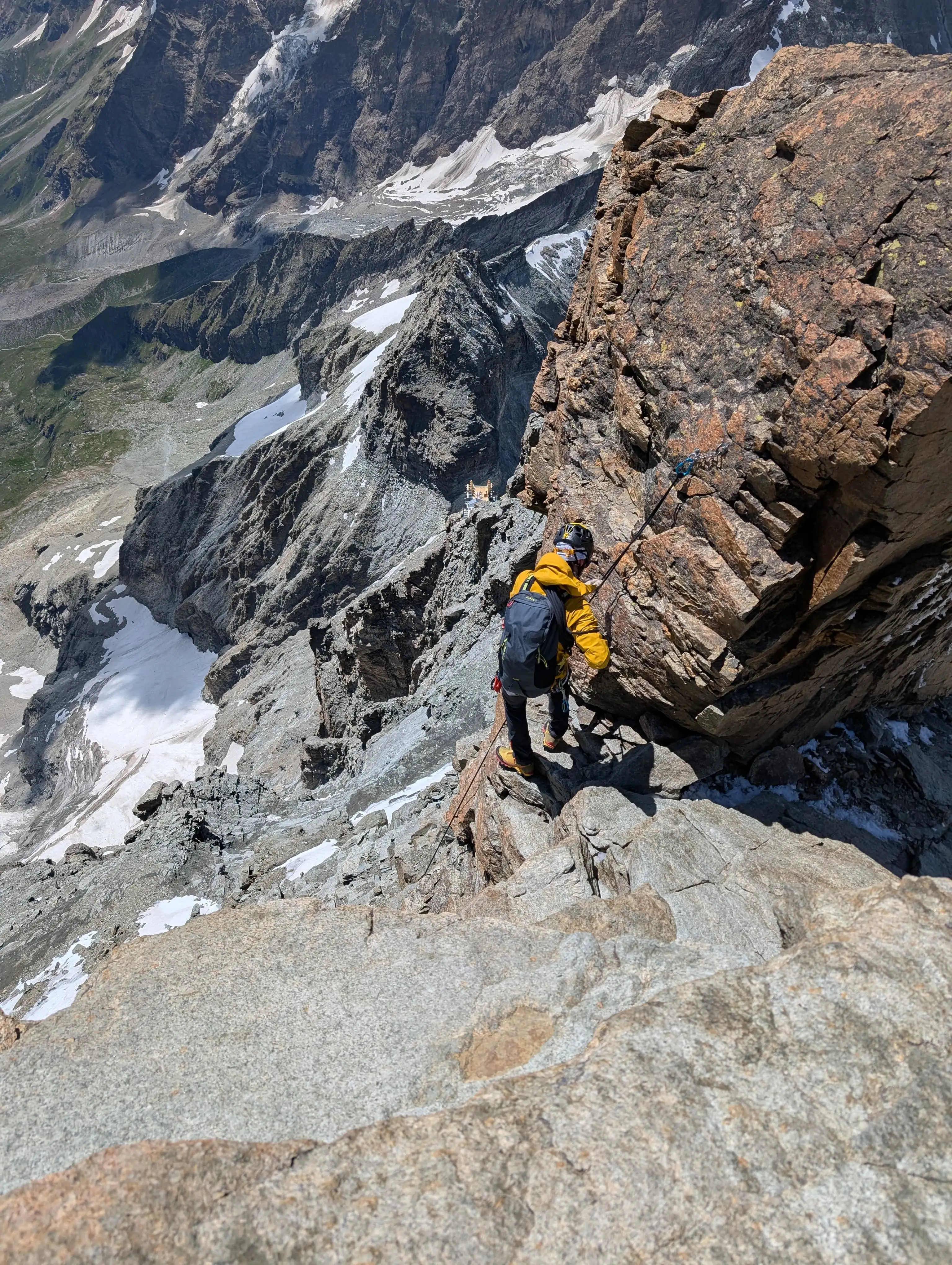 Spot where we enter the ridge back again. The chain cannot be seen, it is left to the rope below. There is a solid anchor for abseiling.
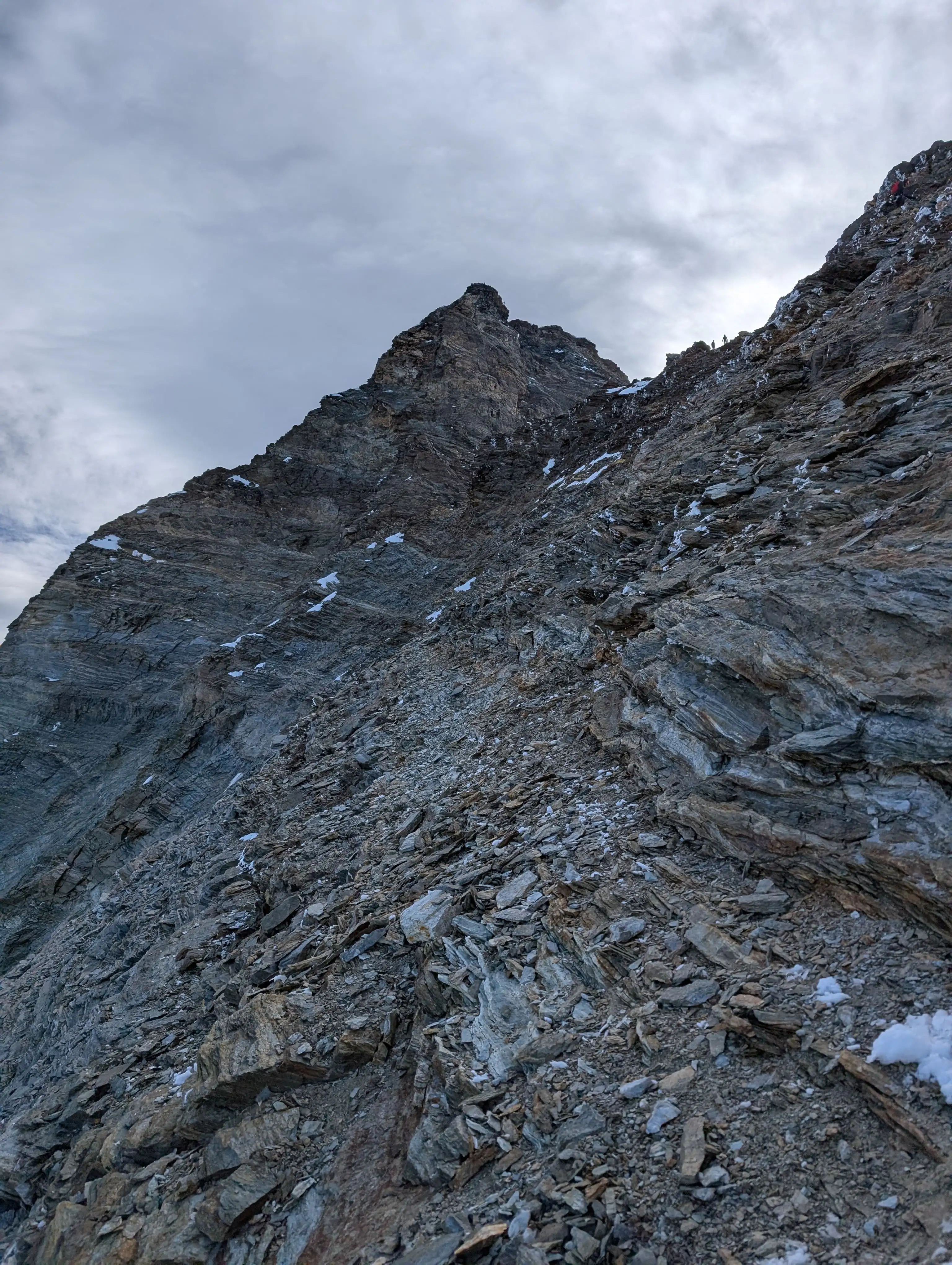 Ascending Pic Tyndal, there are some bypasses to be made on the western side. Try to look for metal rings and signs of rock erosion from walking.
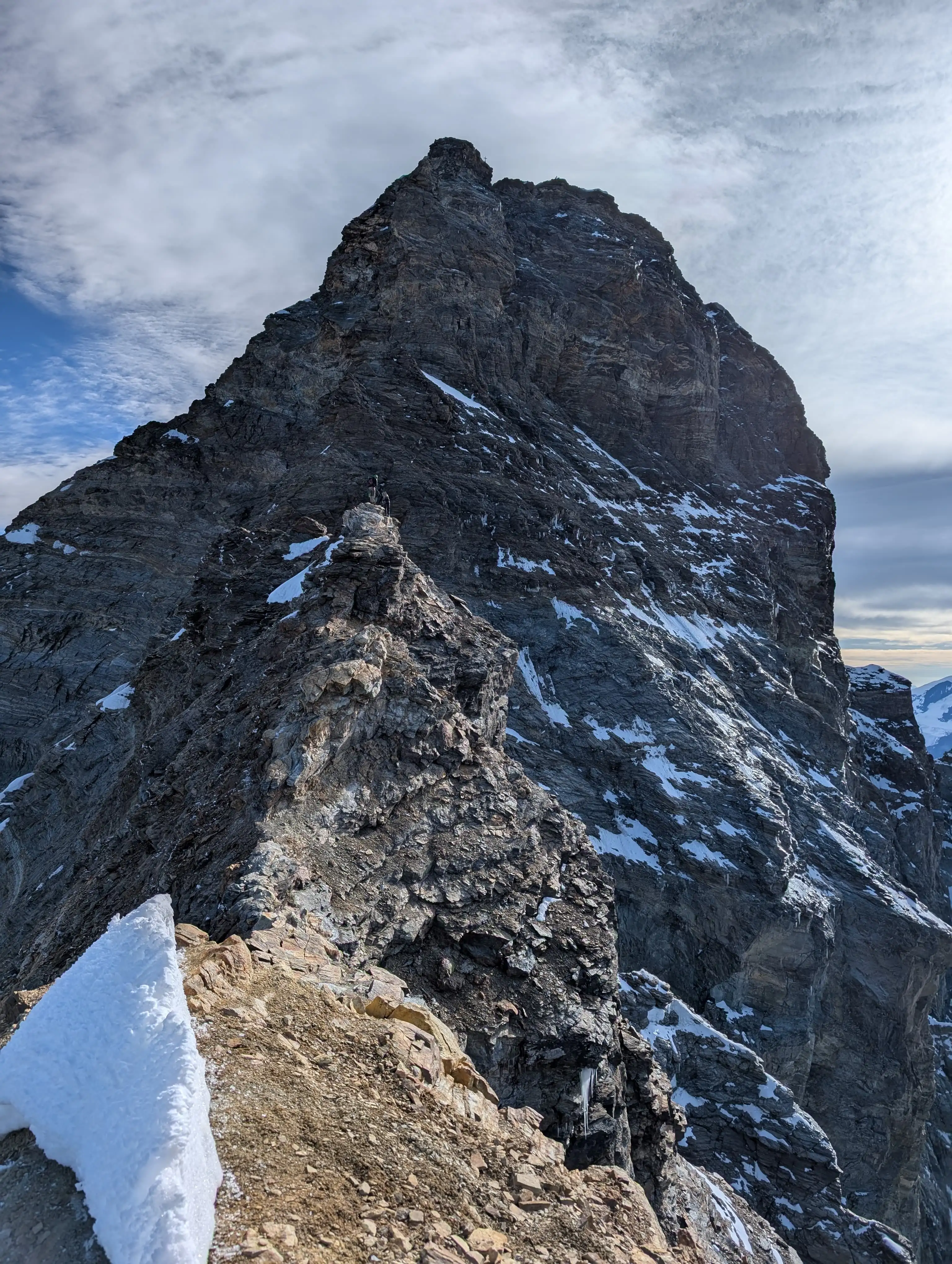 Approaching rocky towers of Pic Tyndal.
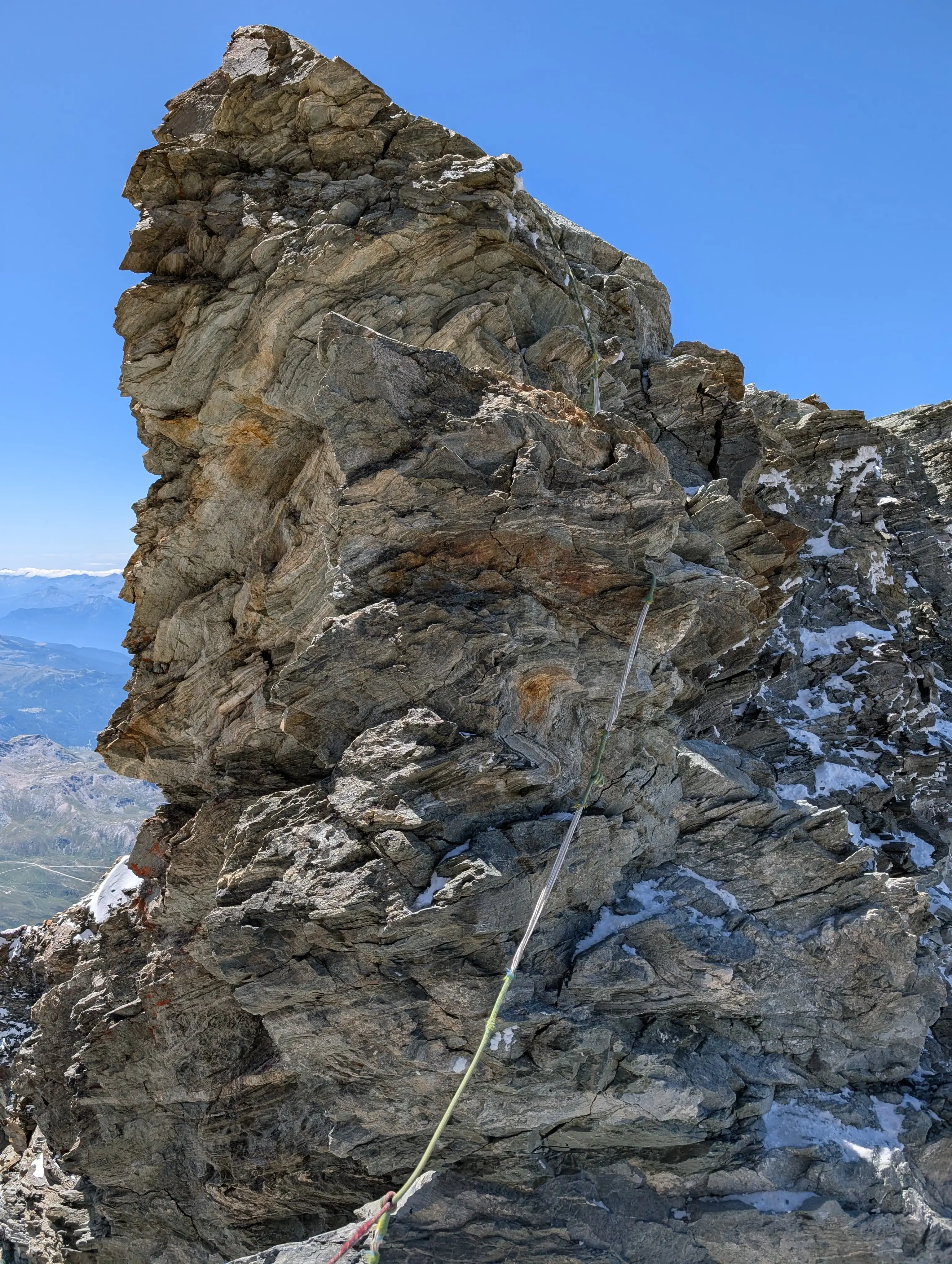 Fixed rope to help with descending one of the Pic Tyndal rocky towers. There is also abseiling anchor.
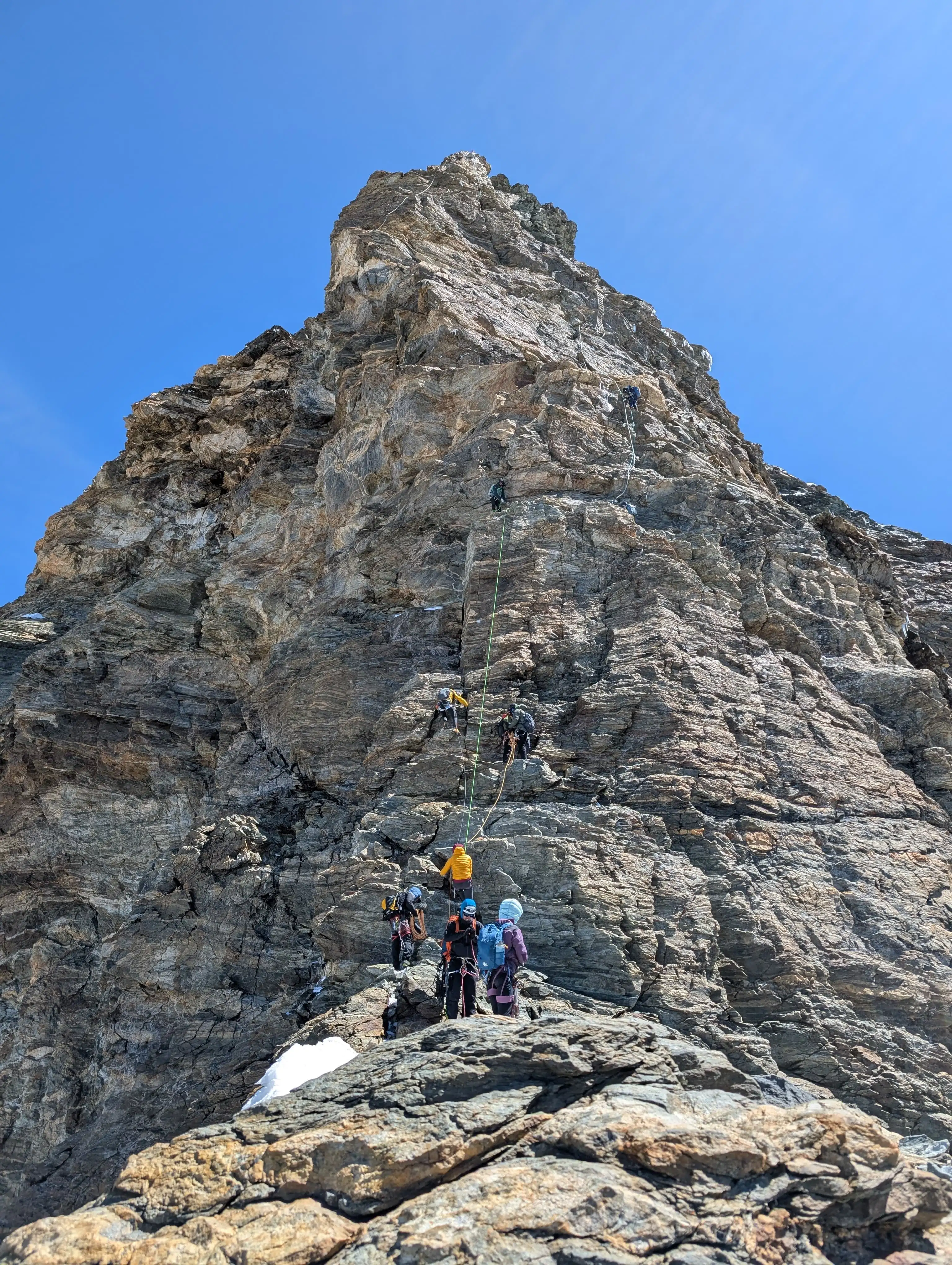 Little plateau with a great view of final section of the climb that consists of main difficulties.
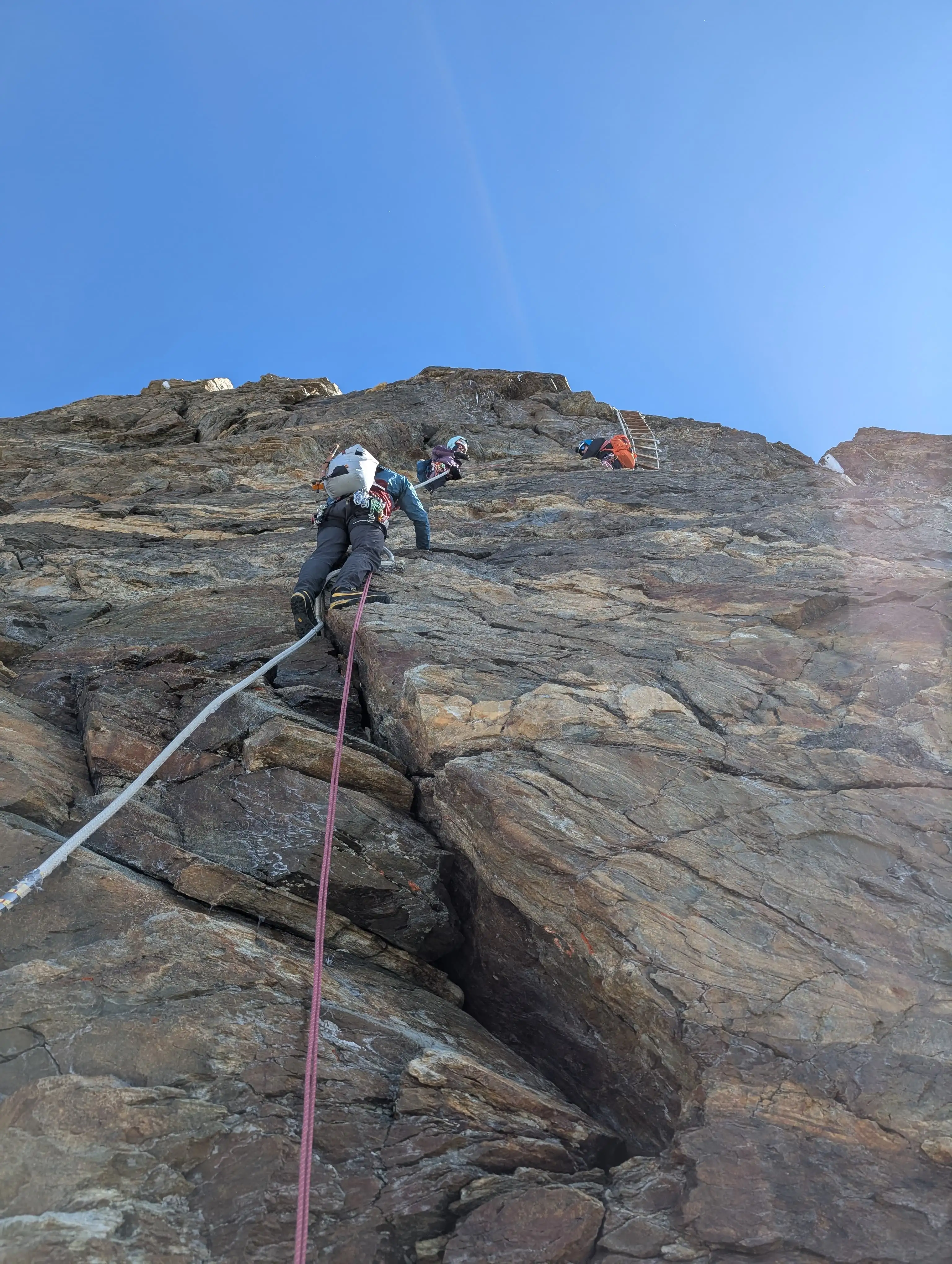 Key difficulties in detail.
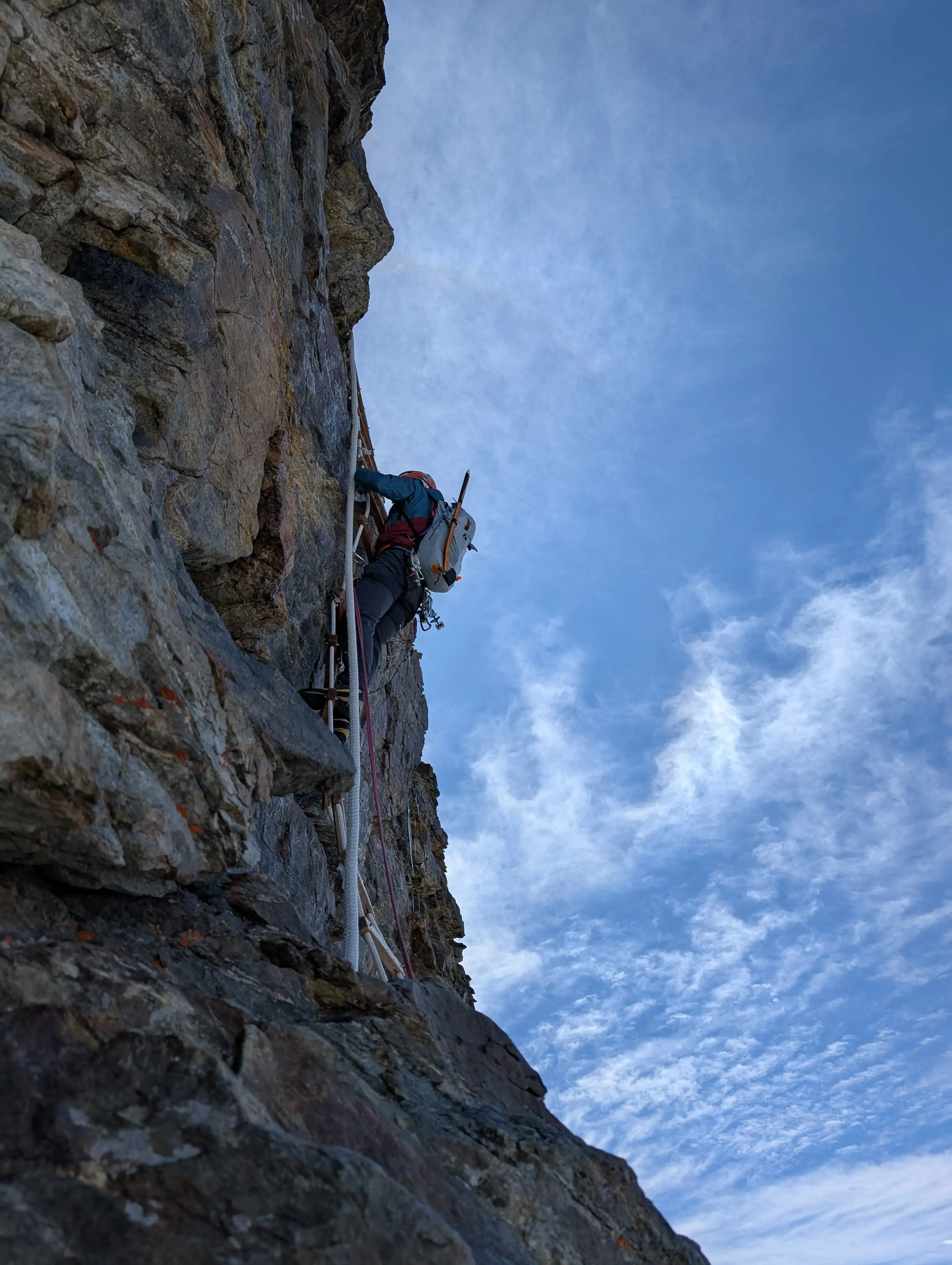 Overhanging ladder - more physical than technical but recommended more than thick ropes.
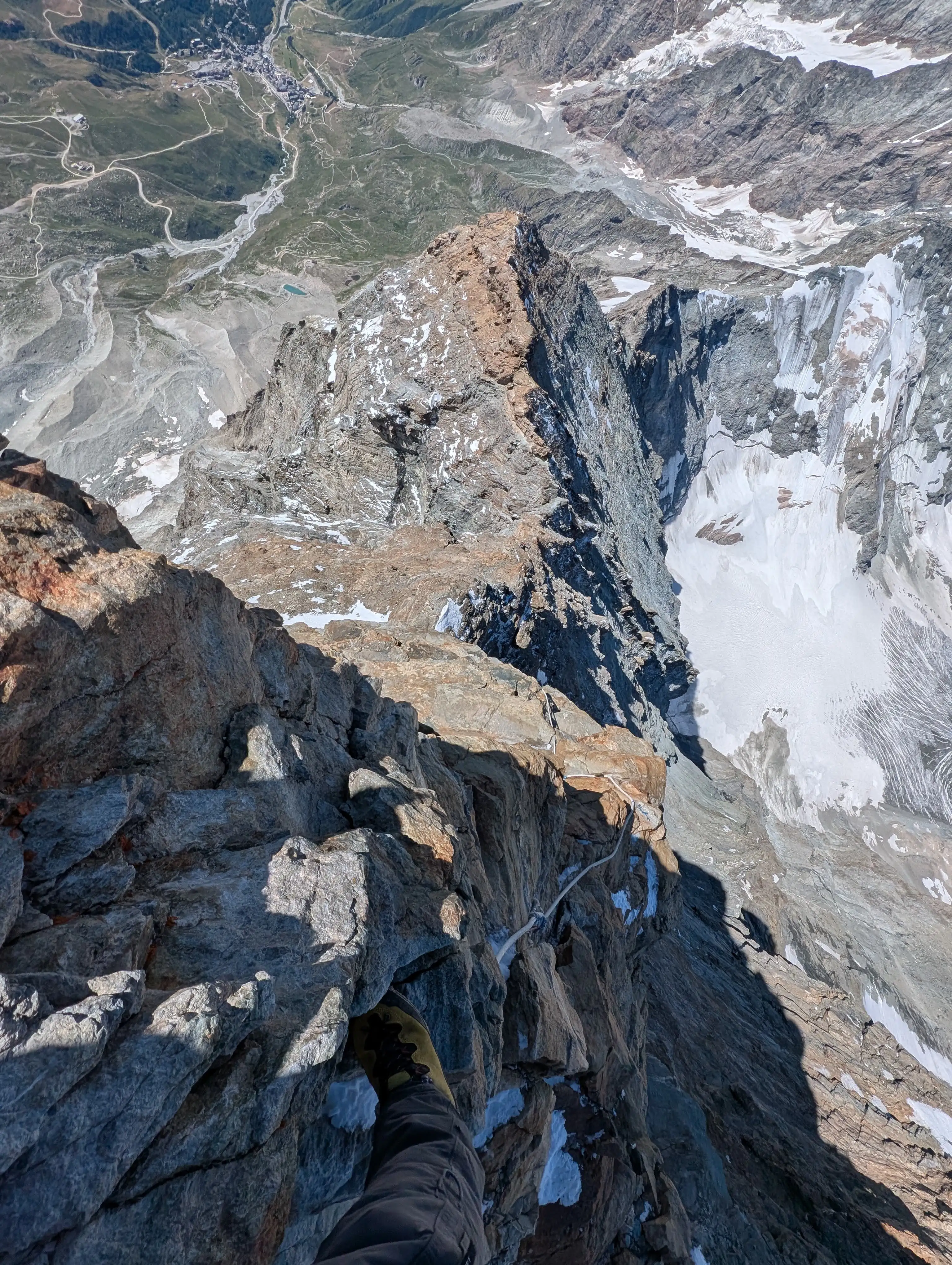 The thick rope variant of the ladder—here used in descent—is definitely more mentally challenging because of its vertical character, exposure, and pillar crossing.
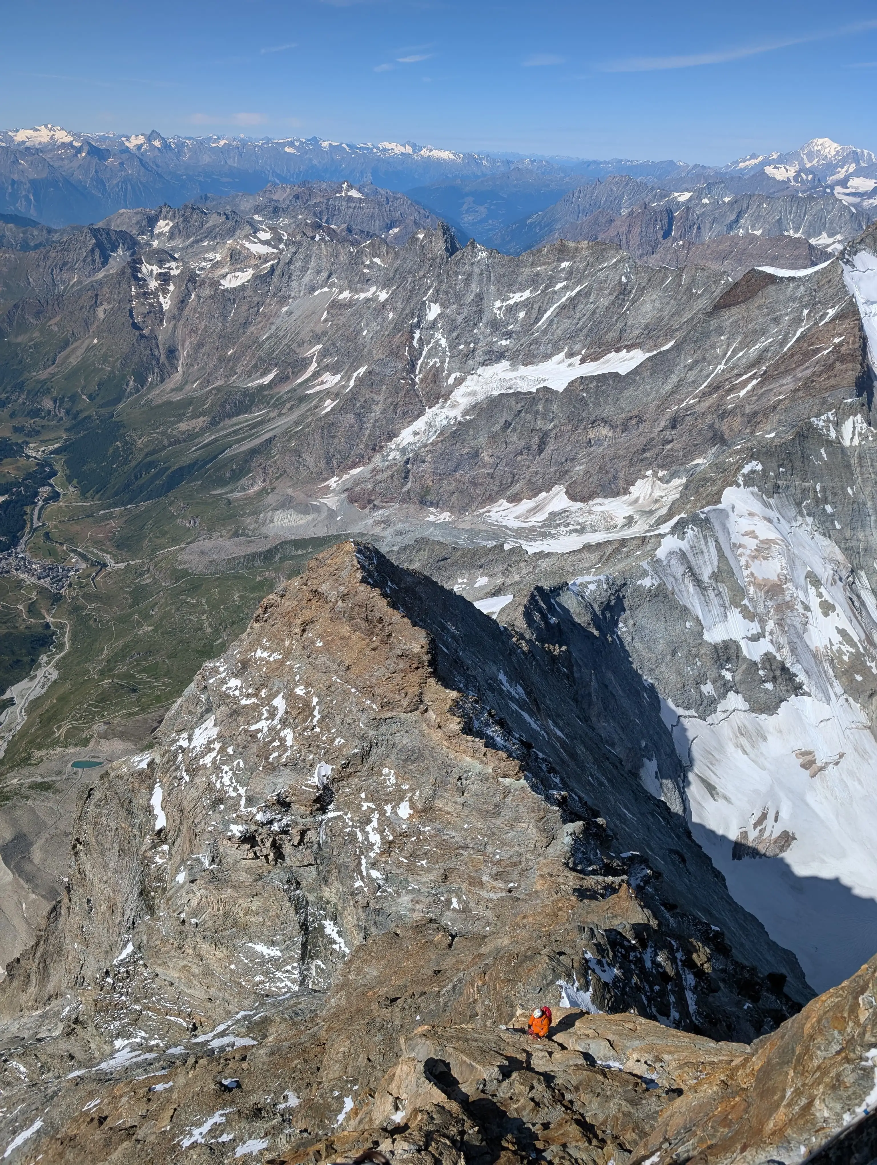 Pic Tyndal as seen from below the peak.
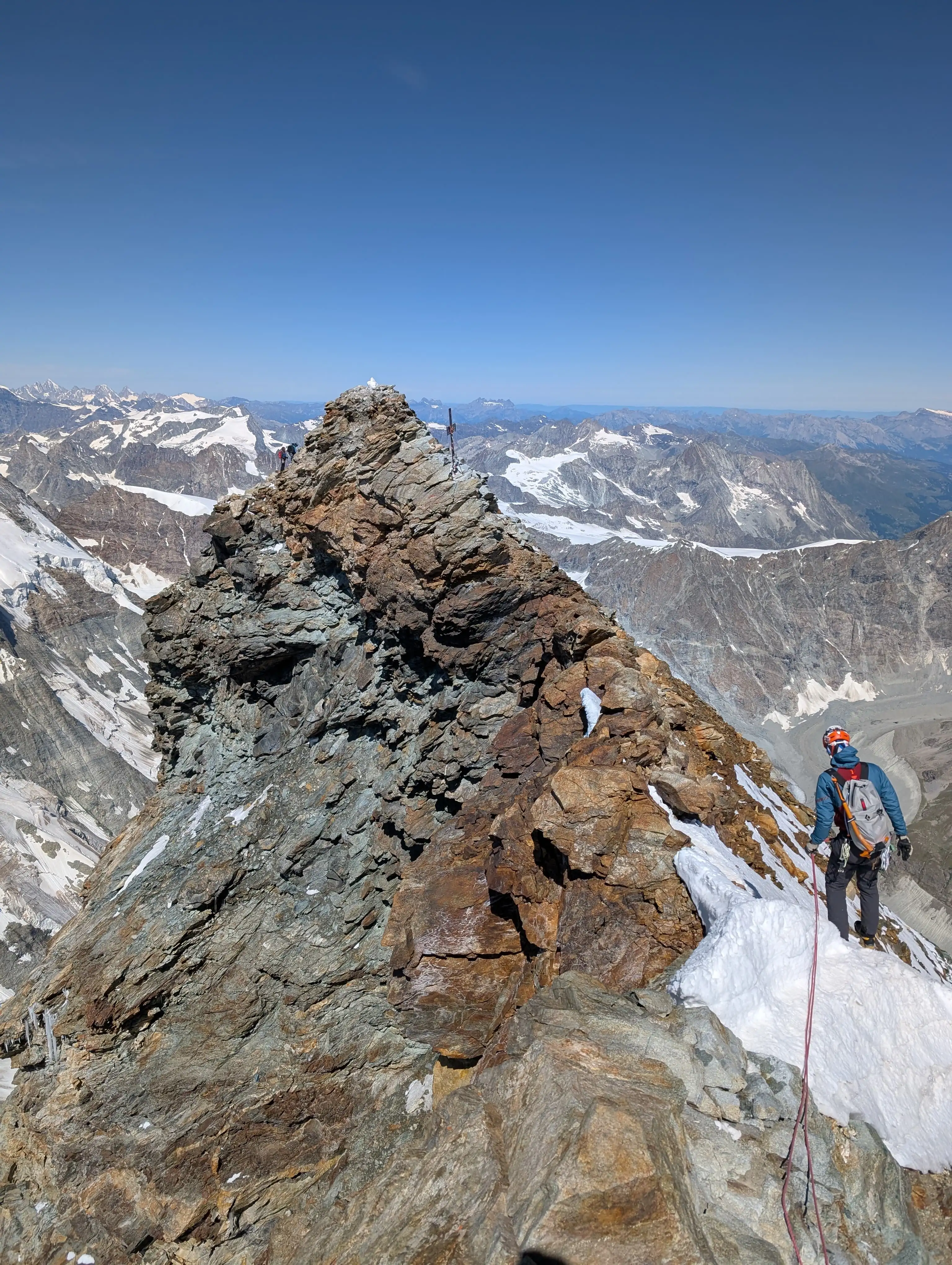 Italian peak of Matterhorn / Monte Cervino (4476m) observed from the ridge between itself and Swiss peak (4478m). Italian one is oftentimes devoid of snow while Swiss has it. Crossing the ridge was possible without winter equipment.